


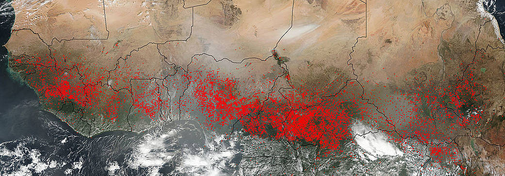
The VIIRS instrument (Visible Infrared Imaging Radiometer Suite) on NASA’s Suomi NPP satellite collected this natural-color image which detected thousands of fires burning in Central Africa on January 15, 2018. Most likely these fires are agricultural in nature as farmers often use fire to return nutrients to the soil and to clear the ground of unwanted plants. Each hot spot, which appears as a red mark, is an area where the thermal detectors on the VIIRS instrument recognized temperatures higher than background. When accompanied by plumes of smoke, as in this image, such hot spots are diagnostic for fire. For another image of this area in December 2017, click here.
NASA image courtesy Jeff Schmaltz LANCE/EOSDIS MODIS Rapid Response Team, GSFC. Caption by Lynn Jenner