


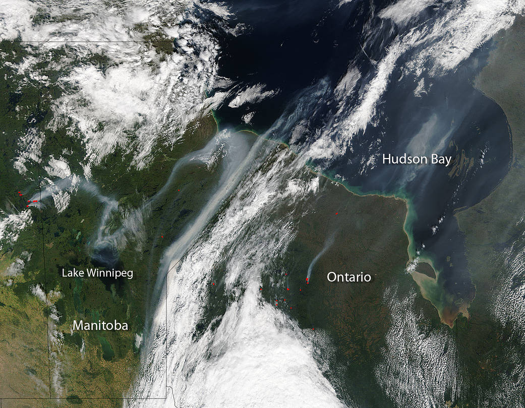
NASA’s Terra satellite captured this image of the Canadian landscape. Besides the clouds, smoke, and lush greenery of the beautiful Canadian panorama are red marks or “hot spots.” The clouds are thick and white in this satellite image, but the wispy gray emanating from the hot spots on the landscape is smoke and the “hot spot” is an area which indicates an active fire. The streams of smoke that meander upward from the fires above the Canadian terrain trail their tendrils for hundreds of miles. While the upper climes of Canada might seem a world away the smoke tends to travel along the jetstreams bringing smoke and its accompanying degraded air quality to areas hundreds to thousands of miles away and the polluted air contributes to climate change that is felt globally.
NASA’s Terra satellite collected this natural-color image with the Moderate Resolution Imaging Spectroradiometer, MODIS, instrument on August 27, 2017. Actively burning areas, detected by MODIS’s thermal bands, are outlined in red. NASA image courtesy Jeff Schmaltz LANCE/EOSDIS MODIS Rapid Response Team, GSFC. Caption by Lynn Jenner