


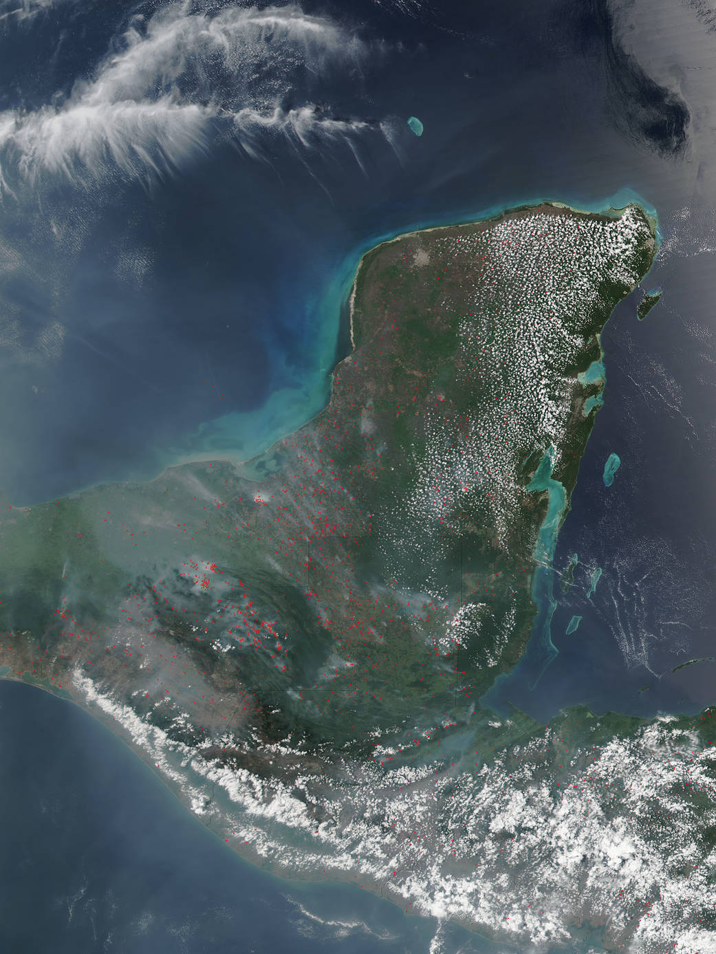
April is in the middle of the dry season for the Yucatan Peninsula which runs from January through May and naturally coincides with fire season. Farmers often use fire to return nutrients to the soil and to clear the ground of unwanted plants. Fire helps enhance crops and grasses for pasture. Some of the fires in this image may be wildfires, with natural (lightning) or accidental (human) sources. As the dry season progresses, the number of fires tend to grow, as does the blanket of smoke which settles over the land, and although the fire may help the farmers get their lands ready for planting season, unfortunately, the fires also produce smoke that degrades air quality.
This natural-color satellite image was collected by the Suomi NPP satellite using the Visible Infrared Imaging Radiometer Suite (VIIRS) instrument on April 25, 2017. Actively burning areas are outlined in red. Each hot spot, which appears as a red mark, is an area where the thermal detectors recognized temperatures higher than background. When accompanied by plumes of smoke, as in this image, such hot spots are diagnostic for fire. Suomi NPP is managed by NASA and NOAA.
NASA image courtesy Jeff Schmaltz, MODIS Rapid Response Team. Caption: NASA/Goddard, Lynn Jenner