


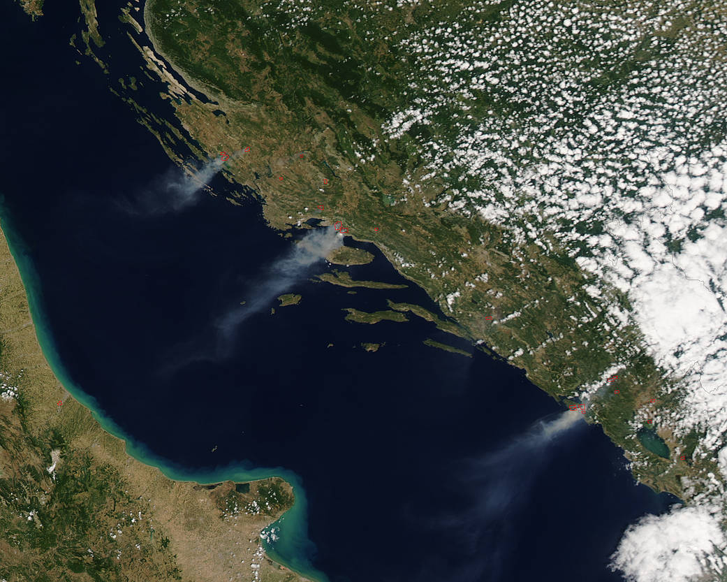
NASA’s Aqua satellite spotted smoke from fires burning in western Croatia and Montenegro along the coast of the Adriatic Sea.
This natural-color satellite image was collected by the Moderate Resolution Imaging Spectroradiometer (MODIS) instrument that flies aboard the Aqua satellite. The image, taken at 8:20 a.m. EDT (1220 UTC) on July 17 and showed actively burning areas in red, as detected by MODIS’s thermal bands.
The northernmost wildfires were burning near Benkovac, Croatia and Lake Vrana. Those fires created a large plume of light brown smoke that extended southwest over the Kornati National Park. The park is part of an archipelago also known as the Stomorski islands. The archipelago stretches 8 miles (13 km) from northeast to southwest in the Adriatic Sea.
The plume of smoke located in the center of the image was generated from fires burning around Srinjene, near the coastal town of Split, Croatia. That larger plume of smoke also extended to the southwest over the Adriatic.
The southernmost plume of smoke initiated from wildfires on the Lustica peninsula of southwestern Montenegro and appear to be burning near the Solila Nature Reserve, located south of Tivat and the Bay of Kotor.
NASA image courtesy NASA MODIS Rapid Response Team. Caption: NASA/Goddard, Rob Gutro