


On Aug. 21, 2017, many Americans saw day turn temporarily to night as the Moon passed between the Sun and the Earth to create a total solar eclipse. As people in the 70-mile-wide (110-kilometer-wide) path of totality looked up and saw blinding light replaced by a dark circle and the Sun’s wispy corona, NASA Earth-observing satellites captured imagery of the Moon’s shadow as it raced eastward over the continental United States.
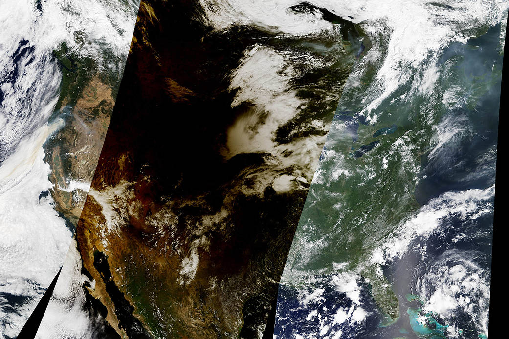
The Moderate Resolution Imaging Spectroradiometer (MODIS) sensor on the Terra satellite captured this mosaic comprised of data collected at three different times. The right third of the image shows the eastern United States at about 12:10 p.m. Eastern Time (16:10 Universal Time), before the eclipse had begun. The middle part was captured at about 12:50 p.m. Central Time (17:50 Universal Time), when the eclipse was in progress in the center of the country. The left third of the image was collected at about 12:30 p.m. Pacific Time (19:30 Universal Time), after the eclipse had ended. Terra has a polar orbit and the MODIS sensor collects imagery in swaths that are roughly 1,450 miles (2,330 kilometers) wide.
Credit: NASA Earth Observatory images by Joshua Stevens and Jesse Allen, using MODIS data from the Land Atmosphere Near real-time Capability for EOS (LANCE) and EOSDIS/Rapid Response