


![Request for Information – Potential [Placeholder for Prize]](https://assets.science.nasa.gov/dynamicimage/assets/science/missions/a-step/FFR_Earth_Background_20251120%20.png?w=1024)


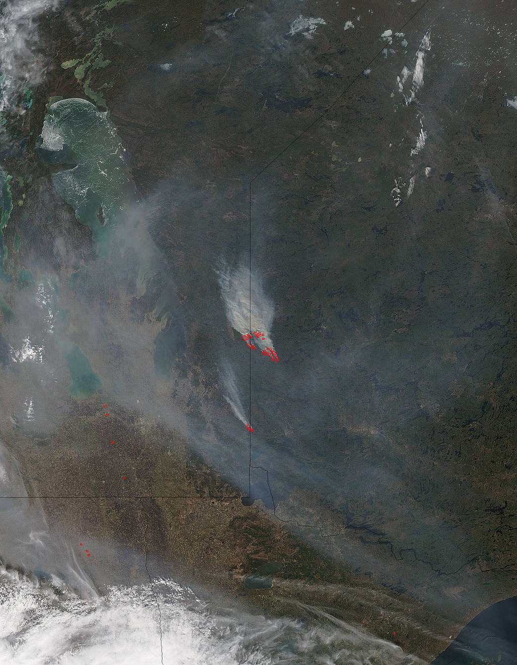
From the Government of Ontario’s emergency preparedness website comes this information about fires in the northwest territory of Ontario:
“The fire of note for the Northwest Region is Kenora Fire Number 18. Kenora Fire Number 18 is not under control at 600 hectares in size and is located near Rice Lake (5km north of Ingolf). Crews are placing sprinklers on values for precautionary means in the Rice Lake Florence Lake and Malachi area. Ingolf has been evacuated for precautionary measures.
There were two new fires confirmed by the early afternoon of May 6th. Red Lake Fire Number 3 is not under control at 13000 hectares and is located in Woodland Caribou Provincial Park near the Manitoba border.”
The fires captured in this image show the Kenora Fire on the border of Ontario and Manitoba. The second larger fire might be the Red Lake Fire but this has not been verified. It is however, a large wildfire and it is located in the Caribou Falls area of Ontario.
NASA’s Aqua satellite collected this natural-color image with the Moderate Resolution Imaging Spectroradiometer, MODIS, instrument on May 09, 2016. Actively burning areas, detected by MODIS’s thermal bands, are outlined in red. NASA image courtesy Jeff Schmaltz LANCE/EOSDIS MODIS Rapid Response Team, GSFC. Caption by Lynn Jenner