


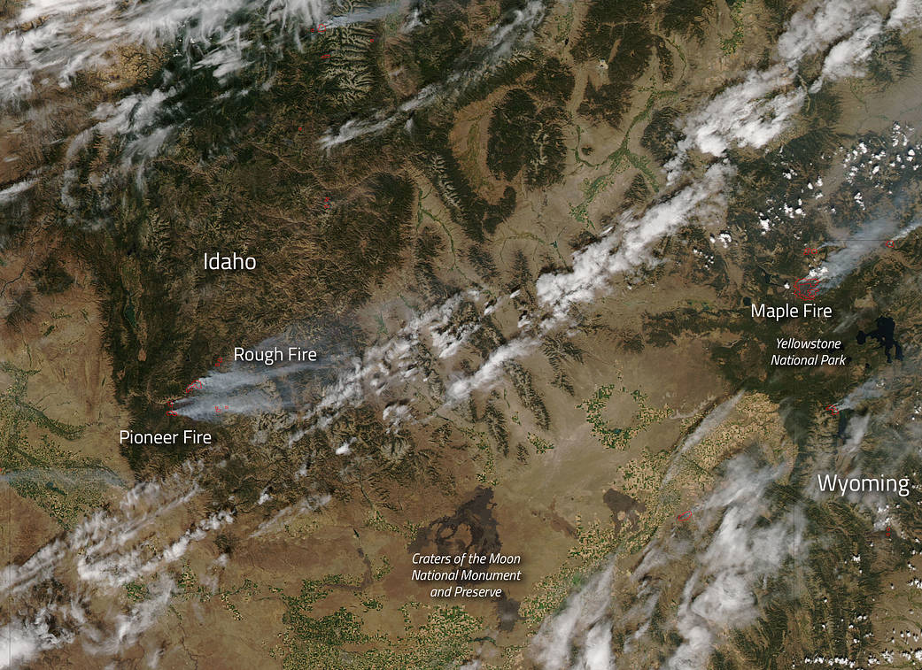
Wildfires have been plaguing the western part of the United States for the summer season and no state seems to be without incident. Both Idaho and Wyoming have their share of wildfires as well. The Pioneer and Rough Fires are both burning in Idaho. The Maple Fire is blazing around Yellowstone National Park in Wyoming.
The Pioneer Fire began on July 18, 2016 eight miles north of Idaho City. The circumstances around the start of the fire are unknown at this time. The fire is now over 100,000 acres in size and is 47% contained. The eastern portion of the fire continues to consume unburned islands of fuels, which produces smoke that can be viewed around the Lowman area. Hot and dry weather continues and an anticipated front may bring increased southwest winds, possibly increasing fire behavior.
The Rough Fire began on August 20, 2016, with a lightning strike. The fire has reached almost 4,000 acres in size and is burning primarily to the northeast. The weather continues to be hot and dry which exacerbates fire behavior. There is a closure in effect around the area which can be viewed on Inciweb.
In Wyoming, the Maple Fire continues after being detected on August 8 by a smokejumper aircraft passing over the park. It began as a lightning strike. The fire is located in a large expanse of the 1988 North Fork fire scar, four miles east of the Park’s west boundary, and five miles northeast of the community of West Yellowstone. The fire is currently 27,101 acres. Weather continues to be a factor with this fire. The National Weather Service has issued a red flag warning for Yellowstone National Park and the surrounding area beginning at noon today. Strong, gusty SW winds (25-30 mph) are anticipated, coupled with lower humidity (8-13%) and warmer temperatures (79-84) which will likely increase fire activity and behavior, especially on the east and northeast edges of the Maple fire.
This natural-color satellite image was collected by the Moderate Resolution Imaging Spectroradiometer (MODIS) aboard the Aqua satellite on August 22, 2016. Actively burning areas, detected by MODIS’s thermal bands, are outlined in red. NASA image courtesy Jeff Schmaltz, MODIS Rapid Response Team. Caption: NASA/Goddard, Lynn Jenner with information from Inciweb.