


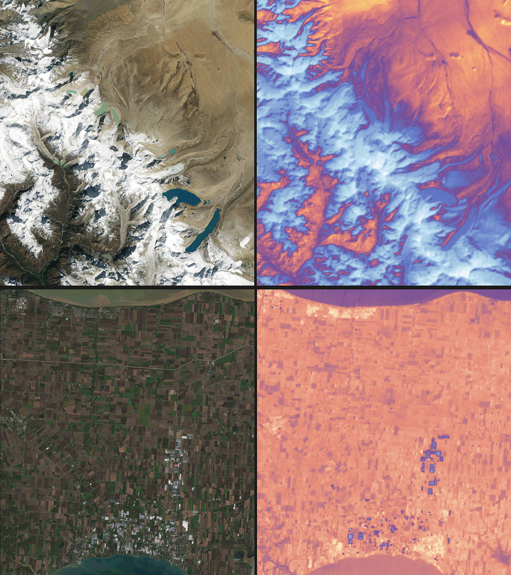
Landsat 9 carries two instruments designed to work together to capture a broad range of wavelengths: the Operational Land Imager 2, or OLI-2, which detects nine different wavelengths of visible, near-infrared and shortwave-infrared light; and the Thermal Infrared Sensor 2, or TIRS-2, which detects two wavelengths of thermal radiation to measure slight changes in temperature. Data from both instruments are shown in the two pairs in this image.
The top left shows snow and glaciers in the Himalayan mountains, leading to the flat Tibetan Plateau to the north. The top right shows the same area in thermal data from the TIRS-2 instrument. Blue-white color indicates relatively cooler surface temperatures, while orange-red indicates warmer surface temperatures.
The bottom left shows the brown and green rectangles of farm fields in southern Ontario, sandwiched between Lake Erie and Lake St. Clair. The white and grey rectangles in the bottom of the image are produce greenhouses, which show up as blue-ish (relatively cooler) spots in the TIRS-2 image on the right.
Image credit: NASA/USGS