


![Request for Information – Potential [Placeholder for Prize]](https://assets.science.nasa.gov/dynamicimage/assets/science/psd/solar/2023/09/s/solarsystem_0.jpg?w=1024)


In 2021, Hurricane Ida left over 1 million people without power, tornadoes tore across the American Midwest, volcanoes forced people to evacuate their homes, wildfires covered the American West and unusual flooding wreaked havoc on Central Europe.
Some characteristics of natural hazards, such as hurricanes, floods and wildfires, have been historically predictable and have informed disaster preparation. However, with human emissions of greenhouse gases increasing Earth’s temperature, we’re seeing changes in those characteristics: wildfire and drought seasons are lengthening, hurricanes and rainfall are becoming more intense, and coastal flooding is increasing.
By sponsoring application science and fostering domestic and international partnerships, the NASA Disasters program seeks to use its Earth observation data to enable disaster-resilient communities in a changing climate.
For details on how the NASA Disasters program supports risk reduction, response and recovery, go to Remembering 2021’s Disasters.
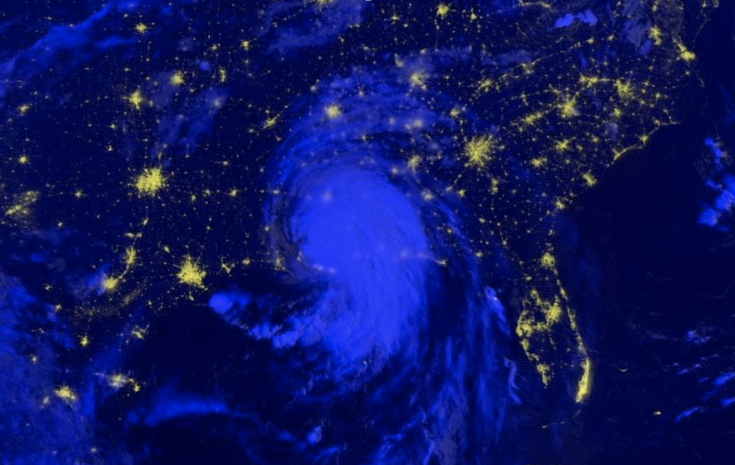
This day/night-band imagery of Hurricane Ida was captured by the VIIRS instrument onboard the NASA/NOAA Suomi-NPP satellite early the morning of Aug. 30, 2021. Day/night-band imagery is useful for identifying nighttime lights from cities and can be used to monitor for loss of light which may indicate power outages in the wake of a disaster. Credits: NASA