


![Request for Information – Potential [Placeholder for Prize]](https://assets.science.nasa.gov/dynamicimage/assets/science/psd/solar/2023/09/s/solarsystem_0.jpg?w=1024)


Earth observations taken from Space Shuttle Columbia during STS-78 mission
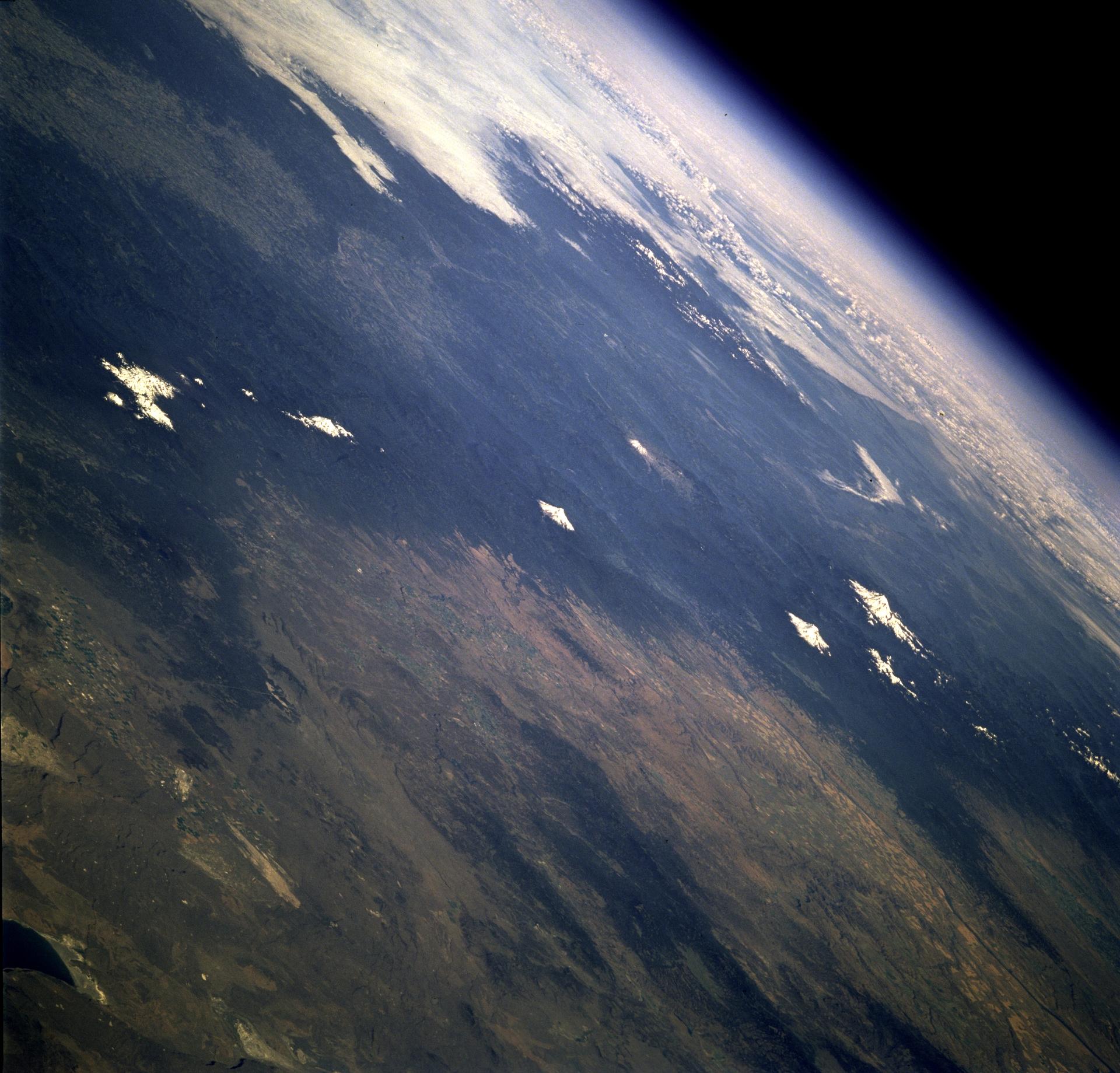
STS078-742-004 (20 June - 7 July 1996) --- This is a north-looking perspective of the major volcanoes of the Cascade Mountains of southern Washington and northern Oregon. With the Earth limb in the upper left corner of the photo, the large mountain at the top right, or northern part of the photo, is Mt. Rainier. The next snow covered area to the south east of Mt. Rainier is Gilbert Point. Mt. Adams is the larger peak, south-southeast of Mt. Rainier, Mt. St. Helens is the gray patch in the center of the photo, west of Mt. Adams. Mt. St. Helens erupted on May 18, 1980, removing 1,300 feet of the 9,677-ft. volcano. The eruption toppled trees with a searing, stone-filled 275-mile-per-hour wind over an area of more than 150 square miles. This area, now referred to as the "blast zone", can be easily spotted in this view. NASA scientists say that natural regrowth of vegetation within the blast zone is progressing at a rapid rate, especially on the outer fringes and in the protected valleys. Many fir trees have grown to heights exceeding 20 feet in a little over 12 years. A large lava dome within the crater of the volcano has grown to a height of over 1,000 feet since the 1980 eruption. The next three snow covered peaks are Mt. Hood, Mt. Jefferson and the Three Sisters all located in Oregon.
- X
https://www.nasa.gov/image-detail/amf-sts078-742-004/
TakenJuly 1, 1996
ProducerJSC
Size1920x1839px
PIA Numbersts078-742-004
