


![Request for Information – Potential [Placeholder for Prize]](https://assets.science.nasa.gov/dynamicimage/assets/science/psd/solar/2023/09/s/solarsystem_0.jpg?w=1024)


Space Shuttle Projects
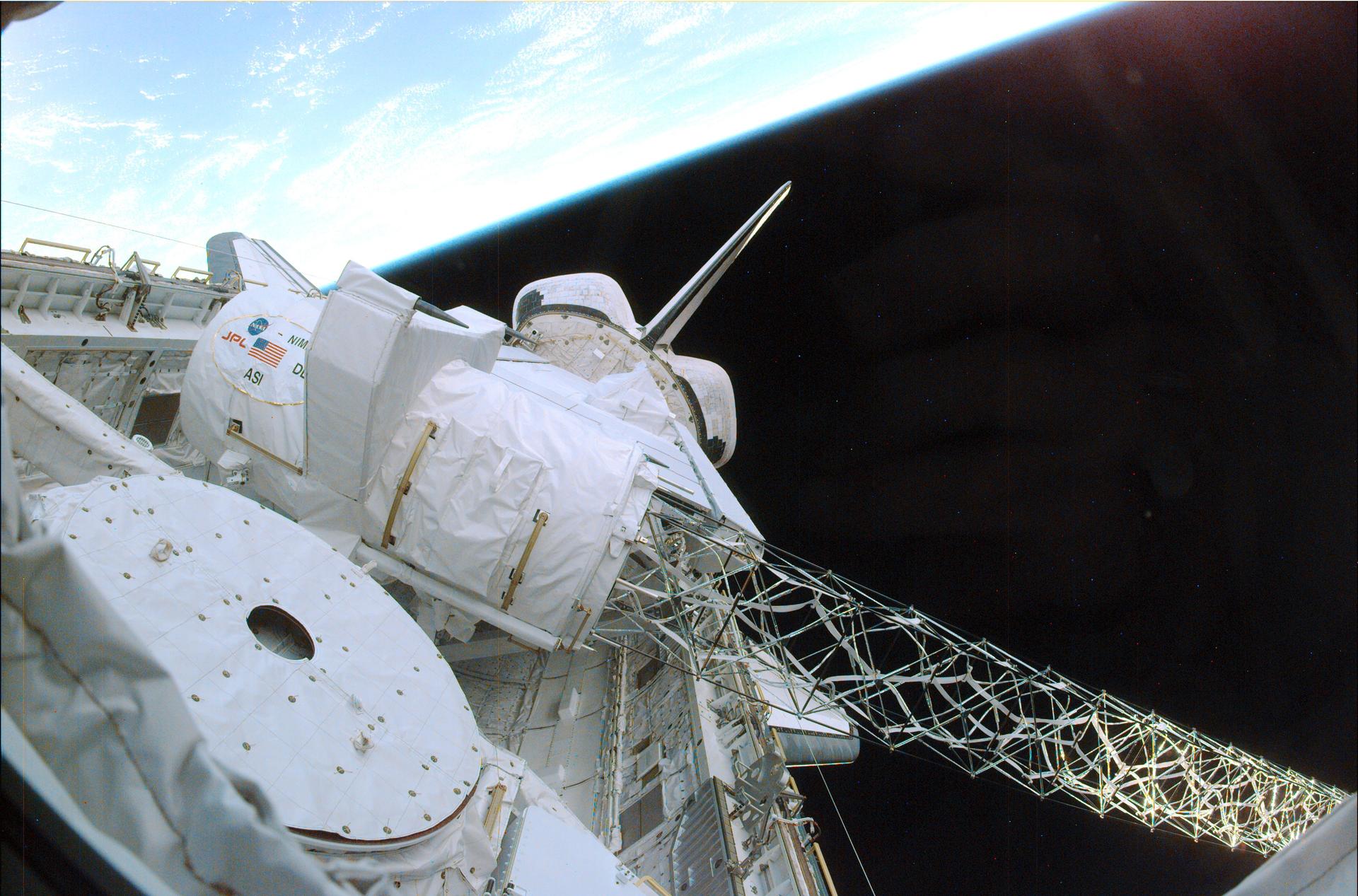
Launched February 11, 2000, the STS-99 Shuttle Radar Topographic Mission (SRTM) was the most ambitious Earth mapping mission to date. A 200-ft long (60 meter) mast supporting the SRTM where it jutted into space from the Space Shuttle Endeavour. In this photograph, part of the SRTM hardware is shown in the payload bay of the shuttle. Orbiting some 145 miles (233 kilometers) above Earth, the giant structure was deployed on February 12, 2000 and the C-band and X-band anternae mounted on it quickly went to work mapping parts of the Earth. The SRTM radar was able to penetrate clouds as well as provide its own illumination, independent of daylight, obtaining3-dimentional topographic images of the world's surface up to the Arctic and Antarctic Circles. The mission completed 222 hours of around the clock radar mapping gathering enough information to fill more than 20,000 CDs.
- X
https://www.nasa.gov/image-detail/amf-0400058/
TakenFebruary 16, 2000
ProducerMSFC
Size1920x1267px
PIA Number0400058
