


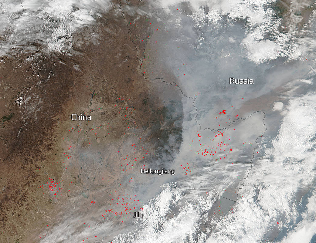
China’s northernmost province, Heilongjiang, was captured in this NOAA/NASA Suomi NPP satellite;s Visible Infrared Imaging Radiometer Suite (VIIRS) instrument image taken on October 19, 2017. Heilongjiang Province has remote mountain ranges and a flat interior plain and is named for the Heilong (Black Dragon) river, bordering Russia. Most notably in this image are the fires that dot the landscape and the copious amounts of smoke that rise from those fires. The fires can also be seen in the Jinin province located south of Heilongjiang. There are a few scattered groups of fires in Russia as well. Jinin is a northeastern Chinese province bordering North Korea and Russia.
Most likely these fires (represented by the red dots across the image) are agricultural in nature. The location, widespread nature, and number of fires suggest that these fires were deliberately set to manage land. Farmers often use fire to return nutrients to the soil and to clear the ground of unwanted plants. While fire helps enhance crops and grasses for pasture, the fires also produce smoke that degrades air quality as evidenced by the smoke that rises from these fires. That smoke will most likely rise up to the jetstream and could potentially travel thousands of mile and affect areas across the globe.
The Suomi NPP satellite is a joint mission between NASA and NOAA.
NASA image courtesy Jeff Schmaltz, MODIS Rapid Response Team. Caption: NASA/Goddard, Lynn Jenner