


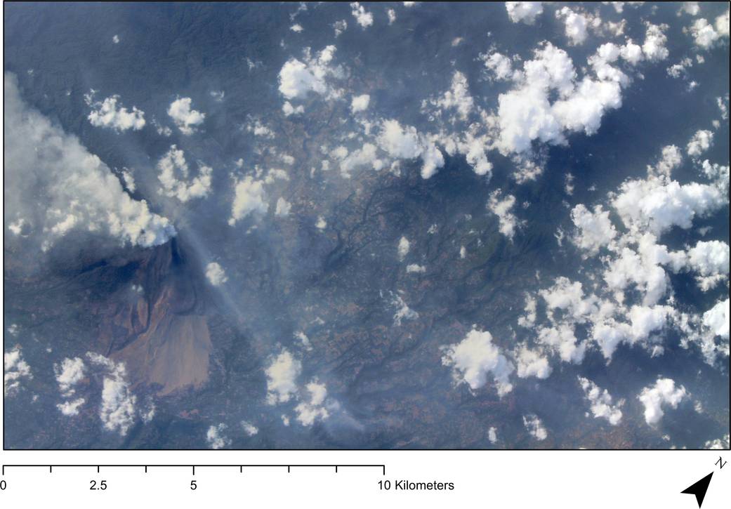
The ISERV camera system onboard the International Space Station captured this image of Indonesia’s Sinabung Volcano on March 9, 2014. This volcano was quiet, at least in recorded history, until 2010, when it erupted enough to prompt the evacuation of about 30,000 people for a short time. It quieted again until early September 2013, and then began a series of violent eruptions that still continues, forcing evacuation of thousands of people and killing 15 in Sukameriah on February 1. Although the volcano’s activity has slowed, it continues to belch smoke and lava, as can be seen in the image.
Click here to go to the time-slider tool to see the Sinabung Volcano region as it appeared before and after the series of eruptions that began in late 2013. ISERV captured the “after” image on March 9, 2014. The source for the “before” image is: ESRI Basemap/Digital Globe 2010/09/13.
ISERV was developed by NASA to support a joint NASA/USAID project known as SERVIR and potentially the broader NASA Applied Sciences community. The SERVIR project provides satellite data and tools to environmental decision makers in developing countries and operates via regional “hubs” in Nairobi, Kenya; Kathmandu, Nepal; and Panama City, Panama. These SERVIR hubs can task the ISERV system to image scenes of Earth’s surface in their countries to address environmental issues and disasters. SERVIR’s coordination office at NASA’s Marshall Space Flight Center in Huntsville, Alabama, controls ISERV operations.