


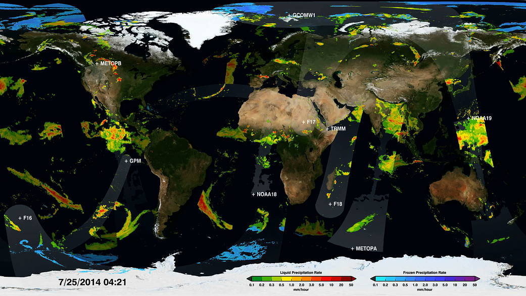
The ten satellites in the Global Precipitation Measurement Constellation provide unprecedented information about the rain and snow across the entire Earth. This visualization shows the constellation in action, taking precipitation measurements underneath the satellite orbits. As time progresses and the Earth’s surface is covered with measurements, the structure of the Earth’s preciptation becomes clearer, from the constant rainfall patterns along the Equator to the storm fronts in the mid-latitudes. The dynamic nature of the precipitation is revealed as time speeds up and the satellite data swaths merge into a continuous animation of changing rain and snowfall.
Animation and additional images: NASA’s Scientific Visualization StudioImage Credit: NASA’s Scientific Visualization Studio