


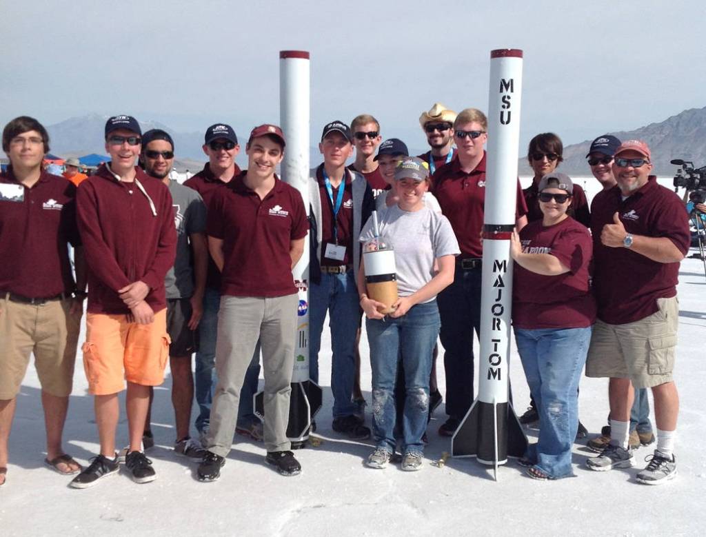
The "Space Cowboys" from Mississippi State University in Starkville designed one of the largest vehicles for NASA's annual Student Launch…
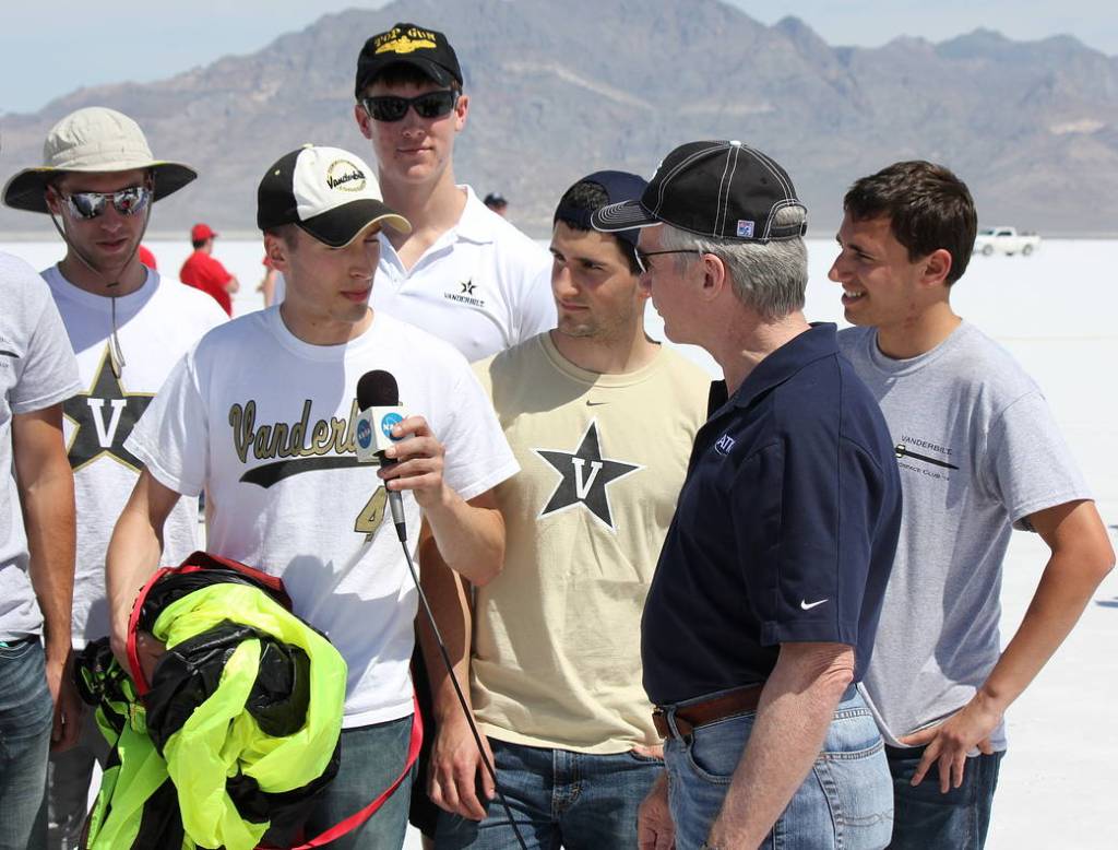
The rocketry team representing Vanderbilt University in Nashville, Tennessee, is interviewed on NASA TV by Charlie Precourt, veteran astronaut and…
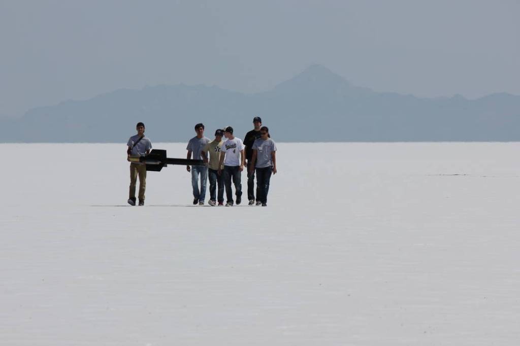
The rocket team from Vanderbilt University in Nashville, Tennessee, recovers its vehicle after a successful launch at the Bonneville Salt…
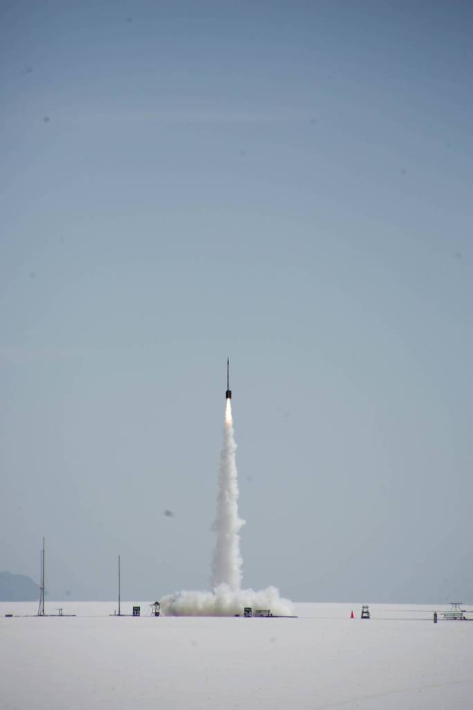
A rocket built by a team of students from the University of North Dakota in Grand Forks launches into the…
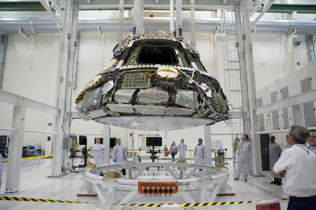
At the Operations and Checkout Building at NASA's Kennedy Space Center, the Orion crew module and heat shield are being…
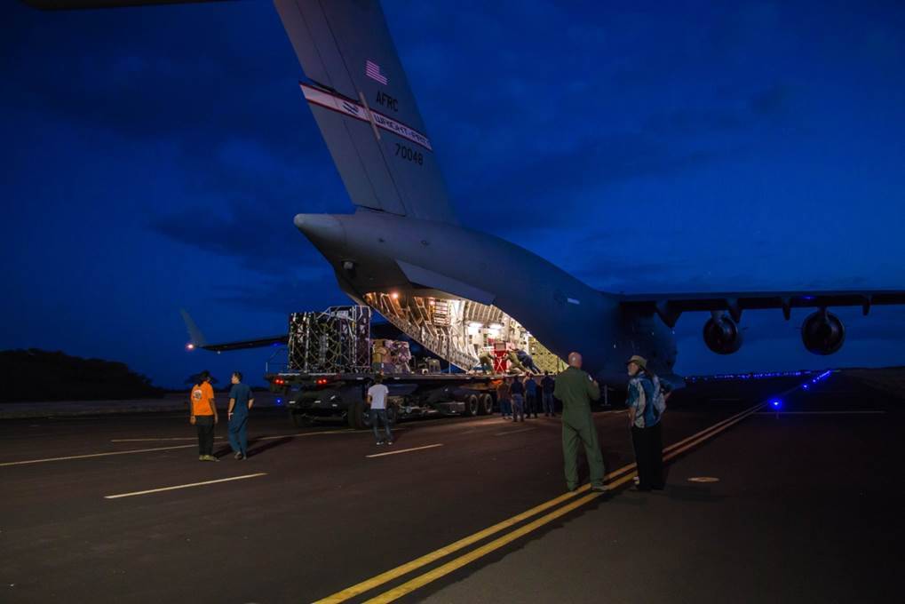
Engineers unload ground support equipment for a June engineering test flight above Kauai, Hawaii. The test flight is part of…
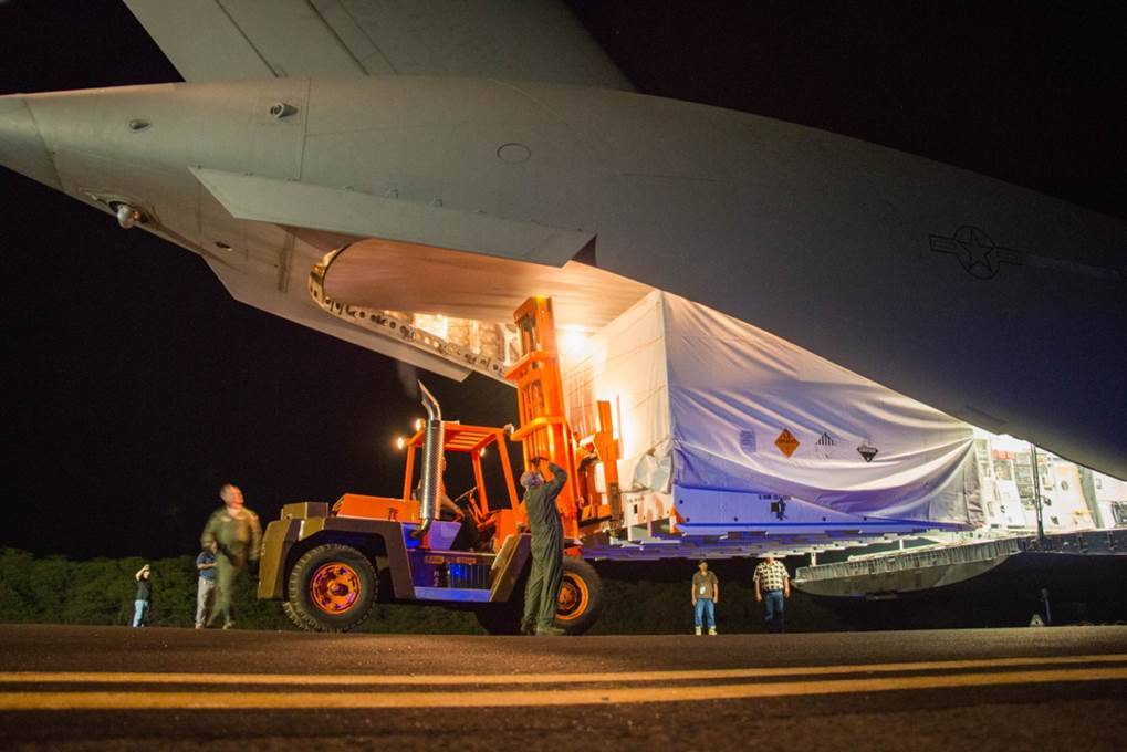
The saucer-shaped test vehicle for NASA's Low-Density Supersonic Decelerator (LDSD) project, packaged in the box shown here, was shipped via…
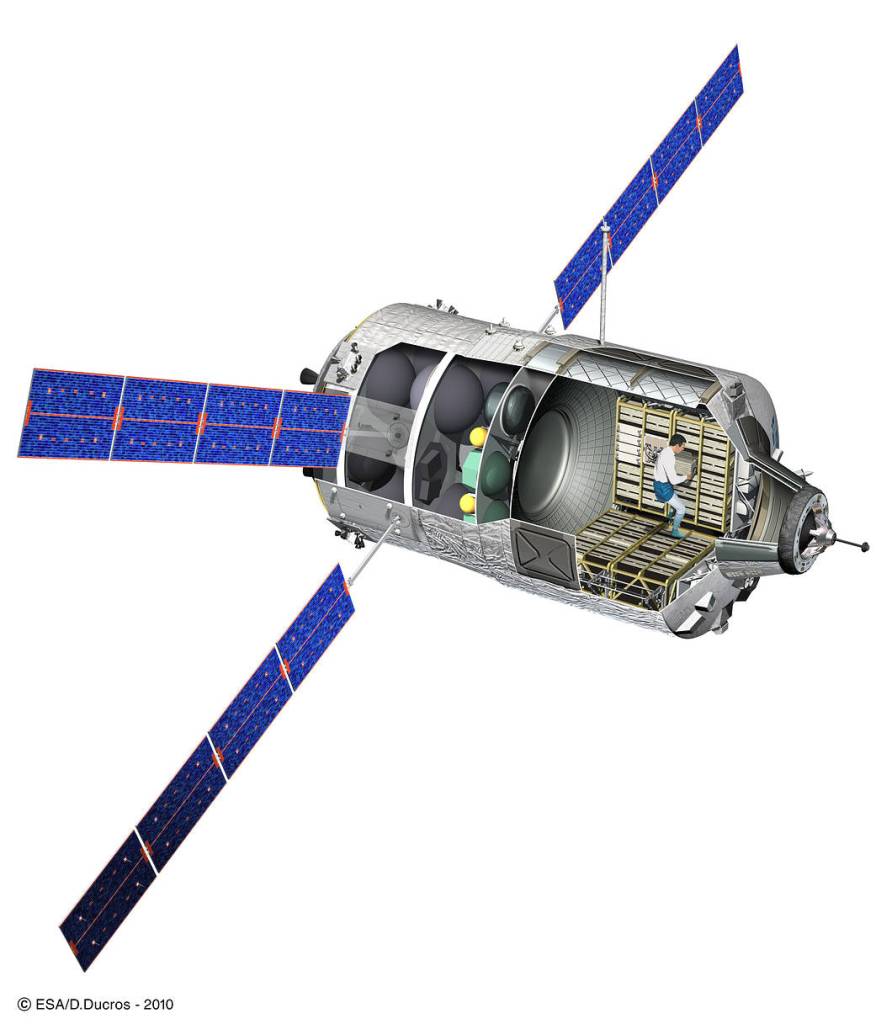
ATVs were unmanned space transport vehicles built by the European Space Agency (ESA) that carried cargo and resupply goods from…
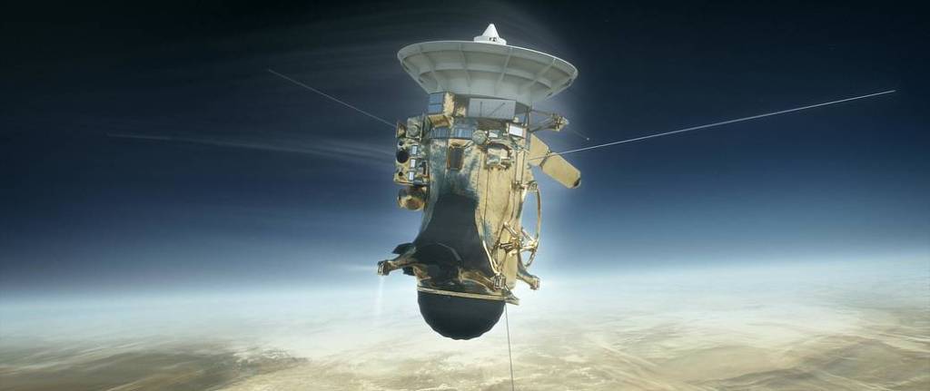
Launched in 1997 with the European Space Agency’s (ESA) Huygens probe, Cassini is the first spacecraft to orbit Saturn. Among…
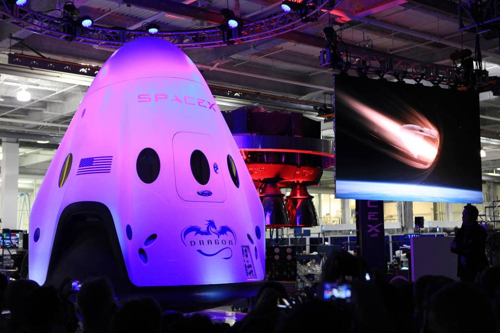
May 29, 2014 - Animation showing the Dragon V2 spacecraft re-entering Earth's atmosphere plays during an unveiling ceremony inside SpaceX…