


In this image taken by the Aqua satellite on May 22, 2015, two prescribed fires can be seen.
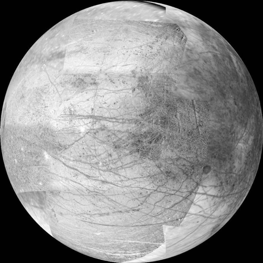
This 12-frame mosaic provides the highest resolution view ever obtained of the side of Jupiter's moon Europa that faces the…

Gazing off toward the horizon is thought-provoking no matter what body's horizon it is.
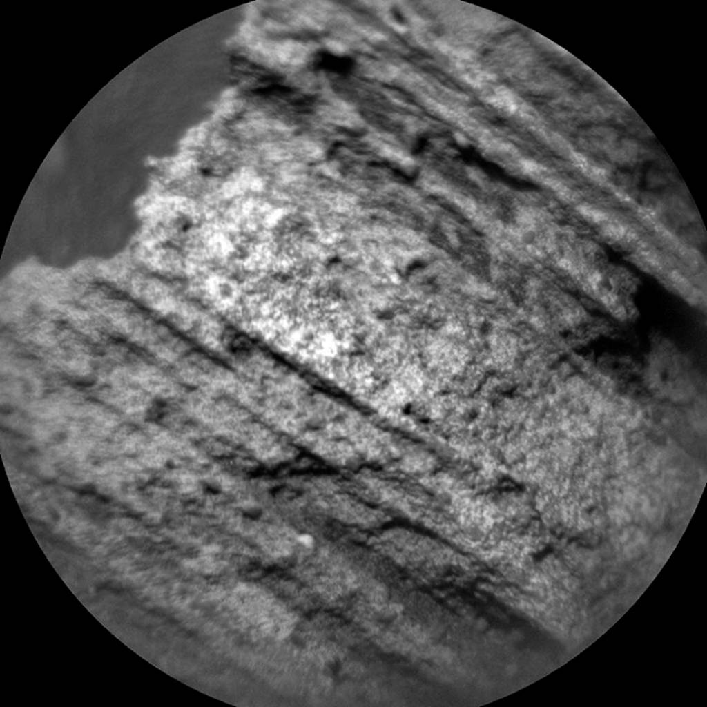
This May 15, 2015, image from the Chemistry and Camera (ChemCam) instrument on NASA's Curiosity Mars rover shows detailed texture…
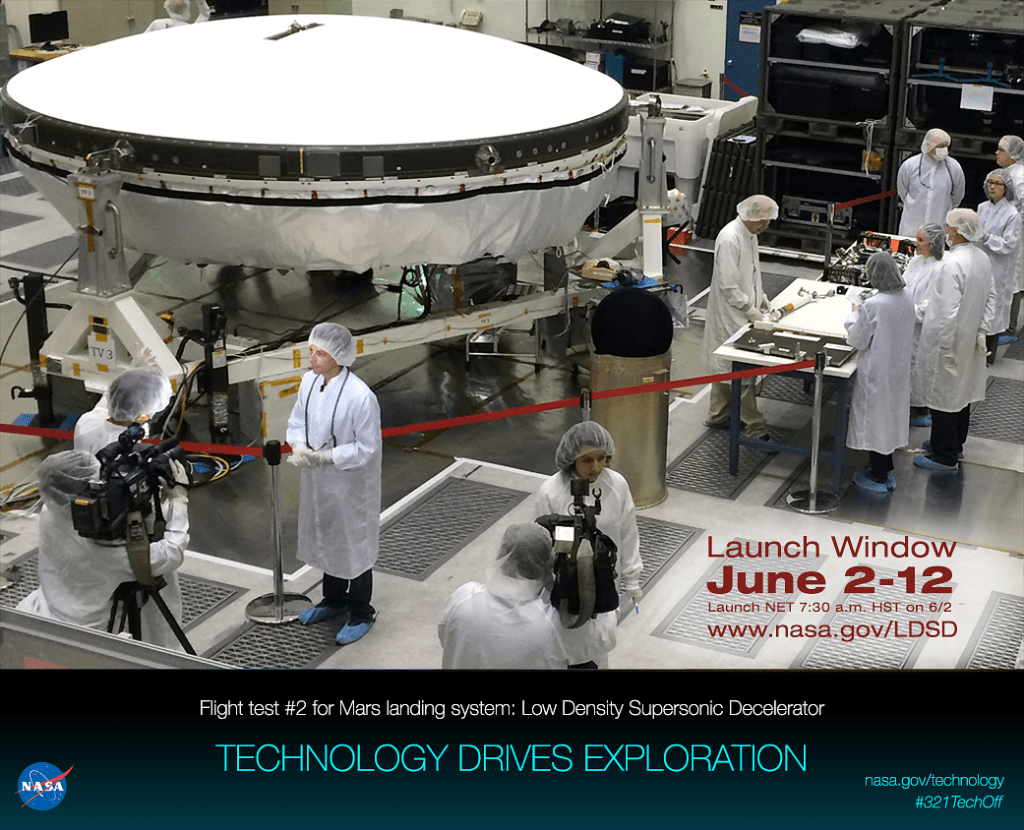
NASA Low Density Supersonic Decelerator (LDSD)

The Martian outcrop where pale rock meets darker overlying rock near the middle of this May 21, 2015, view is…
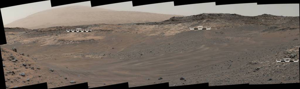
This May 10, 2105, view from Curiosity's Mastcam shows terrain judged difficult for traversing between the rover and an outcrop…
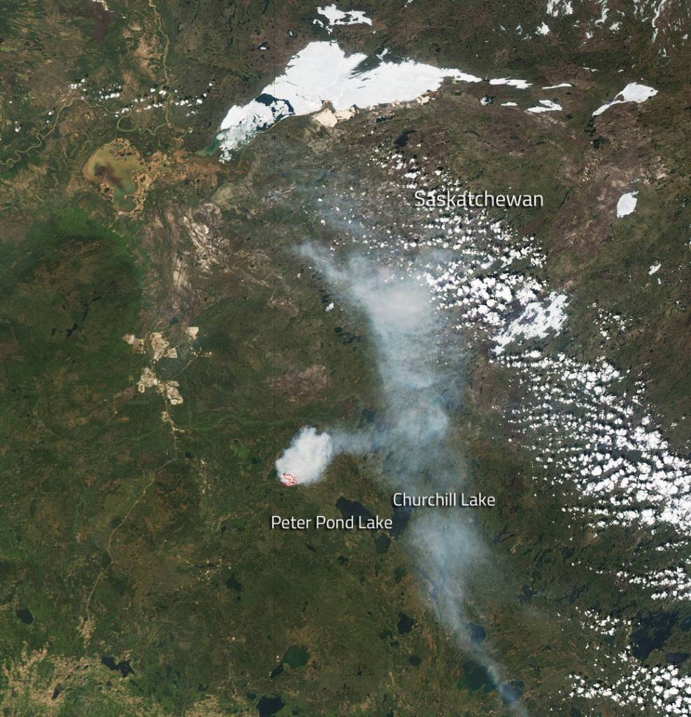
This fire began on May 20, 2015 according to the Canadian Wildland Fire Information System.

Permafrost thawing provides perfect fodder for wildfires in Siberia.
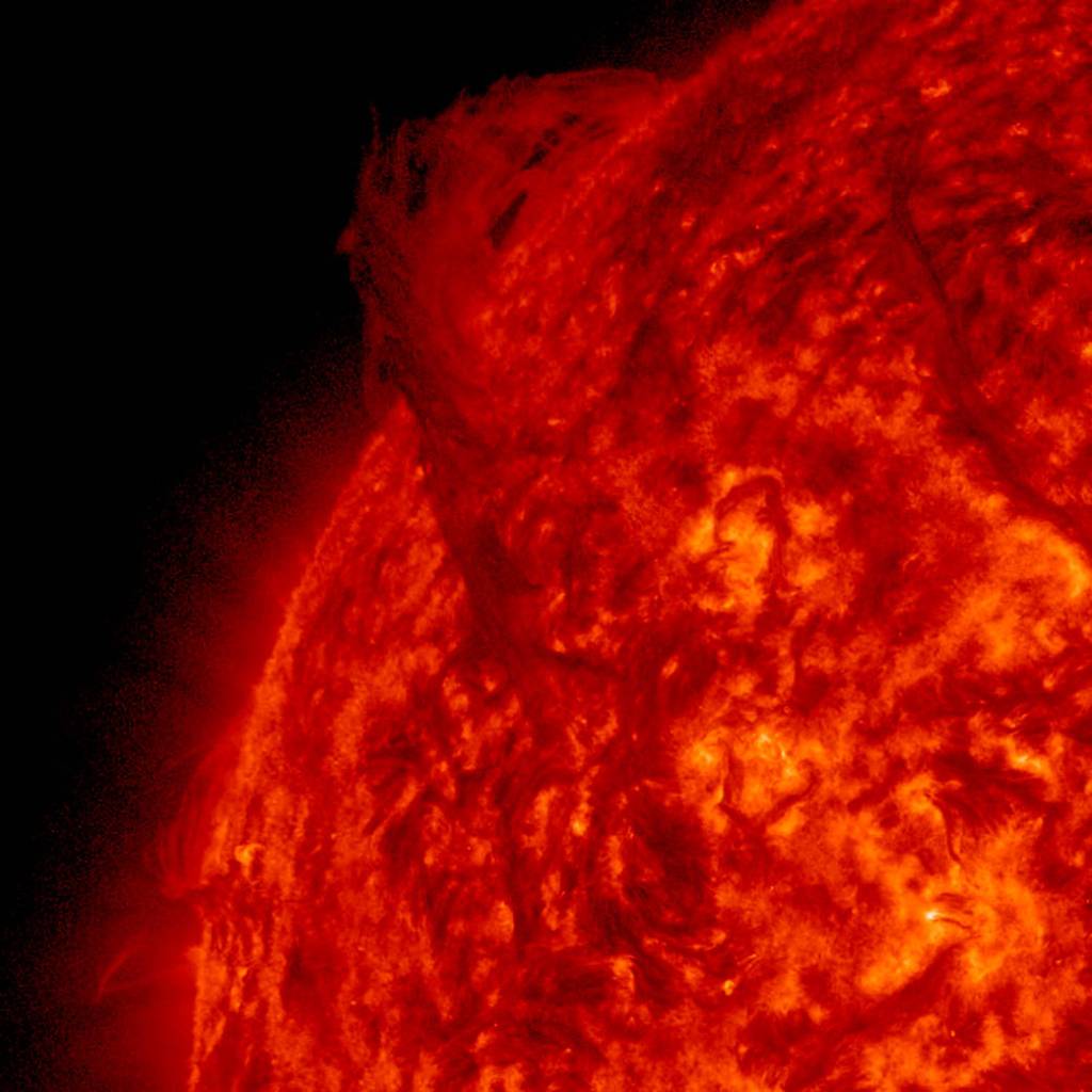
A long prominence suspended above the Sun's surface rotated into view this week, demonstrating the intricate pushing and pulling of…


