


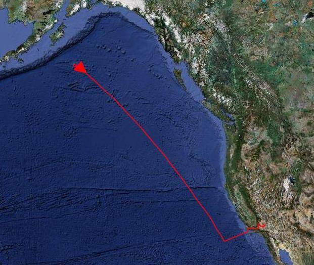
The outbound flight path of NASA's Global Hawk was marked in red shortly after it turned around over the North Pacific Ocean south of the Aleutian Islands.
Glopac_outbound_flt_path
Mission: Global Hawk Pacific (GloPac) Environmental Science
The outbound flight path of NASA’s Global Hawk was marked in red shortly after it turned around over the North Pacific Ocean south of the Aleutian Islands on the first data-collection flight in the GloPac environmental science mission on April 7, 2010. The remotely operated aircraft flew approximately 4,500 nautical miles along a flight path that took it to 150.3 degrees West longitude, and 54.6 degrees North latitude, just south of Alaska’s Kodiak Island. The flight lasted just over 14 hours at altitudes up to 60,900 feet.April 7, 2010
NASA Image