


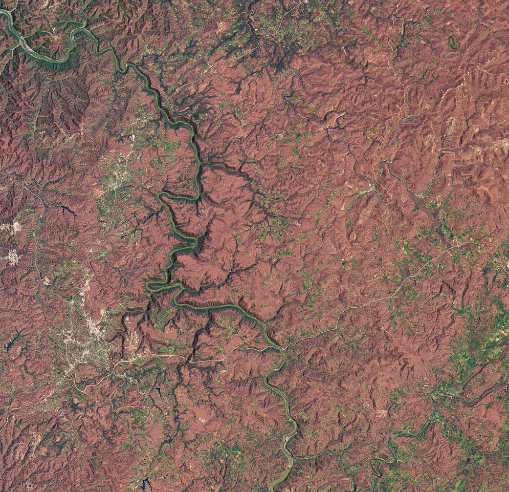
The image above shows the New River Gorge National Park and Preserve in southern West Virginia on April 22, 2020. The image was acquired by the Operational Land Imager (OLI) on the Landsat 8 satellite and overlaid on digital elevation data from the Shuttle Radar Topography Mission (SRTM) to give a sense of the topography. The shading in the image denotes the land within the park. In December 2020, the United States Congress passed a bill designating the New River Gorge as a national park and preserve, making it the first in the state.
More: NASA Earth Observatory
Credit: NASA Earth Observatory image by Lauren Dauphin, using Landsat data from the U.S. Geological Survey and topographic data from the Shuttle Radar Topography Mission (SRTM) Caption: Kasha Patel