


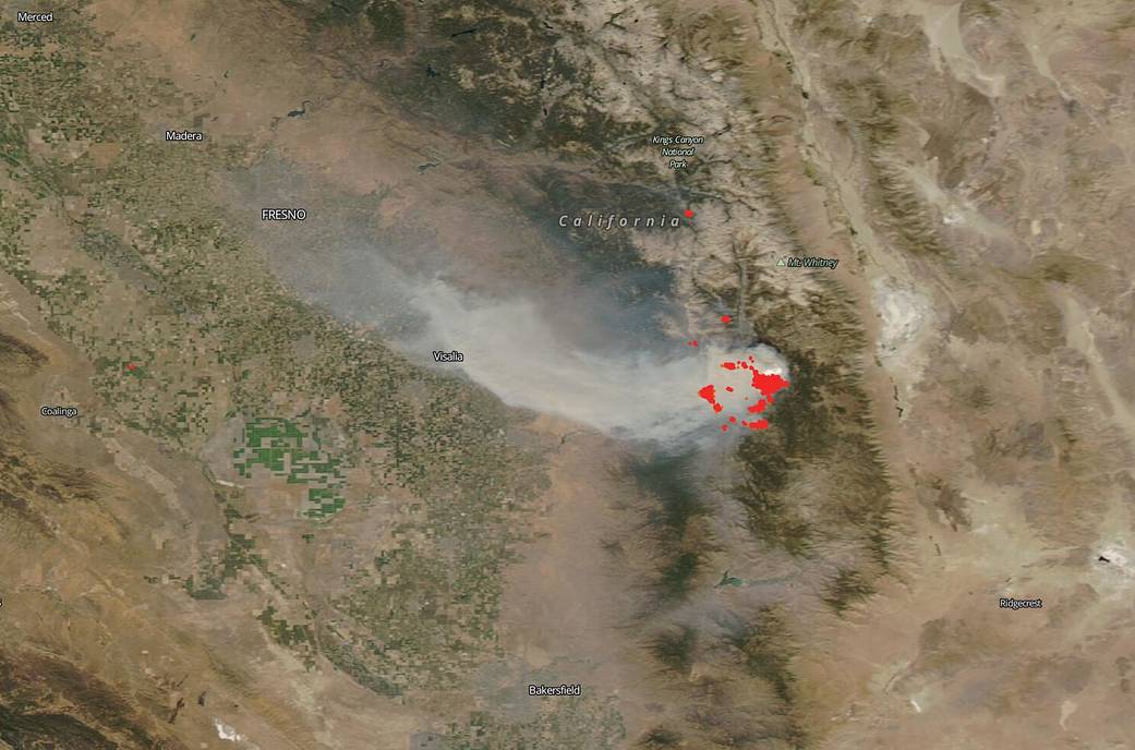
NASA’s Aqua satellite flew over California on Sep. 04, 2020 and captured this image of the SQF Complex of fires that began during the mid-August spate of lightning strikes that numbered over 12,000. Even though the SQF Complex, which encompasses the Castle and Shotgun fires, was not reported until August 24, 2020, it is assumed that the fires began during the lightning strike event. Fighting any fires in California is a top priority but due to the fact that so many fires were reported at once after the lightning storm, prioritization of the fires has been necessary due to the sheer numbers. As always, protecting life is the first priority and then property and infrastructure.
The SQF Complex is currently 46,328 acres and is 1% contained. Weather continues to be the main issue with fighting the fires as that continues to provide perfect conditions for the fires to grow. A high pressure system over the area persists bringing hot and dry conditions. Relative humidity remains low, potentially dropping into the single digits, which can contribute to extreme fire conditions. Increasing southeast winds with gusts to 20 mph are expected in the afternoon which significantly contributes to fire movement and growth. An extreme heat warning will extend through Labor Day weekend, with critical fire weather to persist in the area for the foreseeable future, according to Inciweb. Another astounding detail from Inciweb is the following: “California has approximately 5,000 USFS personnel available for incidents in the state. Additionally, approximately 13,300 firefighters – across all agencies – out of approximately 22,400 firefighters across the United States, are currently assisting California fires.”
NASA’s satellite instruments are often the first to detect wildfires burning in remote regions, and the locations of new fires are sent directly to land managers worldwide within hours of the satellite overpass. Together, NASA instruments detect actively burning fires, track the transport of smoke from fires, provide information for fire management, and map the extent of changes to ecosystems, based on the extent and severity of burn scars. NASA has a fleet of Earth-observing instruments, many of which contribute to our understanding of fire in the Earth system. Satellites in orbit around the poles provide observations of the entire planet several times per day, whereas satellites in a geostationary orbit provide coarse-resolution imagery of fires, smoke and clouds every five to 15 minutes. For more information visit: https://www.nasa.gov/mission_pages/fires/main/missions/index.html
NASA’s Earth Observing System Data and Information System (EOSDIS) Worldview application provides the capability to interactively browse over 700 global, full-resolution satellite imagery layers and then download the underlying data. Many of the available imagery layers are updated within three hours of observation, essentially showing the entire Earth as it looks “right now.” Actively burning fires, detected by thermal bands, are shown as red points. Image Courtesy: NASA Worldview, Earth Observing System Data and Information System (EOSDIS). Caption: Lynn Jenner with information from Inciweb.