


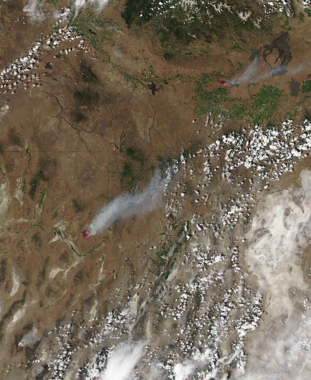
NASA’s Aqua satellite passed over the western U.S. and spotted plumes of smoke from the Drew, Rooster’s Comb and Antelope fires.
The Rooster’s Comb fire located in Nevada is in the middle of the image and appears as the largest red spot, indicating heat from the fire. The Drew fire, also in Nevada appears as a small red area with a plume of smoke in the bottom left part of the image. At the top of the image a plume of smoke can be seen from the Antelope Fire burning in south central Idaho.
This natural-color satellite image was collected by the Moderate Resolution Imaging Spectroradiometer (MODIS) aboard the Aqua satellite at 2030 UTC (4:30 p.m. EDT) on July 10, 2017. Actively burning areas, detected by MODIS’s thermal bands appear in red.
The Antelope fire is burning 4 miles west of Shoshone, Idaho. As of July 10, this fire had consumed nearly 10,000 acres. The fire was caused by lightning. The Notch Butte Rangeland Fire Protection Association is helping the U.S. Bureau of Land Management to help fight the fire.
Inciweb, an interagency all-risk incident information management system that coordinates with federal, state and local agencies to manage wildfires has been reporting on the Rooster Comb and Drew fires in Nevada. Inciweb reported on July 11 that the Rooster Comb fire was approximately 25,000 acres and 15 percent contained. The fire was located 25 miles north of Battle Mountain, Nevada, and started on July 9.
The Drew Fire was first reported at 10:33 p.m. EDT (8:33 p.m. MDT) on July 7, 2017.
Inciweb reported that the command of the Drew Fire is approximately 50 miles east of Fallon, Nevada. This fire has caused evacuations in Alpine. The fire threatens structures and critical infrastructure. Highway 50 has been closed, causing delays, re-routing traffic to unimproved dirt roads and turning traffic around.
For updates on the Drew fire, visit: https://inciweb.nwcg.gov/incident/5348/
For updates on the Roosters Comb fire, visit: https://inciweb.nwcg.gov/incident/5351/
For updates on the Antelope fire, visit: https://www.nifc.gov/fireInfo/nfn.htm
NASA image courtesy NASA MODIS Rapid Response Team. Caption: NASA/Goddard, Rob Gutro