


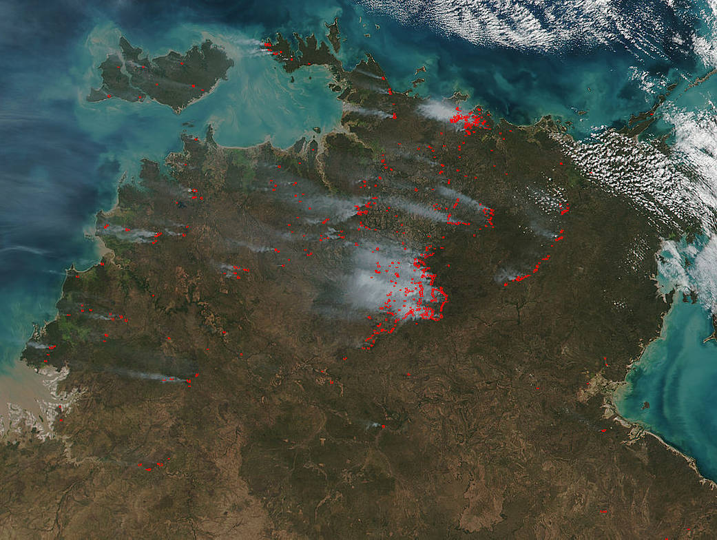
The Suomi NPP satellite’s Visible Infrared Imaging Radiometer Suite (VIIRS) instrument captured a look at multiple fires and smoke burning in northern Australia on June 15, 2017. The fire incident map for the last 24 hours does not show many incidents in the area seen in the image: http://www.pfes.nt.gov.au/Fire-and-Rescue/Incident-map.aspx
It is reasonable to assume with the information given by the Northern Territory Fire and Rescue (NTFR) service website it is more likely that the majority of fires on the image are prescribed burns. Also the NTFR has issued 18 different prescribed fire alerts for the area around Darwin and the rural areas in the Northern Territory. Another indication that these fires captured by Suomi NPP is that the fires appear in lines on the satellite image rather than haphazard dots as would be expected with lightning strike fires. The NTFR also has published the prescribed burn schedule for 2017 and that can be viewed here: http://www.pfes.nt.gov.au/~/media/Files/Fire/Precribed%20burn%20advice/Burn%20Locations%202017.ashx On this schedule can be seen a huge number of prescribed fires that have been slotted for this year.
The Suomi NPP satellite is a joint mission between NASA, NOAA and the U.S. Department of Defense.
NASA image courtesy Jeff Schmaltz, MODIS Rapid Response Team. Caption: NASA/Goddard, Lynn Jenner with information from the Northern Territory Fire and Rescue website