


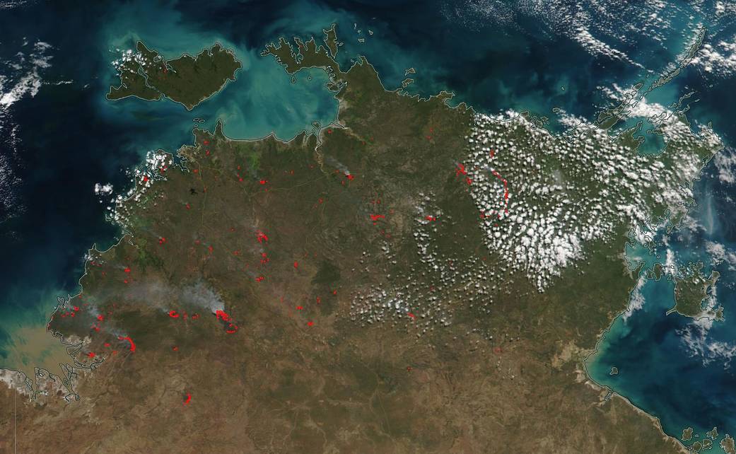
The Northern Territory Fire and Rescue Service (NTFRS) in Australia maintains a listing of all fire and rescue incidents in the Northern Territory for the preceding 24 hours. The current situation map lists a number of small grass and scrub fires in the area as well as some ongoing permitted fires. NASA/NOAA Suomi NPP satellite was able to capture this image of the heat signatures in the Northern Territory of Australia on May 27, 2019. The actively burning fires, detected by thermal bands, are shown as red points, when accompanied by smoke the red points are usually indicative of fire. The current incident report for the NTFRS does not detail every fire seen in this image. For more information visit: http://www.pfes.nt.gov.au/Fire-and-Rescue.aspx and their Facebook page.
NASA’s Earth Observing System Data and Information System (EOSDIS) Worldview application provides the capability to interactively browse over 700 global, full-resolution satellite imagery layers and then download the underlying data. Many of the available imagery layers are updated within three hours of observation, essentially showing the entire Earth as it looks “right now.” Image Courtesy: NASA Worldview, Earth Observing System Data and Information System (EOSDIS). Caption: Lynn Jenner with information from NTFRS