


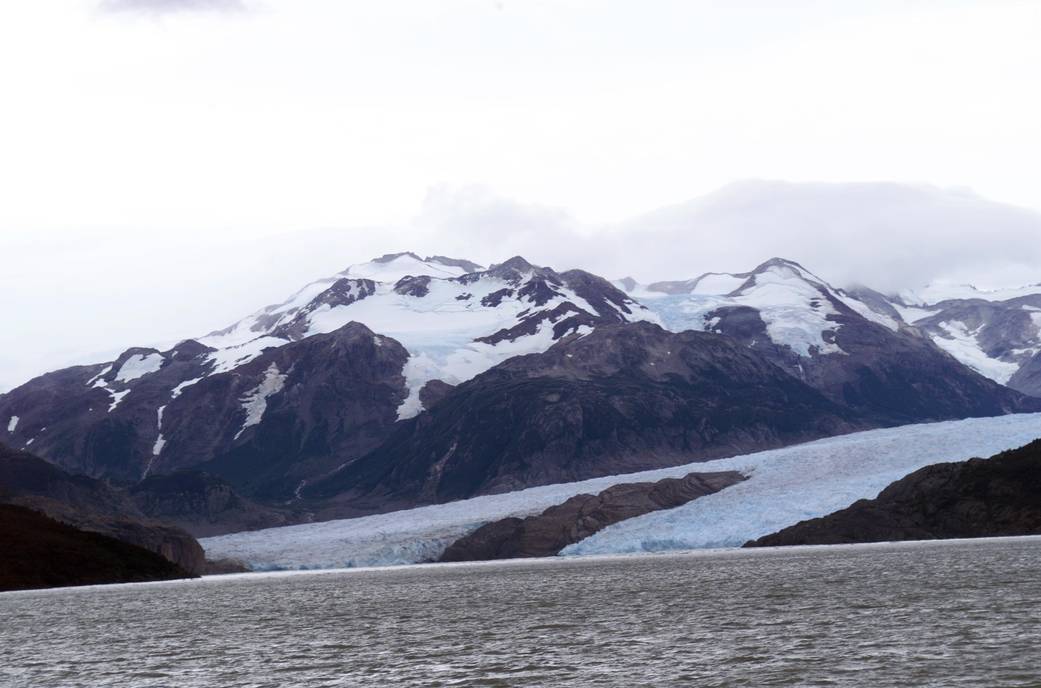
Glacier Grey view from Lago Grey (Grey Lake), photographed during NASA's AirSAR 2004 campaign in Chile.
ED04-0056-101
Mission: Airborne Synthetic Aperture Radar 2004 (AirSAR)
Glacier Grey view from Lago Grey (Grey Lake), photographed during NASA’s AirSAR 2004 campaign in Chile. Land visible in this photo was covered by glacier just 6 years earlier. AirSAR 2004 was a three-week expedition in Central and South America by an international team of scientists that used an all-weather imaging tool, called the Airborne Synthetic Aperture Radar (AirSAR), located onboard NASA’s DC-8 airborne laboratory. Scientists from many parts of the world combined ground research with NASA’s AirSAR technology to improve and expand on the quality of research they are able to conduct.March 11, 2004
NASA Photo / Jim Ross