


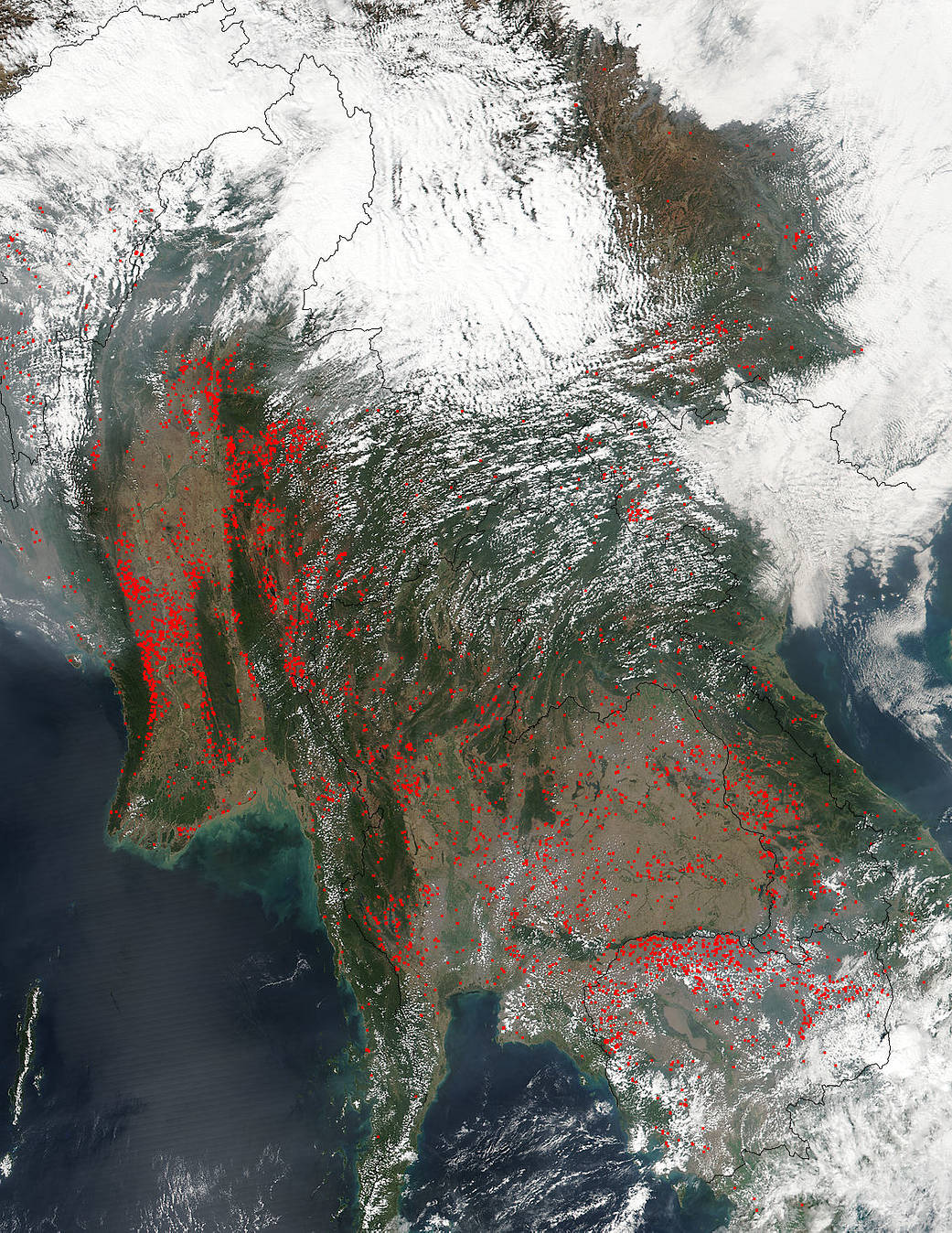
Once again agricultural fires are set in Southeast Asia for the purpose of clearing fields peak in late winter/early spring as farmers prepare land for seasonal planting. Fires from the biomass burning cover most of Indochina with the highest number being in Myanmar and Thailand in this image compared with the image on Feb. 6, 2017 which showed more signficant burning in Cambodia and Laos. The burning moves from area to area depending on the crops and the climate. Snow is still visible in the upper right hand corner of the image and the rest of the white across the image being cloud cover.
NASA’s Suomi NPP satellite collected this natural-color image using the VIIRS (Visible Infrared Imaging Radiometer Suite) instrument on February 20, 2017. Actively burning areas are outlined in red. NASA image courtesy Jeff Schmaltz LANCE/EOSDIS MODIS Rapid Response Team, GSFC. Caption by Lynn Jenner