


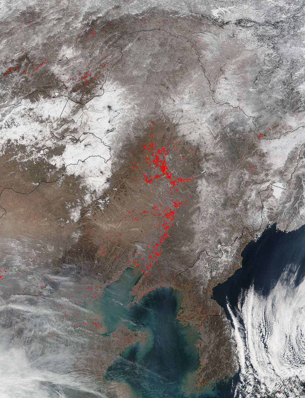
Fires have cropped up in eastern China as denoted by the red dots on this satellite image. They may be agricultural in nature, which is usually the case where numerous fires are found across a landscape, but that is unconfirmed. NASA’s Suomi NPP satellite collected this natural-color image using the VIIRS (Visible Infrared Imaging Radiometer Suite) instrument on March 15, 2017. The Suomi NPP instruments recognized temperatures higher than background and these areas are outlined in red. The VIIRS instrument is a 22-band radiometer which collects infrared and visible light data to observe weather, climate, oceans, nightlight, wildfires, movement of ice, and changes in vegetation and landforms. Suomi NPP is the first Earth-observing satellite to measure both global climate changes and key weather variables.
Suomi NPP is managed by NASA and NOAA. NASA image courtesy Jeff Schmaltz LANCE/EOSDIS MODIS Rapid Response Team, GSFC. Caption by Lynn Jenner