


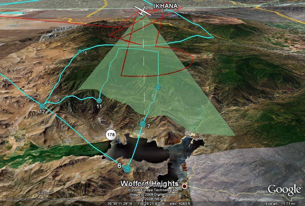
This 3-D illustration shows the real-time, mid-mission flight track of NASA's Ikhana remotely piloted aircraft over Southern California's Lake Isabella on Nov. 19, 2009.
LkIsabella_AMS-scan
This 3-D illustration shows the real-time, mid-mission flight track of NASA’s Ikhana remotely piloted aircraft over Southern California’s Lake Isabella on Nov. 19, 2009. The green swath emanating from Ikhana depicts the actual scanning profile of NASA’s Autonomous Modular Scanner over the mountain terrain. The sensor, carried in a pod under the aircraft’s wing, operated like a digital camera with specialized filters to detect light energy at visible, infrared, and thermal wavelengths.November 19, 2009
NASA Image