


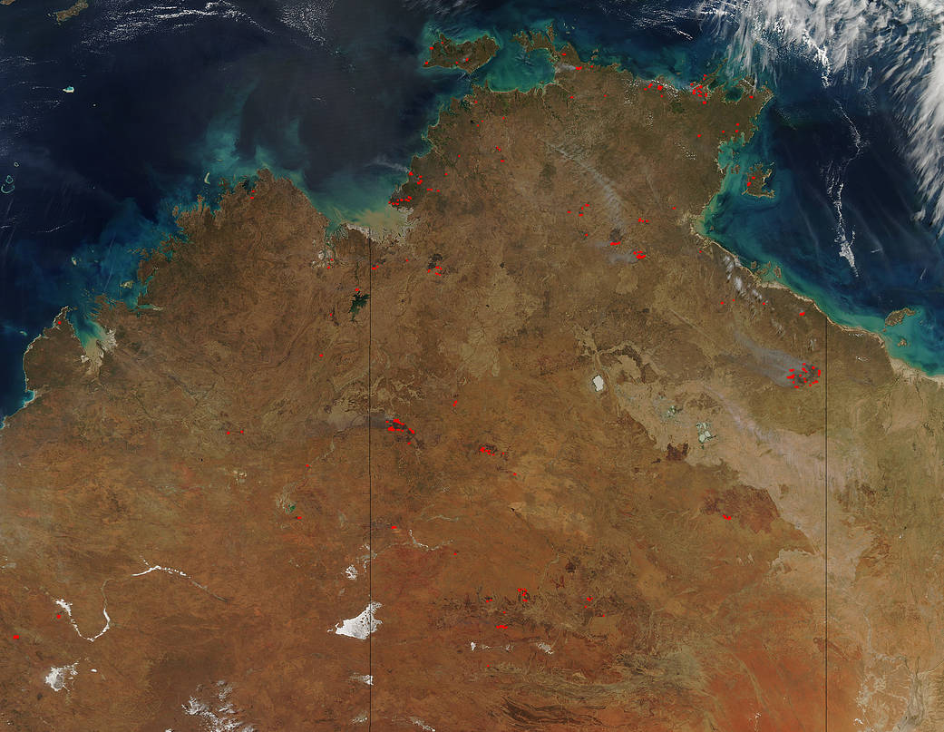
Australia’s Northern Territory is experiencing fires across the landscape which is not unusual in this area of the country. So too, Australia is entering its summertime which means more fires will break out as temperatures rise and humidity falls. There are also fires spotted in Western Australia which is to the left of the Northern Territory in the image. In addition, there is a possibility that some of these fires are prescribed fires set deliberately by land management teams to rid the area of potential fuel which may be ignited later in the season by lightning strikes. The number of fires has decreased since June when the Aqua satellite captured this image of the same area.
NASA’s Aqua satellite collected this natural-color image with the Moderate Resolution Imaging Spectroradiometer, MODIS, instrument on August 31, 2017. Actively burning areas (hot spots), detected by MODIS’s thermal bands, are outlined in red. Each hot spot is an area where the thermal detectors on the MODIS instrument recognized temperatures higher than background. When accompanied by plumes of smoke, as in this image, such hot spots are diagnostic for fire.NASA image courtesy Jeff Schmaltz LANCE/EOSDIS MODIS Rapid Response Team, GSFC. Caption by Lynn Jenner