


![Request for Information – Potential [Placeholder for Prize]](https://assets.science.nasa.gov/dynamicimage/assets/science/psd/solar/2023/09/s/solarsystem_0.jpg?w=1024)


Scientists are flying an airborne campaign out of NASA’s Langley Research Center in Hampton, Virginia this month to contribute to a joint U.S.-Canadian study on air quality in a region with high surface ozone levels.
A community-organized effort led by the Michigan Department of Environment, Great Lakes, and Energy named Michigan Ontario Ozone Source Experiment (MOOSE) is targeting the border region that’s home to Detroit on the U.S. side and Windsor, Ontario, in Canada. The southeast Michigan region has ozone levels higher than the U.S. federal standard and elevated ozone also exists across the border in southern Ontario.
High surface ozone levels are harmful to human health, especially in children, older adults and people with asthma. They tend to occur near urban regions in the summer months with high temperatures and strong sunlight, which both accelerate ozone formation. This issue is more complex when emissions occur near large water bodies where pollutants can be trapped near the surface and then are transported by breezes that result from the large temperature differences between water and land. Detroit and Windsor are separated by the Detroit River, which runs between Lake St. Clair to the north and Lake Erie to the south.
The MOOSE study includes partners from a number of agencies, both state and federal, as well as organizations and academic institutes from both the U.S and Canada. Measurements will be taken on land and in the air. Scientists hope to better characterize causes of elevated ozone levels in the region, the strength of emissions from sources such as vehicular traffic, power plants and other industrial processes burning fossil fuels, which all will help identify potential strategies for improving ozone air quality.
“From NASA’s vantage point in space, we have the unique ability to monitor Earth’s air pollution and contribute to studies that help researchers shine a light on the human health impacts of air quality,” said NASA Administrator Bill Nelson. “NASA’s research is essential to the future of the planet and improving life here on Earth. The air quality data we and our partners collect now will help NASA carry out that mission, bringing about changes that will benefit people living in vulnerable and often underserved areas.”
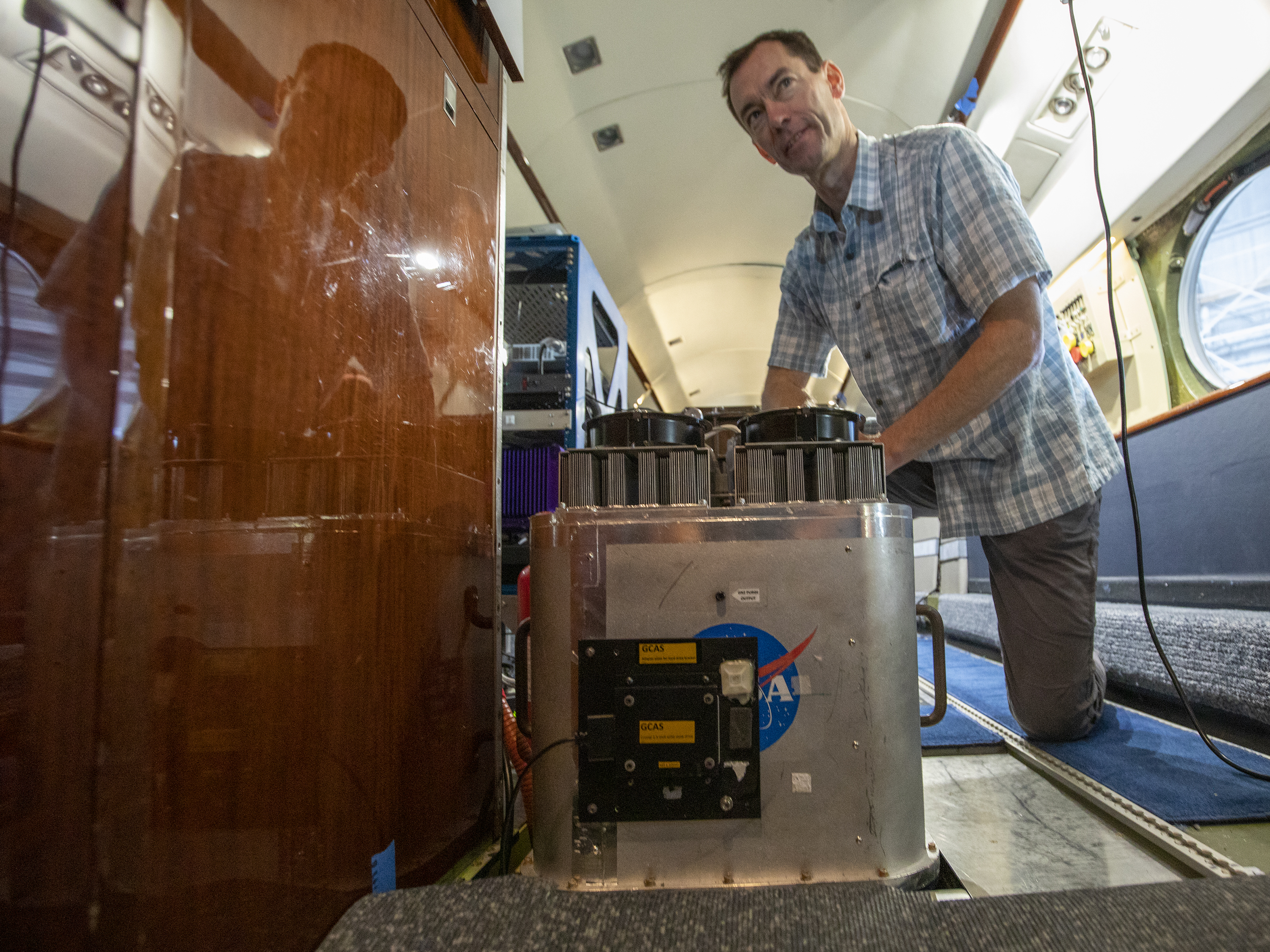
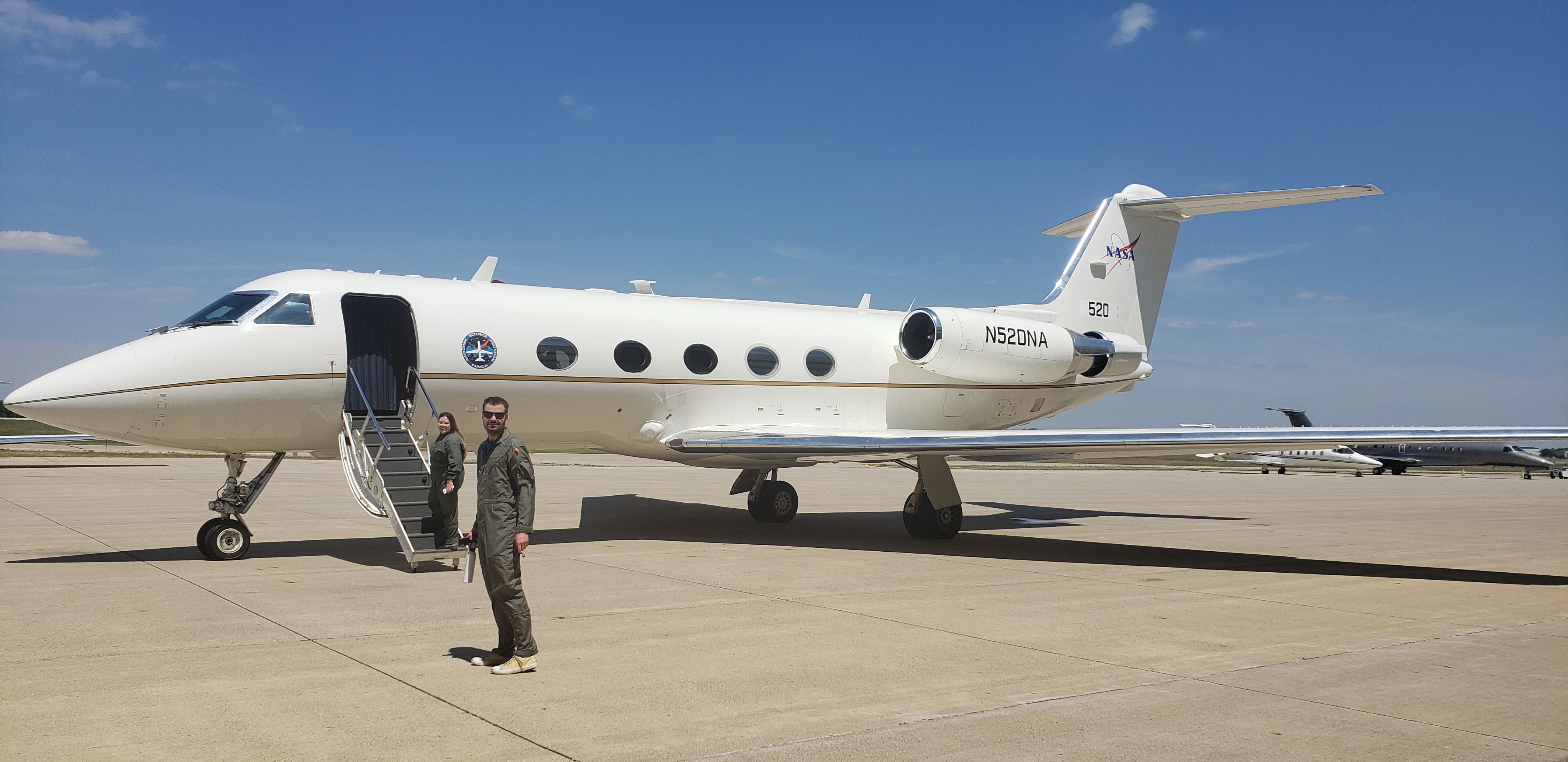
NASA scientists are aiming to conduct flights during six days on Langley’s C-20B Gulfstream III (G-III) aircraft carrying two instruments from NASA’s Goddard Space Flight Center in Greenbelt, Maryland. One instrument, called the Cloud Physics Lidar, uses a laser to make measurements of clouds and tiny atmospheric particles called aerosols. The G-III also carries the GEOstationary Coastal and Air Pollution Events (GEO-CAPE) Airborne Simulator (GCAS), an instrument that measures proxies of ozone precursors such as nitrogen dioxide and formaldehyde. The GCAS instrument’s measurements will provide a top-down view of emission hotspots and the evolution of these trace-gases downwind of the source.
“This is the first time these instruments have flown on a G-III,” said Laura Judd, a Langley atmospheric scientist who is leading NASA’s participation in the study. “Evolving from slower, shorter range aircraft that we’ve flown on in the past field studies to these jets for our airborne measurements is an advancement through the increase in the range we can fly in a day, which allows us to do repeated mapping over a larger area to observe changes in pollution throughout the day.”
GCAS is a test bed for an upcoming NASA mission called Tropospheric Emissions: Monitoring of Pollution (TEMPO)—the first geostationary air quality mission over North America. Scheduled to launch in 2022, TEMPO will make hourly measurements of air pollution over an area that will reach from Puerto Rico and Mexico to northern Canada, and from the Atlantic to the Pacific, encompassing the entire lower 48 United States. It will also form part of a virtual air quality satellite constellation looking at pollution around the Northern Hemisphere. Other satellites in the constellation include South Korea’s Geostationary Environment Monitoring Spectrometer (GEMS) instrument, which launched in 2020, and Europe’s Sentinel-4, currently scheduled to launch in 2023.
“Our airborne measurements not only help us and our partners prepare for using TEMPO data, but also provide an unseen perspective on emissions and can even identify if socioeconomic disparities in air quality exposure exist in these polluted metropolitan areas investigated, ’ said Judd.
MOOSE is one of several regional air quality studies in which NASA has participated in recent years. Other studies have looked at elevated ozone levels on the Lake Michigan coast, around the Long Island Sound and in both the southern and northern parts of the Chesapeake Bay. Later this summer, Judd and John Sullivan from Goddard will be co-principal investigators for Tracking Aerosol Convection interactions ExpeRiment-Air Quality (TRACER-AQ), a study looking at air quality issues in Houston. TRACER-AQ is tied to the Department of Energy’s TRACER study, which will look at the impact of aerosols on microphysical processes within convective clouds in the region near Houston, Texas.
Joe Atkinson
NASA Langley Research Center