


A large, slow-moving landslide is accelerating in eastern Congo, putting a community at risk. New research exposes geologic hazards amid unprecedented urban sprawl.
Creeping from just a finger’s width up to a few feet per year, slow-moving landslides occur naturally throughout the world. They typically are detected inching downslope in rocky areas with high seasonal precipitation and clay-rich soil, and they can take months to years – even centuries – to develop. Yet they can also bring sudden violence. Thousands of landslides are flowing, slipping, toppling, and sliding down hills from coastal California to China’s Three Gorges Reservoir. How these stealthy geologic phenomena respond to urban development has not been well understood.
Now a team of international researchers, including one from NASA’s Jet Propulsion Laboratory, has combined satellite and archival imagery to show how one African city’s changing water usage influences land movements near and just below the surface.
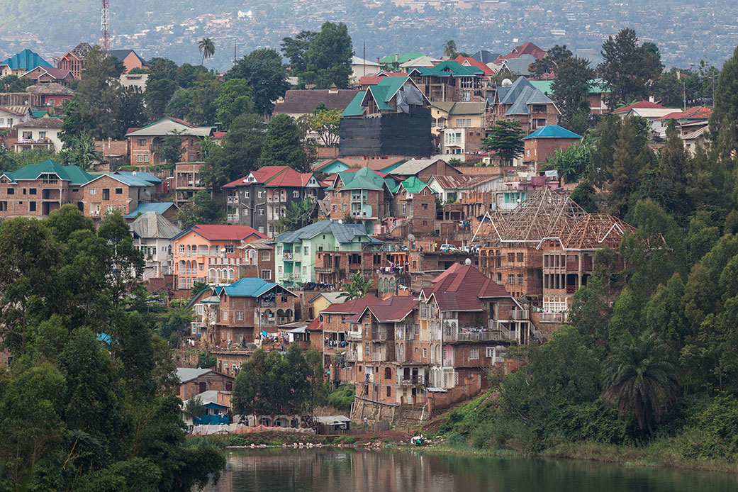
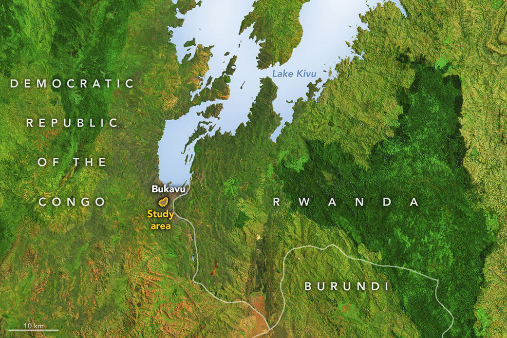
The new study zeroed in on Bukavu, a hillslope city in the Democratic Republic of the Congo. The researchers noted that Bukavu – with a population estimated to double to more than a million inhabitants by 2030 – is emblematic of many cities in the developing world that have seen rapid and unplanned growth on tectonically active landscapes. The city, originally established along the flat shoreline of a lake, has been expanding up steep slopes. Along the way, parts of Bukavu have experienced slow, ongoing destruction of infrastructure due to ground surface motion.
One of these active zones is the Funu neighborhood, where 80,000 people live, often in poor-quality housing, on top of a slow-moving landslide that shifts continuously up to 9 feet (3 meters) per year. To measure the land motion, the research team analyzed radar data collected by the Sentinel-1 satellites of the ESA (European Space Agency) and the COSMO-SkyMed satellite from the Italian Space Agency (ASI). The measurements were processed into maps showing land movement and then related to a number of landslide-triggering factors such as rainfall, earthquakes, and urban development.
To better visualize how Bukavu has transformed in recent decades, the team also drew on more than 70 years of aerial photographs (from 1947 to 2018) archived in the Royal Museum for Central Africa in Belgium. The images document a mushrooming cityscape. One reason for the growth is an influx of people fleeing violence in the broader region, where Bukavu is seen as a safe haven.
Focusing on week-to-week landslide motion over the past 4 1/2 years, the researchers found that rainfall, tectonic activity, and urban development all played roles in landslide behavior across seasons and years. But the most important factor was water runoff.
“For one of the first times, we were able to document a clear connection between the growth of a city and the acceleration of a slow-moving landslide,” said Alexander Handwerger, a landslide scientist at JPL and a co-author of the study. “We think this is driven by changes in slope hydrology – the way that water flows into the ground there – and not the additional weight of the houses on top.”
Water weakens rock by infiltrating its pores. In urban settings, infrastructure such as roads, storm drains, and ruptured pipes can drastically alter water flow, soaking and destabilizing parts of a slope. The cycle is self-reinforcing: Rerouting water flow weakens the slope, which in turn damages plumbing infrastructure, which releases more water into the rock.
Compared to high-velocity landslides (such as mudslides or lahars), which cause thousands of casualties and billions of dollars in damage each year, slow-moving landslides pose less of a threat to human lives. But inch by inch, year by year, they can cause mounting destruction. And on occasion they have been known to accelerate catastrophically. A recent example is the 2017 Mud Creek landslide near Big Sur, California, which dislodged about 6 million cubic yards (5 million cubic meters) of rock and debris across state Highway 1.

More attention should be paid to slow-moving landslides, the researchers said, because the current rate and scale of urban growth globally are unprecedented in human history. When populations migrate to potentially unsafe landscapes such as hillslopes, more people will be exposed to these natural hazards. Understanding how urban sprawl influences Earth’s surface will be vital to plan for and mitigate risk to communities.
“Attention is typically focused on landslides located in high-income, high-latitude countries, while landslide impacts disproportionately affect tropical areas where extremely rapid changes are taking place, such as population growth and environmental degradation,” said Antoine Dille, the study’s lead author and a scientist at the Royal Belgian Institute of Natural Sciences.
A space mission set to launch in 2024 could help provide even better information on these processes: The NASA-Indian Space Research Organization Synthetic Aperture Radar (NISAR) mission will observe surface changes around the world with accuracies down to a fraction of an inch. Such data will help scientists and policymakers protect lives and property by better monitoring subtle motions connected to landslides, earthquakes, volcanic eruptions, and other natural hazards.
Jane J. Lee / Andrew Wang
Jet Propulsion Laboratory, Pasadena, Calif.
818-354-0307 / 626-379-6874
jane.j.lee@jpl.nasa.gov / andrew.wang@jpl.nasa.gov
Written by Sally Younger
2023-014