


Like hurricane categories, a scale for atmospheric river storm severity could help communities around the globe compare and prepare.
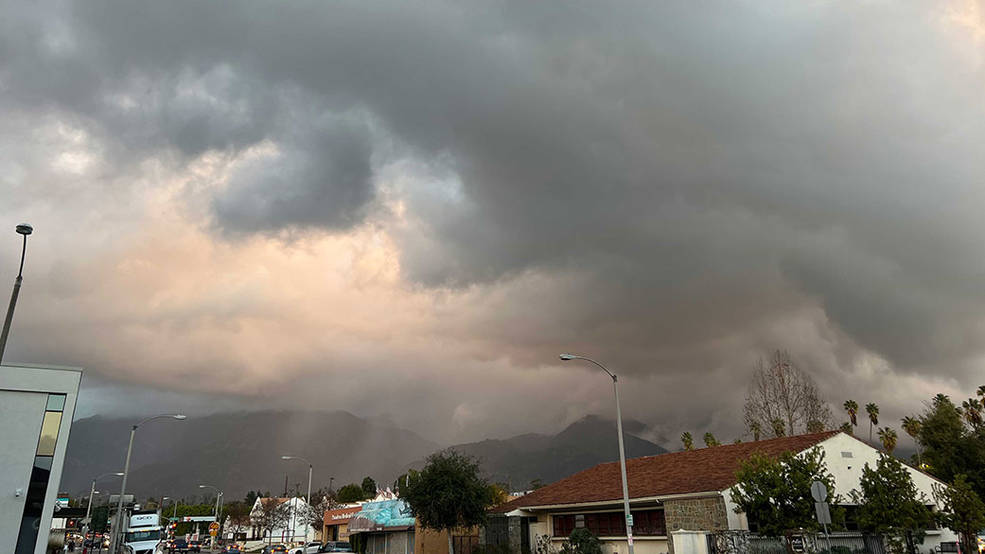
Atmospheric rivers – vast airborne corridors of water vapor flowing from Earth’s tropics toward higher latitudes – can steer much-needed rain to parched lands. But in extreme form, they can also cause destruction and loss of life, as recently occurred in parts of California. Their effects, both hazardous and beneficial, are felt globally.
A new study using NASA data shows that a recently developed rating system can provide a consistent global benchmark for tracking these “rivers in the sky.” Research into atmospheric rivers has largely focused on the west coasts of North America and Europe. The new findings help expand our understanding of how these storms arise, evolve, and impact communities all over the world. In addition, the ratings could help meteorologists better warn people to plan for them.
The findings also revealed an increasing number of atmospheric river events around the world and across all ranks, with peak activity in mid-latitude oceans (temperate belts roughly between 30 and 60 degrees north and south).
To help forecast the potential strength and impacts of the storms as they make landfall on the West Coast of North America, meteorologists from the Scripps Institution of Oceanography at the University of California, San Diego, along with the National Weather Service, introduced an atmospheric river (AR) scale in 2019. By ranking them from 1 to 5, or weakest to strongest, the scientists sought to differentiate between primarily beneficial storms versus primarily hazardous ones. By one estimate, insured losses due to flood damages increase by a factor of 10 with every step up in rank, with AR 5 events linked to a median damage amount of $260 million in the Western U.S.
Shaping the Water Cycle
Although the term “atmospheric river” was only coined in 1994, the storms’ impacts were felt well before then. Scientists have estimated some 300 million people worldwide are at risk for flooding due to atmospheric rivers which, on average, transport quantities of water vapor more than double the flow of the Amazon River. A growing body of research is exploring how these storms play a critical role in shaping the global water cycle from the Andes to the Arctic, where moisture from atmospheric rivers has recently been found to melt and slow the seasonal recovery of sea ice.
In the new study, scientists built a database of global atmospheric river events from 1980 to 2020, using a computer algorithm to automatically identify tens of thousands of the events in the Modern-Era Retrospective analysis for Research and Applications, version 2 (MERRA-2), a NASA re-analysis of historical atmospheric observations. To rank the events, the study authors then applied the atmospheric river scale, which is based on a storm’s expected duration and maximum rate of water vapor transport.
Across the 40 years studied, higher-ranked storms lasted longer and traveled farther than lower-ranked storms. Mean travel distance was found to be about 400 miles (650 kilometers) with AR 1 and about 2,900 miles (4,700 kilometers) with AR 5, while mean lifetime was about 17 hours for AR 1 and 110 hours for AR 5. Higher-ranked storms (AR 4 and AR 5) were less common and tended to begin their life cycle closer to the tropics while ending in colder, higher-latitude regions.
Additionally, the scientists detected an increase in atmospheric river frequency during strong El Niño years.
Credits: NASA/JPL-Caltech
Diagnosing a Storm
“The current study helps to highlight the global reach of atmospheric rivers, as well as their possible origins, including in less-explored regions where the environmental conditions and societal impacts could be different from where we currently live [in the United States],” said lead author Bin Guan, a scientist at the Joint Institute for Regional Earth System Science and Engineering (JIFRESSE). The institute is a collaboration between University of California, Los Angeles and NASA’s Jet Propulsion Laboratory in Southern California.
A uniform scale can be useful for diagnosing atmospheric rivers in an era of instant communications, the scientists said. A key advantage is that the ratings minimize possible confusion when comparing the same meteorological phenomenon across languages and cultures. They noted this has not been the case for some more familiar weather events, such as tropical cyclones, which have been categorized using different thresholds in different regions.
Guan and colleagues said that taking the next step and translating the scale into region-specific impacts will require more research that takes into consideration local characteristics. They noted that many factors, from geography to socioeconomics, can influence how a storm is perceived by those who weather it.
Jane J. Lee / Andrew Wang
Jet Propulsion Laboratory, Pasadena, Calif.
818-354-0307 / 626-379-6874
jane.j.lee@jpl.nasa.gov / andrew.wang@jpl.nasa.gov
Written by Sally Younger
2023-037