


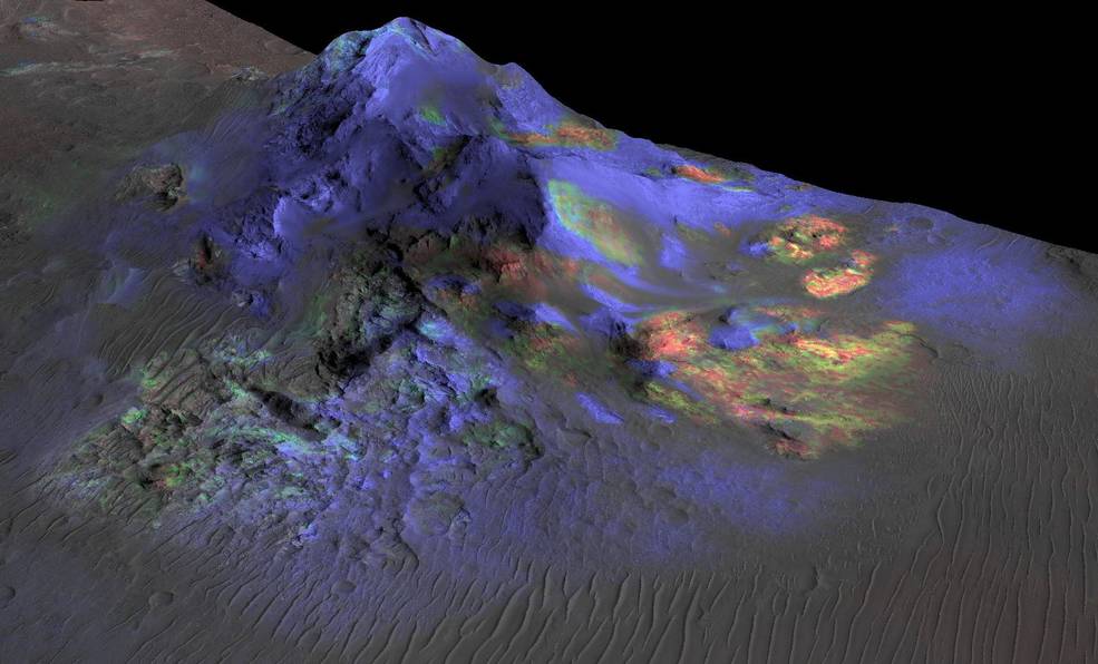
One of six instruments aboard the agency’s Mars Reconnaissance Orbiter, CRISM produced global maps of minerals on the Red Planet’s surface.
NASA switched off one of its oldest instruments studying Mars on April 3, a step that’s been planned since last year. Riding aboard NASA’s Mars Reconnaissance Orbiter, CRISM, or the Compact Reconnaissance Imaging Spectrometer for Mars, revealed minerals such as clays, hematite (otherwise known as iron oxide), and sulfates across the Red Planet’s surface for 17 years.
Led by Johns Hopkins University’s Applied Physics Laboratory (APL) in Laurel, Maryland, CRISM produced high-resolution mineral maps crucial in helping scientists understand how lakes, streams, and groundwater shaped the planet billions of years ago. The instrument’s two detectors saw in visible and infrared light, spotting the chemical fingerprints, or spectra, of minerals that form in the presence of water.
“Shutting down CRISM marks the end of an era for us,” said Rich Zurek, MRO’s project scientist at NASA’s Jet Propulsion Laboratory, which manages the mission. “It’s revealed where and how water transformed ancient Mars. The CRISM data products will be mined by scientists for years to come.”
NASA has also relied on CRISM maps to figure out where the most scientifically interesting landing sites are, as with Gale Crater, which Curiosity has been exploring since 2012, and Jezero Crater, where NASA’s Perseverance rover recently collected its 19th sample.
In order to study infrared light, which is radiated by warm objects and is invisible to the human eye, CRISM relied on cryocoolers to isolate one of its spectrometers from the warmth of the spacecraft. Three cryocoolers were used in succession, and the last completed its lifecycle in 2017.
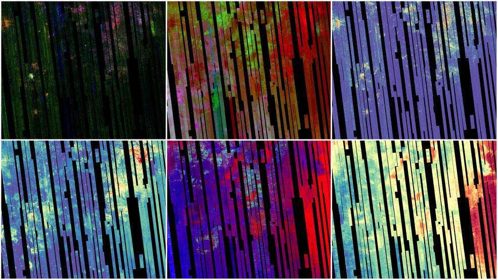
The CRISM team then looked for ways to continue producing data without the use of cryocoolers, deciding to create two new, nearly global maps. The first of these relied on data previously collected by the infrared spectrometer and by the second spectrometer on the instrument, which viewed a more limited range of minerals in visible and near-infrared light. This first map of water-related minerals, containing 5.6 gigapixels, has a spatial resolution of 600 feet (180 meters) per pixel and covers 86% of Mars. Scientists began releasing it in sections last year.
For the second map, CRISM’s remaining spectrometer gathered data at an even higher spatial resolution (300 feet, or 90 meters per pixel). This map is slated for release in September.
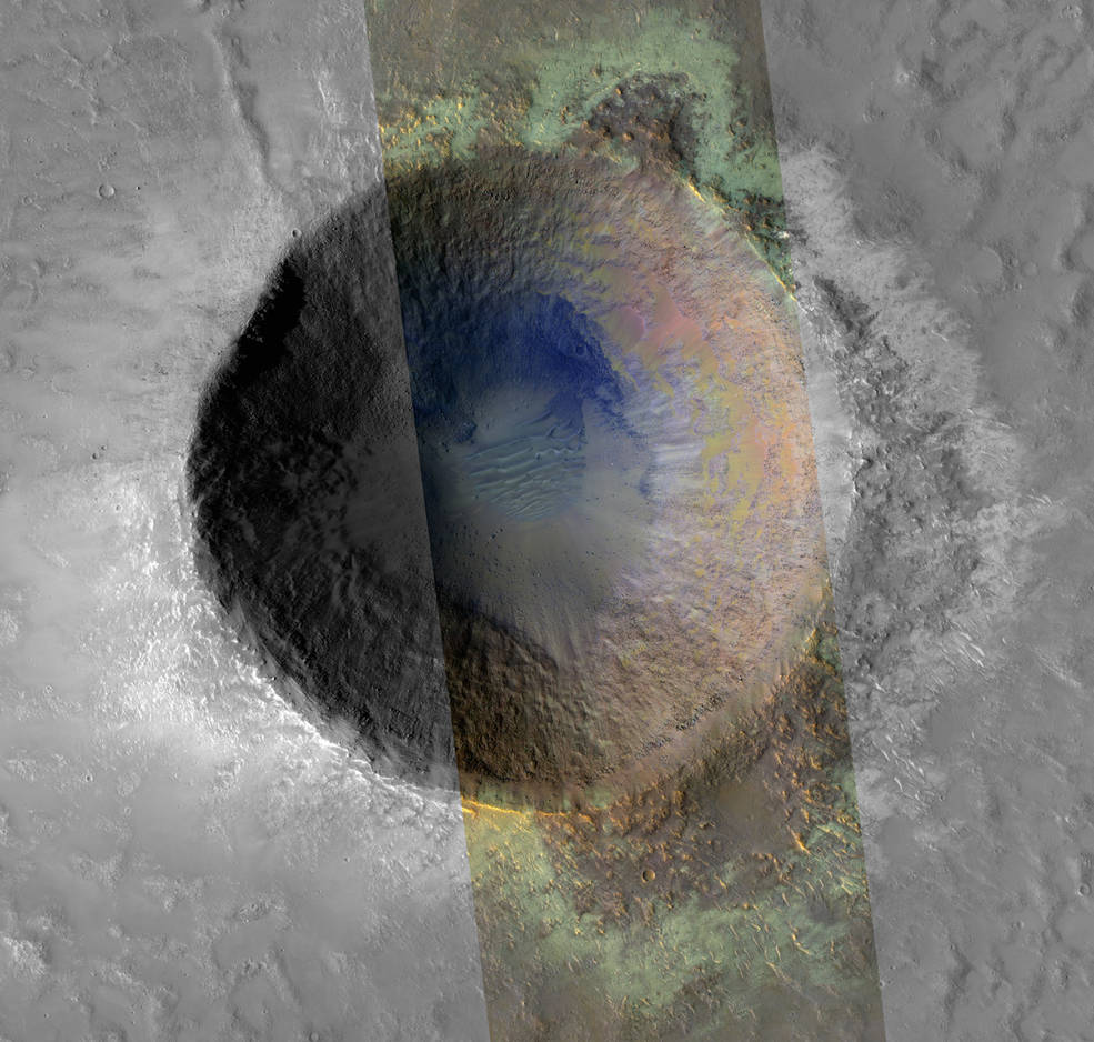
“With these new maps, researchers can easily tie mineral deposits observed in high-resolution images to regional scale trends, landscape features, and geology,” said Kim Seelos, CRISM’s deputy principal investigator at APL. “Even though the CRISM investigation is formally coming to a close, I hope and expect to see many future scientists taking advantage of CRISM data for their research.”
NASA’s JPL, a division of Caltech in Pasadena, California, manages MRO for NASA’s Science Mission Directorate in Washington.
Andrew Good
Jet Propulsion Laboratory, Pasadena, Calif.
818-393-2433
andrew.c.good@jpl.nasa.gov
Karen Fox / Alana Johnson
NASA Headquarters, Washington
301-286-6284 / 202-358-1501
karen.c.fox@nasa.gov / alana.r.johnson@nasa.gov
2023-057