As the seasons turn from spring, to summer, to fall – farmers plant crops, monitor their growth and harvest them. And now increasingly they are using NASA Earth science data to help make their decisions. While NASA satellites primarily support scientific understanding, the data can also be applied for societal benefits like agriculture.
In our skies, NASA’s Earth-observing satellites help farmers track rainfall amounts, soil moisture, crop health, and more. On the ground, NASA partners with agencies and organizations around the world to help farmers use that data to care for their own fields.
Here are a few ways NASA helps put food on the table, from planting to harvest.
Planting
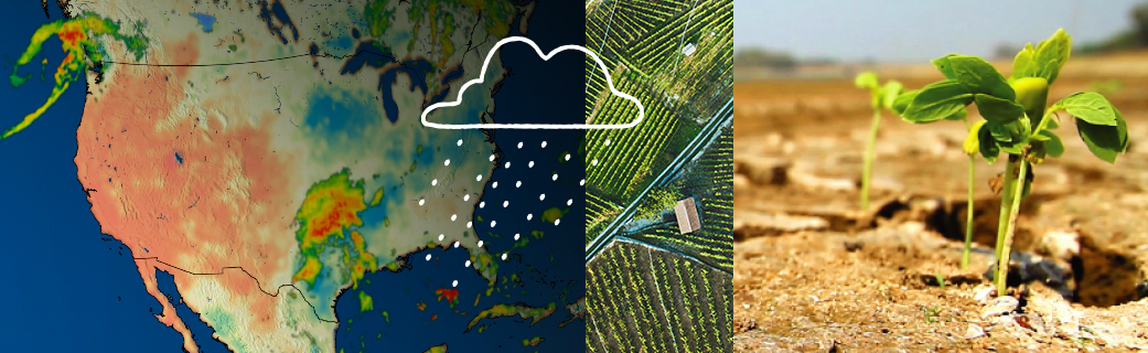
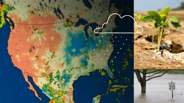
Wrapping seeds in wet paper towels is a classic science lesson to show how seeds sprout and grow. Moisture is critical for germinating seeds; they like a moist but not soggy environment. Farmers can use satellite data taken from hundreds of miles above their fields to “see” how moist their soil is across large fields.
“When you’re not sure when to water your flowers or your garden, you can look at the soil or touch it with your hands. We are sort of ‘feeling’ the soil, sensing how much water is in the soil – from a satellite, 685 kilometers above the Earth [just over 537 miles],” said John Bolten, the associate program manager of water resources for NASA Earth Science Division’s Applied Sciences Program.
This spring, NASA, the U.S. Department of Agriculture and George Mason University released Crop-CASMA, a tool that shows 1-kilometer [247 acres] resolution soil moisture and vegetation conditions for the United States. With Crop-CASMA, instead of relying on soil moisture reports for large regions, farmers can see differences in moisture between much smaller areas – about the size of a couple of golf courses or half of a section.
The USDA also uses Crop-CASMA to power their monthly Crop Progress Reports, which update farmers on their state’s soil moisture, crop health and growing progress.
Growing
It’s dangerous being a seedling.
Heavy spring rains or summer storms can flood fields and drown growing plants. Dry spells and droughts can starve them of nutrients. Insects and hail can damage them. Farmers need to keep a close eye on plants during the growing season. NASA satellites help them do that.
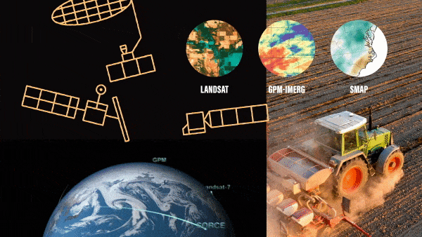
- The Landsat program, which will launch its ninth satellite in 2021, has tracked changes to Earth’s surface since 1972.
- The Soil Moisture Active Passive (SMAP) satellite measures soil moisture.
- The Moderate Resolution Imaging Spectroradiometer (MODIS) and the ECOsystem Spaceborne Thermal Radiometer Experiment on Space Station (ECOSTRESS) instruments measure crop health.
- The Global Precipitation Measurement Mission (GPM) measures rain, snow and more around the world in near real time.
- The Gravity Recovery and Climate Experiment (GRACE-FO) measures groundwater that farmers use for irrigation.
“What’s really cool about what NASA does is that everything is in the public domain,” Bolten said. “Our products are free and publicly accessible to everyone around the world.”
As NASA’s Earth-observing satellites collect all this data, NASA’s Earth Science Division works with farmers, water resource managers and others to determine what data they need and how it can best be put to use.
For example, in California, irrigation is essential for agriculture. California’s Central Valley annually produces more than 250 types of crops and is one of the most productive agricultural regions in the country – but it’s dry. Some parts only get 6 inches of rain per year.
“California has a long history of trying to manage water,” said Michael Cahn, an irrigation and water resource advisor for University of California Cooperative Extension. “Most of the water that we receive, whether as snow or precipitation generally, is in the northern part of the state. Most of the vegetable, tree crop and fruit crop production is farther south.”
Cahn and his NASA colleagues help make irrigation a little easier. Landsat data powers CropManage – an app that tells farmers how long to irrigate their fields, based on soil conditions and evapotranspiration, or how much water plants are releasing into the atmosphere. The warmer and drier the atmosphere, the more plants “sweat” and lose water that needs to be replenished.
Knowing how long to irrigate helps farmers conserve water and be more efficient. In years like 2021, intense droughts can make water management especially critical.
Credits: NASA/ Jefferson Beck
Harvest
Leading up to harvest, farmers need to know their expected yields – and profits.
In partnership with NASA Harvest, NASA’s Food Security and Agriculture Program within the Earth Sciences Division, USDA’s Foreign Agricultural Service (FAS), and other national and international organizations, GEOGLAM, or the Group on Earth Observations Global Agricultural Monitoring Initiative, tracks and reports on crop conditions around the world. USDA FAS is also one of the main users of a SMAP-based soil moisture product developed by Bolten and his team at NASA’s Goddard Space Flight Center to drive their crop forecasting system.
To learn more about NASA’s role in agriculture, visit: https://www.nasa.gov/subject/20266/food/
By Jessica Merzdorf
NASA’s Goddard Space Flight Center, Greenbelt, Maryland