


It’s the most wonderful time of the year – the time NASA’s SnowEx campaign hits the skies and ground of the world’s snowy places, measuring snow properties to understand how much water is contained by each winter’s snowfall.
Snow is a vital source of water for drinking, agriculture and electrical power in the western United States and other locations around the world. To know how much water will be available the following spring, water resource managers and hydrologists need to know where snow has fallen, how much there is and how is characteristics change as it melts. Measuring snow water equivalent, or SWE, tells them how much water is contained within the snowpack.
NASA currently has no global satellite mission to track and study SWE. SnowEx’s airborne measurements, ground measurements and computer modeling are paving the way for future development of a global snow satellite mission. Here are some things they will be watching for in the 2020 campaign.
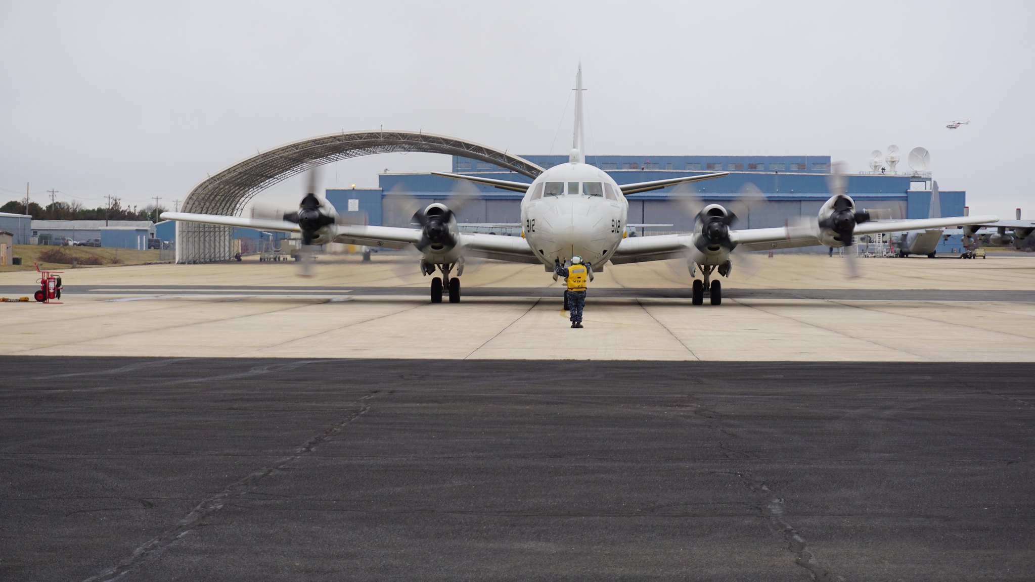
In the air …
Snow is challenging to measure because its characteristics change depending on what terrain it falls on, how deep it is and whether it is melting. No one tool or measurement can measure all types of snow all the time, the team said.
“The research gaps in snow remote sensing can be grouped by snow climate classes — tundra snow, snow in forests, snow in maritime areas – and by how snow evolves over time,” said Carrie Vuyovich, a research scientist at NASA’s Goddard Space Flight Center in Greenbelt, Maryland and SnowEx 2020’s current deputy project scientist. “Different snow characteristics impact the measurements differently.”
Tracking snow-water equivalent (SWE) across the season helps hydrologists and water resource managers know what water will be available when it melts in the spring, as well as plan for possible floods or droughts.
“It’s not so much the depth of the snow – that’s the measure most people are probably familiar with,” said Ed Kim, a research scientist at Goddard and SnowEx’s former project scientist. “You know, in the winter, if it snows and you’ve got to shovel your driveway, you want to know how many centimeters of snow you have to shovel. But we’re after the water equivalent: How much water that snow represents and what it means for floods and droughts.”
The SnowEx airborne campaign will fly radar and lidar (light detection and ranging) to measure snow depth, microwave radar and radiometers to measure SWE, optical cameras to photograph the surface, infrared radiometers to measure surface temperature, and hyperspectral imagers to document snow cover and composition. Some of these instruments work better than others across different types of terrain, vegetation and snow conditions, and seeing where and when each performs best will help snow scientists decide how different combinations of instruments would provide useful measurements for a potential satellite mission.
SnowEx 2020 will first test the instruments near Grand Mesa, Colorado, which includes both flat snow and forest. This year’s campaign will also include a time series of flights across Colorado, Utah, Idaho and California as snow melts in the spring, documenting changes between locations and seasons. The team began flights in December 2019 and will finish in May 2020.
“The last campaign was a snapshot in time,” said Vuyovich. “We did not see a lot of change in snow conditions over the three-week period in 2017, and some techniques we are interested in use a change detection method.”
The time series campaign will test and validate a SWE measurement method using L-band interferometric synthetic aperture radar (InSAR), measured with the NASA Jet Propulsion Laboratory’s UAVSAR instrument.
“The UAVSAR instrument is very reliable — it’s flown often for non-snow applications such as deformation of the earth surface after earthquakes or volcanoes,” said HP Marshall, an associate professor at Boise State University, Idaho and researcher with the U.S. Army Cold Regions Research and Engineering Lab, and SnowEx 2020’s project scientist. “In our preliminary tests in 2017, we got some pretty promising results that correlate with snow depth and SWE, but there wasn’t a very big change, so we couldn’t test over a wide range of conditions. In 2020, we will make InSAR measurements weekly to bi-weekly during a time series experiment, from snow-free conditions through transition into the wet spring snowpack.”
SnowEx will also test the Snow Water Equivalent Synthetic Aperture Radar and Radiometer (SWESARR). SWESARR was developed at NASA Goddard, and its combination of active and passive microwave measurements allows it to measure characteristics of the snow as well as the soil underneath, which can affect the microwave signal.
SnowEx includes partners from universities, private institutions and other government agencies who bring additional expertise and instruments — such as the National Oceanic and Atmospheric Administration’s airborne gamma instrument and the University of Alabama’s FMCW radar. These instruments cannot be used in space, but they will help the snow science community advance their understanding of snow across various conditions.
The team will also compare their data to NASA’s ICESat-2 and the European Space Agency’s Sentinel 1A and 1B satellites, and high-resolution optical imagery from NASA WorldView and private imaging companies.
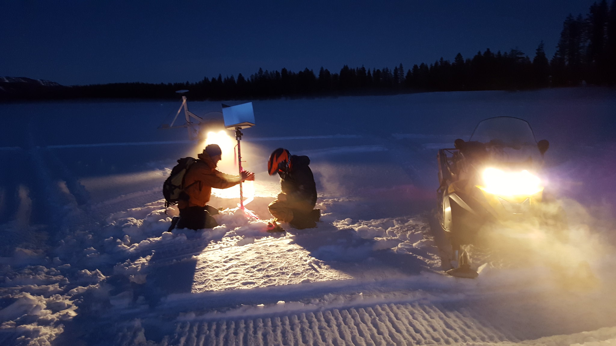
… and on the ground
In order to know if their algorithms are accurate, the team also collects data on the ground. SnowEx 2020’s ground teams will measure snow depth, density, accumulation layers, temperature, wetness and snow grain size — the size of a typical particle. Measuring these characteristics lets them see how different locations and on-the-ground characteristics impact the airborne data.
This year, real-time computer modeling will be integrated into the campaign as well.
“Our snow modeling group has been working to understand where we see the greatest uncertainty in model simulations of SWE,” said Vuyovich. Here, “uncertainty” refers to the range of estimates from a number of simulations. The team assembled a twelve-member ensemble of different models and atmospheric data to simulate nine years’ worth of snow seasons across North America, pinpointing areas where uncertainty was highest.
“Evaluating the data real-time will help us understand what is driving the uncertainty.” Vuyovich said. “Next, we’ll start looking at how assimilating different remote sensing observations can help improve our estimates.”
To follow SnowEx 2020 in the field, watch https://blogs.nasa.gov/earthexpeditions/.
To learn more about NASA’s snow research, visit https://snow.nasa.gov/.
By Jessica Merzdorf
NASA’s Goddard Space Flight Center, Greenbelt, Maryland