


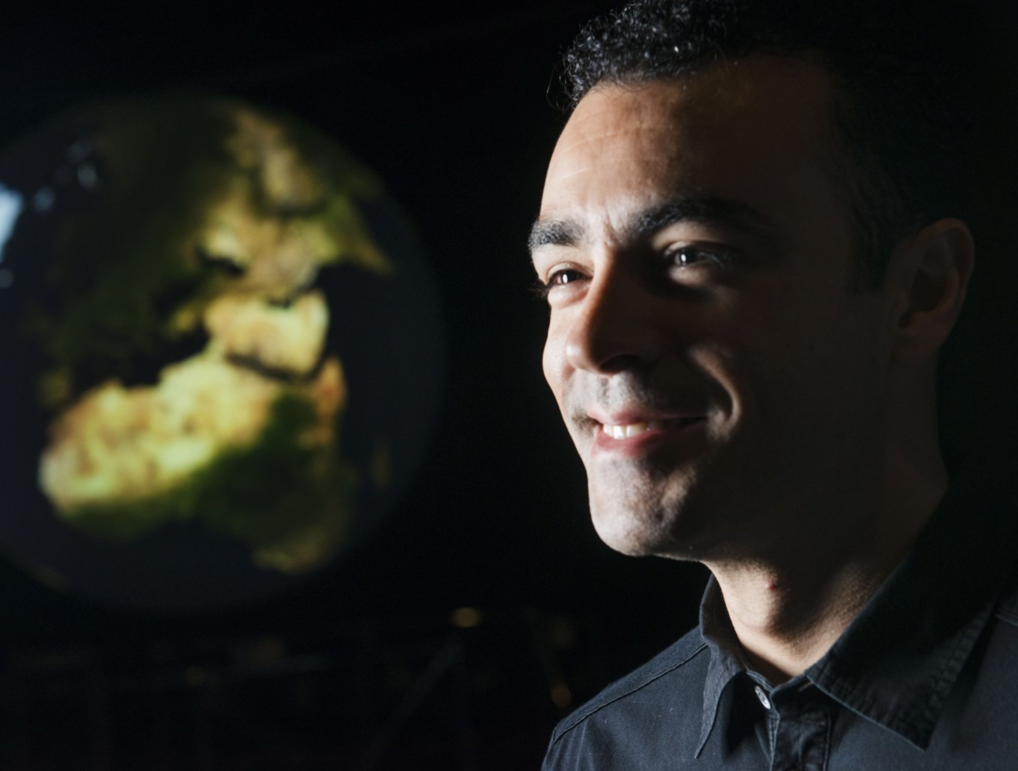
Name: Miguel O. Román
Title: Deputy Land Discipline Lead: Suomi National Polar-orbiting Partnership Mission
Formal Job Classification: Research Physical Scientist
Organization: Code 619, Terrestrial Information Systems Laboratory, Earth Science Division, Science Directorate
From City Lights to Climate Change
What do you do and what is most interesting about your role here at Goddard? How do you help support Goddard’s mission?
On a typical day, I wake up and check my email to get the latest mission updates concerning the Visible Infrared Imaging Radiometer Suite (VIIRS) on the Suomi National Orbiting Partnership (NPP) satellite. VIIRS provides timely global coverage of many of Earth’s components including the land, ocean, atmosphere and cryosphere. I use these measurements to produce and distribute a suite of global land products to provide scientists and policy makers with useful information about issues such as water and land use, disaster management, agricultural problems, energy consumption and biodiversity conservation.
How important is teamwork or collaboration with others?
Ours is an international effort. NASA has 25 Earth-observing satellites orbiting the Earth right now. To get a complete picture of what is going on, it is very important for us to collaborate with other space agencies. We team with national agencies like the National Oceanographic and Atmospheric Administration (NOAA) and the U.S. Geological Survey (USGS); as well as international partners, such as ESA (the European Space Agency), the French space agency, the Japanese space agency and others, to ensure that we have sustained observations for very long periods of time. Polar-orbiting satellites usually last five to 10 years. As they age, they become more unpredictable. It is very important for us to integrate measurements from different satellites operated by NASA in concert with other space agencies.
What is your role in interacting with other space agencies?
I am the chair of the Land Product Validation (LPV) Subgroup of the Committee of Earth Observation of Satellites (CEOS) Working Group on Calibration and Validation (WGCV). Space agencies from the U.S., Europe, China, Japan and others are members of CEOS. Leadership of this committee changes every three years. Currently, NASA is currently lead coordinating agency for the CEOS land validation program.
As a CEOS officer, I lead an international team of independent experts that are actively involved in global land product validation activities. Our goal is to ensure that all space agencies work together to devise agreed upon standards and techniques for measuring and assessing the quality and rigor of Earth observations. Our measurements are used as the basis of national and international climate policy, so they have to be accurate.
What kinds of land measurements do you track and what can they tell us about the climate?
We study many of the Earth’s processes over land. We treat the atmosphere as a noise that needs to be removed because we want to measure a satellite signal impacting the Earth’s surface. Different scientists need different data. At Goddard, we provide a portfolio of different data from which our users may select. We look at natural and human-induced changes.
What are some of the natural changes being tracked?
Natural changes include phenology, which is the study of vegetation dynamics, meaning how forests, meadows and crops change throughout the seasons. We track the pulse of vegetation from space by looking at the changes in vegetation structure and function over time.
Our data is used to help predict when our Washington, D.C., cherry blossoms will bloom. We also look at the temperature record because it has to get hot. Then we look at how the vegetation is responding to that warming. The same principles apply to farming. Many farmers use our data, including our soil moisture satellite record, to time their planting season and to determine how much water and fertilizer they will need during extreme periods of drought and rain.
We can even estimate the total area that is formed by leaves in a forest from space, which is called the leaf area index. This tells us what types of tree species dominate a particular forest. By collecting these measurements during long periods of time, the satellite data can indicate whether the forest canopy species composition is changing, which is really useful to help detect insect infestations in forests, as well as other disturbances related to climate change and human activities.
What is your role in tracking the human-caused changes?
My recent work has focused on the role that cities play in addressing climate change. As climate scientists, we want to improve our understanding of cities – what makes cities grow, change form, or become dense through time? Answering these questions can help us understand the drivers of energy use in cities, especially in developing and “data poor” countries. Almost 70 percent of the Earth’s carbon emissions comes from cities.
Why are you interested in developing countries?
Today’s developing countries will hold the megacities of tomorrow. We need to be able to predict the next metropolises 100 years from now. These countries are also in areas where we expect to see the largest impacts due to climate change. Many relief agencies, both in the U.S. and elsewhere, are helping these countries by providing them with the data and analytical tools needed to build more sustainable, livable, and low-carbon cities.
We do our best to make sure that our satellite data reflects all communities on Earth – those which have electricity and those which lack access. An estimated 1.2 billion people, 17 percent of the global population, did not have access to electricity last year. We cannot ignore that many people, especially when we are trying to understand how human activities impact our planet. A key to solving the climate crisis is to be able to help these communities become more resilient and more sustainable.
What is your educational background?
I have an undergraduate degree in electrical engineering from the University of Puerto Rico. I have a master’s degree in systems engineering from Cornell University. I also have a Ph.D. in remote sensing from Boston University.
Why did you become an engineer and what made you morph into a scientist?
I was born and raised in Puerto Rico. My uncle was an engineer for the local phone company and he inspired me to pursue a career in STEM [science, technology, engineering and math]. At that time, to be successful in Puerto Rico, you could study to become an engineer and work as a line manager for a local biotech company or Bacardi Rum. When I was still in college, Goddard offered me a summer internship. That opportunity helped me looked beyond the things that happened on my local community and broadened my interests into some fascinating areas of scientific research.
At Goddard, I noticed that scientists were the most enthusiastic about their work. The broader impact of NASA’s Earth science missions really appealed to me. These folks were changing the text books I once read as a young kid! From that point, I wanted to learn and understand the science behind climate change. So, I became a NASA scientist. I still believe that scientists have the most fun.
When did you come to Goddard?
I came to Goddard in 2003 as an intern. In 2009, after I finished my doctorate, Goddard offered me a permanent position. In between, Goddard gave me scholarships and fellowships to finish my degrees. I really feel that I became a part of Goddard in 2003.
What do you look for in an intern?
I host interns in our laboratory every summer. I try to find interns who are passionate about space and Earth science. Goddard is unique in that we have access to an incredible amount of space, airborne and ground Earth science assets. We have the planes, the rockets and the satellites. I want someone who will make the most of these assets.
Goddard also offers first-seat access to a lot of observational data. We can sit right in front of that server, right in front of that global archive. We turn that data into useful products and distribute them globally to our partners. So, we have to see the big picture. I want an intern who can see the big picture.
The one thing I always tell my interns is that they have to have a knack for turning raw pixels into useful data. That says it all.
What are the qualities of a good scientist?
You have to have integrity for the scientific process. You also have to be open about your research and understand that the best science is that which is crowd-sourced, the science where everybody contributes something. We are all standing on the shoulders of giants who paved the way for new science. A good scientist is a team player.
What is the coolest thing you have done at Goddard?
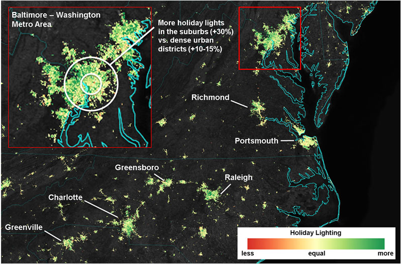
In 2014, our team detected an unexpected increase in our nocturnal visible satellite observations. We never thought that our instrument would be sensitive enough to detect the increase in light emissions during the holidays, but it turns out that our engineers built an instrument 100 times more sensitive than its required design. Our composite images of the Christmas lights went viral.
Are you involved in fieldwork?
I’ve done fieldwork all over the U.S. We’ve run experiments using airborne and ground-based measurements to calibrate and validate the satellite data records. I’ve taken soil moisture profiles in Chickasha, Oklahoma, measured leaf area index in Harvard Forest, Massachusetts, and installed solar radiation sensors in Howland, Maine. Most recently, I’ve helped deployed night sky brightness meters around 20 sites in Puerto Rico to measure light pollution levels.
What is the most exciting thing that happened to you at Goddard?
While I was an intern in 2004, I met this bright, young woman from Normandy, France, who was an international intern working in astronomy. We reunited as doctoral students at Boston University. We married in 2007. She now works for the Hubble Space Telescope Science Institute.
She looks up at the galaxies and the interstellar medium. I look down at the Earth. We now have three kids, all big space enthusiasts. We have a big Dobsonian telescope in the backyard, as is tradition.
Is there something surprising about you that people do not generally know?
I love to cook. I married a French woman from a family of chefs with beautiful kitchens. We are an international family, so we love all kinds of food. The last special dish I made was beef Wellington and it turned out very well. At the end of the summer, I always invite my interns over for a five-course, gourmet dinner to thank them.
By Elizabeth M. Jarrell
NASA’s Goddard Space Flight Center, Greenbelt, Md.
Conversations With Goddard is a collection of Q&A profiles highlighting the breadth and depth of NASA’s Goddard Space Flight Center’s talented and diverse workforce. The Conversations have been published twice a month on average since May 2011. Read past editions on Goddard’s “Our People” webpage.