![Request for Information – Potential [Placeholder for Prize]](https://assets.science.nasa.gov/dynamicimage/assets/science/missions/a-step/FFR_Earth_Background_20251120%20.png?w=1024)


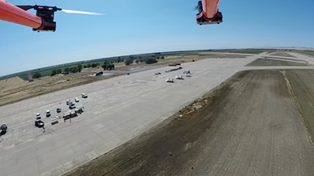
NASA recently successfully demonstrated rural operations of its unmanned aircraft systems (UAS) traffic management (UTM) concept, integrating operator platforms, vehicle performance and ground infrastructure. The next steps involve further validation through Federal Aviation Administration (FAA) test sites.
“UTM is designed to enable safe low-altitude civilian UAS operations by providing pilots information needed to maintain separation from other aircraft by reserving areas for specific routes, with consideration of restricted airspace and adverse weather conditions,” said Parimal Kopardekar, manager of NASA’s Safe Autonomous Systems Operations project and lead of NASA’s UTM efforts.
Engineers at NASA’s Ames Research Center in Moffett Field, California, are developing UTM cloud-based software tools in four segments of progressively more capable levels. They design each “technical capability level” for a different operational environment that requires development of proposed uses, software, procedures and policies to enable safe operation, with Technical Capability Level One focusing on a rural environment. With continued development, the Technical Capability Level One system would enable UAS operators to file flight plans reserving airspace for their operations and provide situational awareness about other operations planned in the area.
The majority of flight testing occurred at Crows Landing, a remote, closed, private-use airfield, 18 miles southwest of Modesto, California. Prior to flight test, the team deployed a 100-foot weather tower, small weather stations, microphone, Automatic Dependent Surveillance-Broadcast (ADS-B) in a ground relay station for air traffic feeds, and a radar station for flight test monitoring and data collection.
The day of the test the team arrived at dawn for preflight vehicle checks, and to test communication, radio, weather and other equipment prior to the preflight briefing, which covered test objectives, abort procedures, and geofence and autopilot boundaries. “Geofencing” is when the global positioning system or a radio frequency is used to define a geographical boundary — a virtual barrier. Marcus Johnson, UTM flight test director, initiated the first test at 8:30 a.m. local time. Pilots then submitted operation plans and their positions into the UTM system, which checked airspace for conflicts, approved or disapproved flight plans and started tracking the drones through the UTM system’s ground control station.
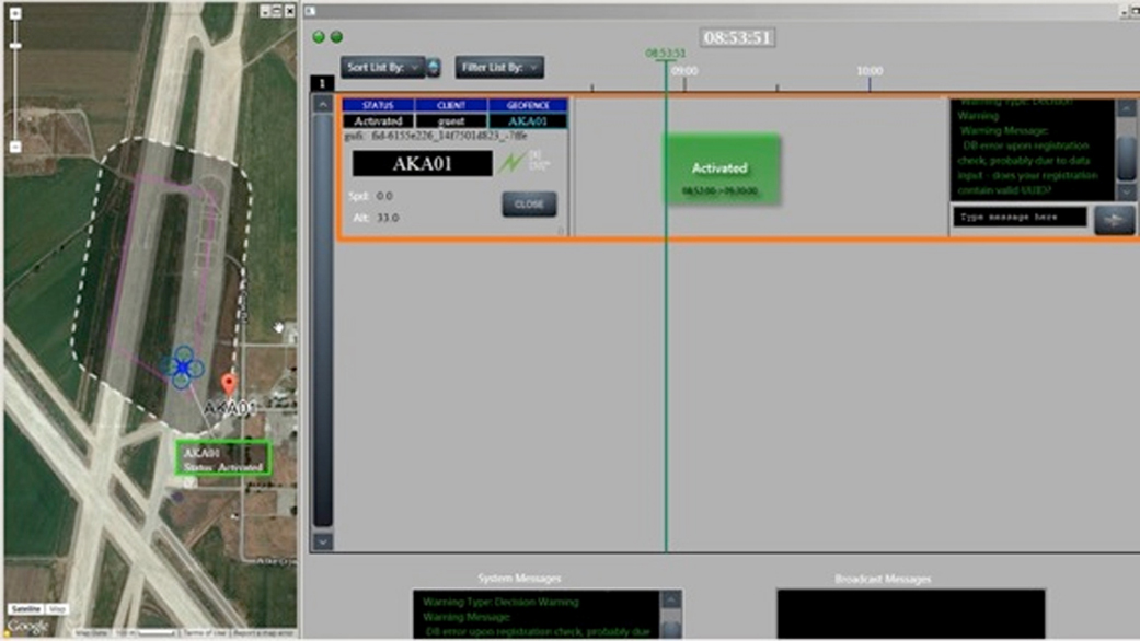
As the pilots flew their drones within the approved geofence, the team monitored each drone’s ability to maintain flight plans in windy conditions with radar, cellular signals, ADS-B and GPS provided by the UAS ground control station to the UTM system. This data provides insight into the reliability, accuracy and delay associated with UAS position reports, and helps researchers further develop the UTM system’s navigational performance. In addition to collecting data about air traffic for UTM development, collaborator Gryphon Sensors made traffic calls to alert the drone operators of non-transponding aircraft approaching the test range.
The team monitored temperature, wind and weather conditions with weather balloons, and a radio frequency band for safety purposes. The team collected the meteorological data to validate low-altitude weather forecasting models developed in partnership with the National Oceanic and Atmospheric Administration and Massachusetts Institute of Technology Lincoln Labs. Researchers took measurements from each aircraft to evaluate potential noise impact to people and wildlife.
Over eight days the UTM team flew 108 flights with 10 different aircraft. Flights averaged 11 minutes, but some flew as long as 38 minutes.
Eleven collaborators participated in the initial testing that focused on vehicle trajectory, the virtual constraints known as geofencing and tracking aspects, including:
- UAS multi-rotor and fixed wing vehicles;
- ADS-B transponders providing GPS altitude, airspeed and location information;
- ADS-B ground stations and air traffic surveillance displays;
- vehicle tracking over the cellular network;
- vehicle tracking using low-altitude radar system; and
- weather measurement equipment.
NASA collaborators for Technical Capability Level One flight tests included Precision Hawk, Raleigh, North Carolina; Verizon, Bedminster, New Jersey; Gryphon Sensors, Syracuse, New York; Airware, San Francisco; University of Nevada-Reno/Flirty, Reno, Nevada; SkySpecs, Ann Arbor, Michigan; ne3rd, Navarre, Florida; Harris/Exelis, San Francisco; Unmanned Experts, Denver; San Jose State University; and Lone Star UAS Center, Corpus Christi, Texas.
The cloud-based system of UTM is described in four technical capability levels.
- Technical Capability Level One involves field-testing of rural UAS operations for agriculture, firefighting and infrastructure monitoring.
- Technical Capability Level Two will be demonstrated in October 2016 for applications that operate beyond visual line of sight of the operator in sparsely populated areas. The system will provide flight procedures and traffic rules for longer-range applications.
- Technical Capability Level Three will include cooperative and uncooperative UAS tracking capabilities to ensure collective safety of manned and unmanned operations over moderately populated areas and is planned for January 2018.
- Technical Capability Level Four will involve higher-density urban areas for autonomous vehicles used for newsgathering and package delivery, and will offer large-scale contingency mitigation. Build Four will be demonstrated in 2019.
As a result of the Level One field test, NASA created implementation and integration guidelines and lessons learned for the UTM system in a rural, remote or over-water environments.
“UTM Level One tests demonstrated awareness of all airspace constraints, and shows promise for vehicle tracking to support initial low-density operations,” said Kopardekar.
UTM Level One tests demonstrated awareness of all airspace constraints, and shows promise for vehicle tracking to support initial low-density operations.

Parimal Kopardekar
Manager of NASA’s Safe Autonomous Systems Operations Project and Lead of NASA’s UTM Efforts
The final test of Level One concluded on November 18 with a test at Moffett Field. During this test the team flew a live drone on the runway while a nearby lab simulated virtual drones with simulated trajectory conflicts. The UTM system recognized the live and virtual drones and responded by sending messages and alerts to all vehicles. Further tests with additional vehicles, trajectory configurations and multiple users will be conducted at FAA designated test sites in an initial safe UAS integration campaign in spring 2016.
To learn more about NASA aeronautics, visit: