


Mars has long fascinated us as a place possibly once hospitable to life. The early robotic missions of the 1960s relayed images of a Moon-like cratered terrain with a forbiddingly cold and thin atmosphere of carbon dioxide. The more sophisticated orbiters and landers in the 1970s found evidence that water possibly once flowed on Mars. The Phoenix Mars Lander, managed by NASA’s Jet Propulsion Laboratory in Pasadena, California, launched on Aug. 4, 2007, to find direct evidence of water ice below the surface of the Martian north polar region. Equipped with an array of cameras and instruments, Phoenix arrived at Mars on May 25, 2008, making the northernmost landing of any spacecraft, and confirming the presence of water ice just below the surface.
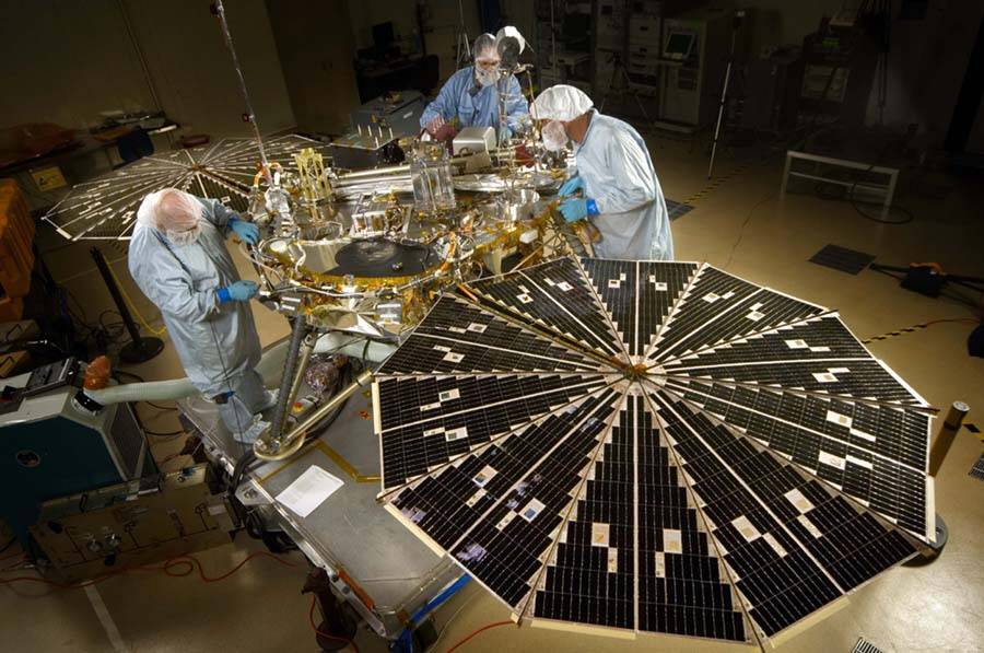
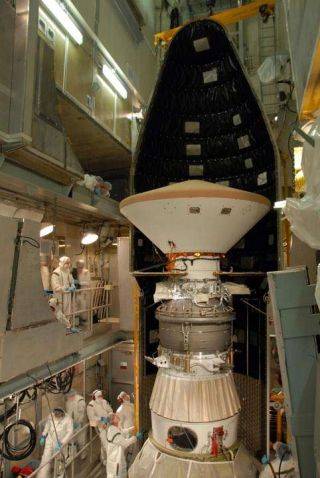
Left: Patch of the Phoenix Mars Lander. Middle: Phoenix during assembly and testing in September 2006 at Lockheed Martin Space Systems in Denver. Right: At Launch Pad 17A at Cape Canaveral Air Force Station, now Cape Canaveral Space Force Station, in Florida, workers place the launch shroud around Phoenix, already encased in its aeroshell.
NASA selected Phoenix in 2003 as the first of its Mars Scout Program of smaller, low-cost spacecraft to explore the planet, in concert with the agency’s “follow the water” strategy to look for signs that Mars may once have been habitable to some form of life. Scientists decided that the planet’s polar regions offered the most promising locations to find water, at least in its frozen form, at or just beneath the surface. In a cost-saving effort, Phoenix made use of the canceled Mars Surveyor 2001 spacecraft and upgraded instruments from it and other programs. The Lunar and Planetary Laboratory at the University of Arizona in Tucson had prime responsibility for Phoenix, with Peter H. Smith as Principal Investigator. Lockheed Martin Space Systems of Denver built and tested the spacecraft, and NASA’s Jet Propulsion Laboratory in Pasadena, California, managed the project and provided mission design and control.
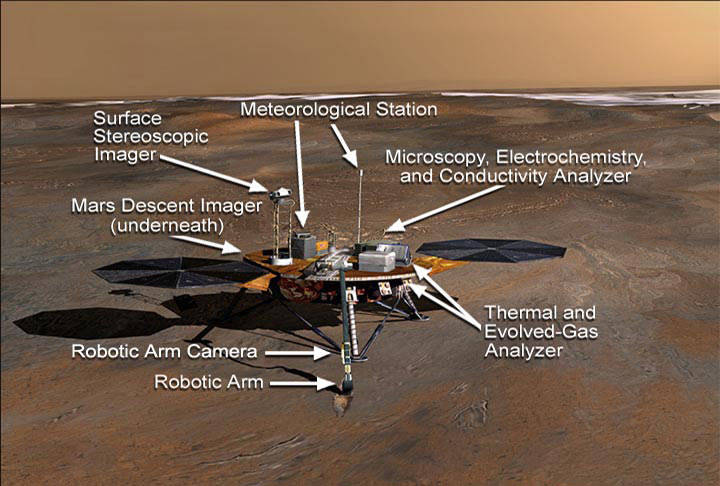
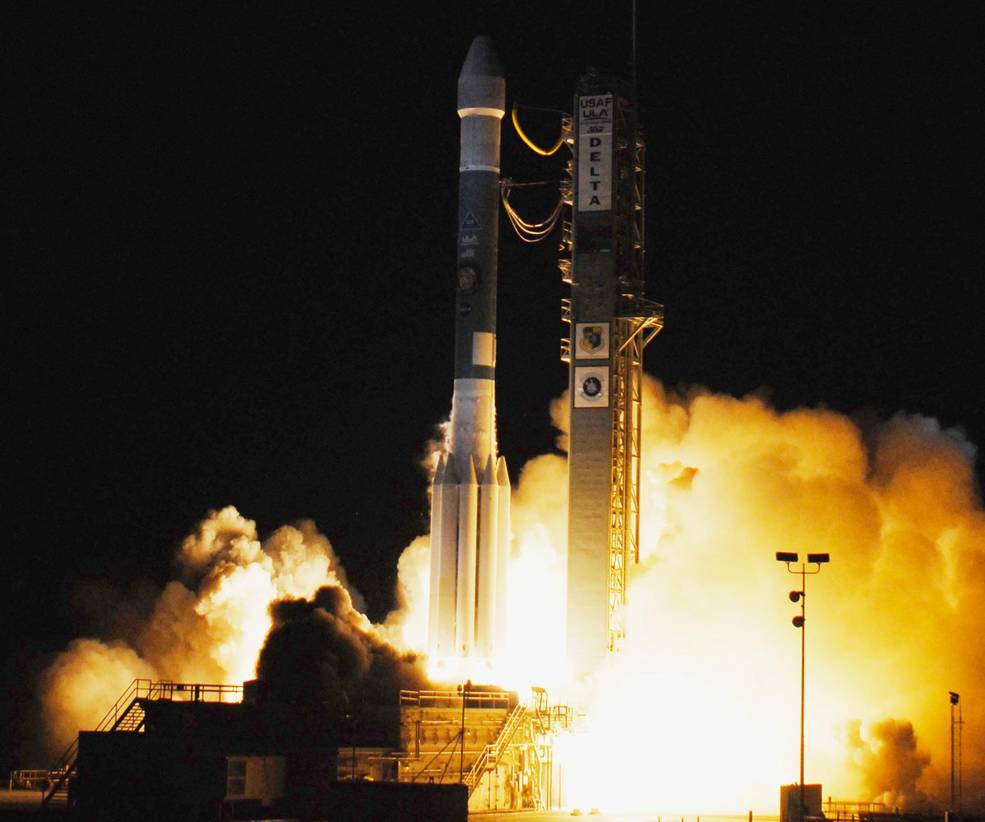
Left: Illustration of the Mars Phoenix Lander on the surface of Mars, showing its instruments. Right: Launch of the Mars Phoenix Lander.
For its 90-day mission to search for water and to characterize its landing site, Phoenix carried a suite of instruments provided by an international partnership of government agencies, universities, and aerospace industry:
- A robotic arm and camera to obtain samples of dirt and ice for analysis by Phoenix’s other instruments, aided by the high-resolution color camera that could see into the arm’s scoop to image the collected samples.
- Surface Stereo Imager (SSI), Phoenix’s primary camera, a higher resolution version of the imager used by Mars Pathfinder.
- Thermal and evolved gas analyzer (TEGA) consisted of a combination high-temperature furnace and a mass spectrometer.
- Mars Descent Imager (MARDI) designed to take pictures of the landing site during the last three minutes of the descent. A problem detected shortly before launch could have caused interference between MARDI and the spacecraft’s control system, so managers decided not to use the imager, but it was too late to remove it from the spacecraft.
- Microscopy, Electrochemistry, and Conductivity Analyzer (MECA). Originally designed for the cancelled Mars Surveyor 2001, MECA consisted of a wet chemistry lab, optical and atomic force microscopes, and a thermal and electrical conductivity probe. They examined soil particles as small as 16 μm across and measured the electrical and thermal conductivity of soil particles.
- The Meteorological Station (MET) recorded the daily weather on the Martian surface, using a wind indicator and temperature sensors.
The launch of Phoenix, weighing 1,477 pounds with its aeroshell, on a Delta rocket took place on Aug. 4, 2007, from Launch Complex 17A at Cape Canaveral Air Force Station, now Cape Canaveral Space Force Station, in Florida. Four mid-course corrections refined the spacecraft’s trajectory during its 295-day, 422-million-mile interplanetary cruise, with the last two to ensure a landing in the planet’s north polar region. As Phoenix approached Mars, ground controllers adjusted the orbits of NASA’s 2001 Mars Odyssey and Mars Reconnaissance Orbiter (MRO) and the European Space Agency’s Mars Express so those spacecraft could observe its landing and, through triangulation, pinpoint its landing site with great precision. As Phoenix approached Mars, it prepared for its harrowing seven-minute entry, descent, and landing phase.
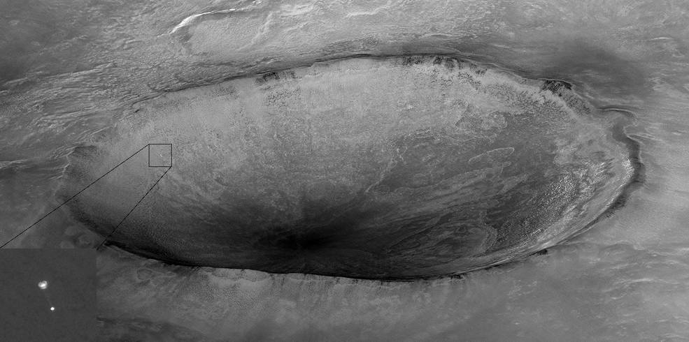
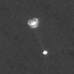
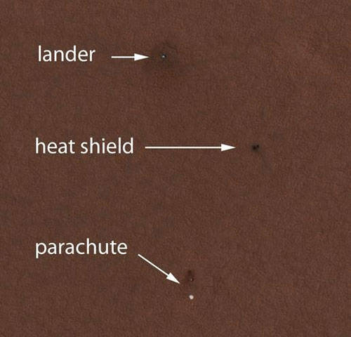
Left: The Mars Reconnaissance Orbiter (MRO) captured an image of Phoenix
descending on its parachute during the entry, descent, and landing phase.
Right: An enlarged view of MRO’s photo of Phoenix.
On May 25, 2008, still in its aeroshell, Phoenix arrived at Mars, traveling at 12,500 mph when it encountered the planet’s atmosphere at an altitude of 70 miles. The friction created by the interaction of the atmosphere with the aeroshell’s heat shield slowed Phoenix down to 900 mph, with the heat shield reaching a temperature of 2,600 degrees Fahrenheit. Phoenix next deployed its parachute, slowing it to 250 mph within 15 seconds, slow enough to jettison its heat shield. With Phoenix’s underside now exposed, it extended its landing gear and activated its landing radar. The High Resolution Imaging Science Experiment (HiRISE) camera aboard MRO captured Phoenix suspended on its parachute, marking the first time that one spacecraft imaged another descending to the surface of a planet. At an altitude of 3,200 feet, now traveling at 125 mph, Phoenix jettisoned its parachute and began free falling toward the surface. Firing its retrorockets to slow it to a comfortable 5 mph, the 770-pound Phoenix touched down on Mars to begin its three-month search for water.
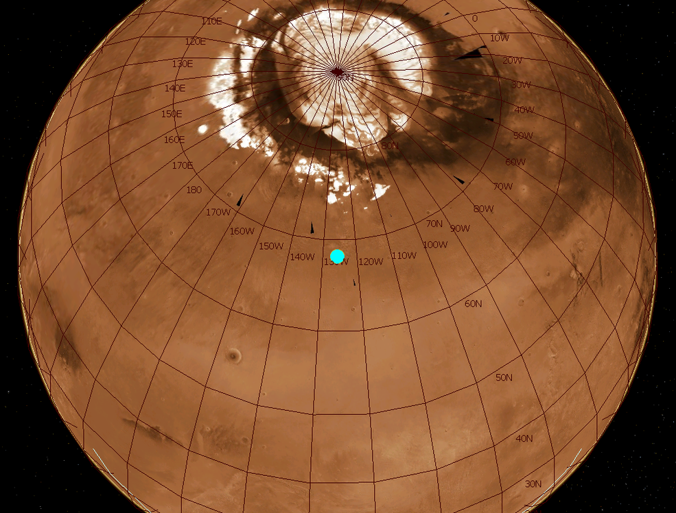
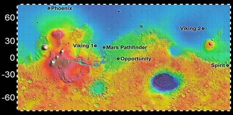
Left: Globe of Mars showing the Phoenix landing site in the planet’s northern
polar region. Right: Map of Mars showing the high latitude location of
Phoenix’s landing site relative to earlier landers and rovers.
Phoenix landed in the informally dubbed “Green Valley” of Vastitas Borealis, at latitude 68.2 degrees North, equivalent to northern Alaska, much further north than all previous landers and rovers. The landing occurred late in the Martian northern hemisphere spring, with the Sun shining on Phoenix’s solar panels the entire Martian day. By the summer solstice on June 25, the Sun appeared at its maximum elevation of 47 degrees.
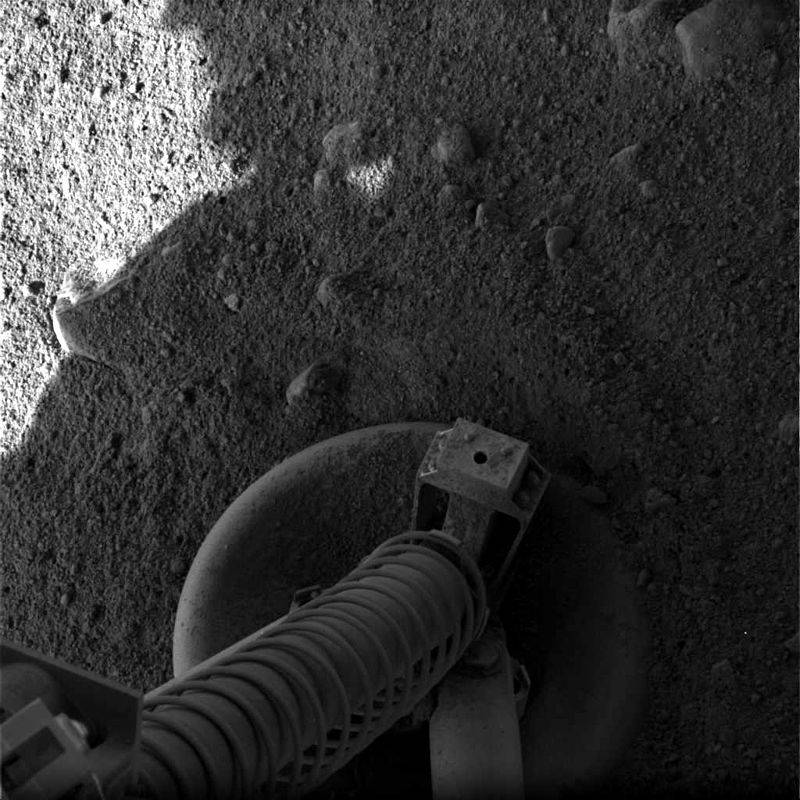
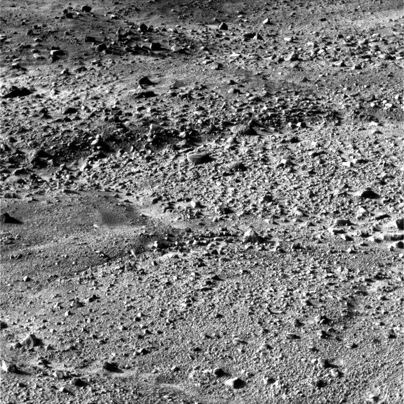
Left: Phoenix image of one its footpads shortly after touchdown. Middle: Phoenix image
of its surroundings shortly after touchdown, showing pebbles and polygons.
Right: Mars Reconnaissance Orbiter image of the Phoenix landing site.
The lander waited 15 minutes to allow any dust kicked up by its engines to settle before opening its solar panels. Within two hours of landing, Phoenix began sending its first photos of its landing site, including one of its three footpads. The images revealed a flat surface strewn with pebbles and incised with small troughs into polygons, similar to patterns seen in permafrost areas on Earth. Soon after, MRO’s HiRISE camera photographed Phoenix, as well as its heat shield and parachute, on the surface.
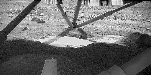
Left: Image taken beneath the Phoenix lander, showing white areas that may be water ice, cleared of surface material by the landing engines. Right: Phoenix’s first partial panorama of its landing site.
On its fifth day on the surface (Sol 5), Phoenix’s robotic arm camera took an image underneath the lander, showing patches of a smooth bright surface uncovered by its exhaust during the landing. The spacecraft later determined that the bright areas constituted water ice. As it prepared to use its robotic arm to collect its first samples, Phoenix took a series of photographs of its surroundings that engineers compiled into stunning panoramic images.
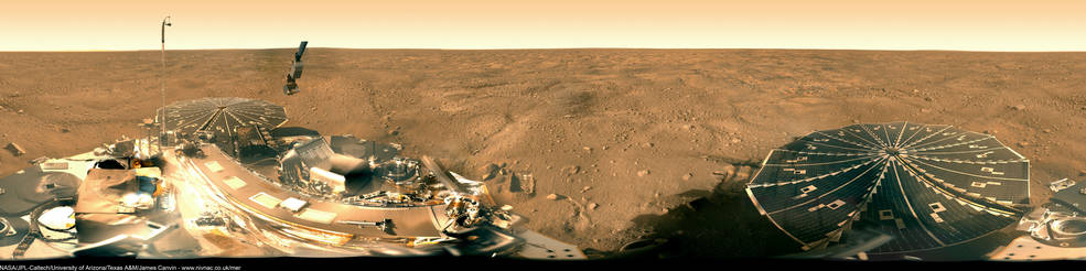
Phoenix’s 360-degree panorama of its landing site.
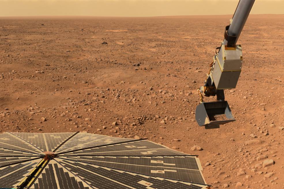
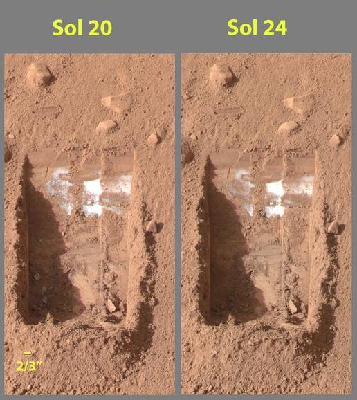
Left: A view of Phoenix’s robotic arm and one of its solar panels. Right: Side-by-side
images of a trench dug by Phoenix’s robotic arm, showing the sublimation of
material – three whitish clumps in the lower left corner of the
trench – presumed to be water ice, over the course of four
days (Sol 20 to Sol 24).
Phoenix’s robotic arm took its first test scoopful of Martian soil on May 31 (Sol 6). The first attempts to place soil samples into the TEGA instrument proved unsuccessful due to soil clumping on the inlet screen. The first sample filled the first of the eight ovens on June 11 but yielded no evidence of water, most likely due to its exposure to the atmosphere for several days prior to testing. Images of trenches dug by the robotic arm taken four days apart (Sol 20 and Sol 24) showed three whitish clumps of material disappearing, interpreted to be water ice sublimating (turning from solid to gas) in the thin Martian atmosphere. Subsequent samples run through the ovens in TEGA led NASA to announce on July 31 (Sol 65) that Phoenix had confirmed the presence of water ice in the Marian soil.
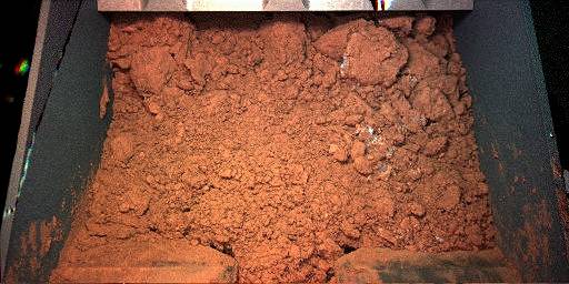
Left: Phoenix’s first test scoop of Martian soil on Sol 6.
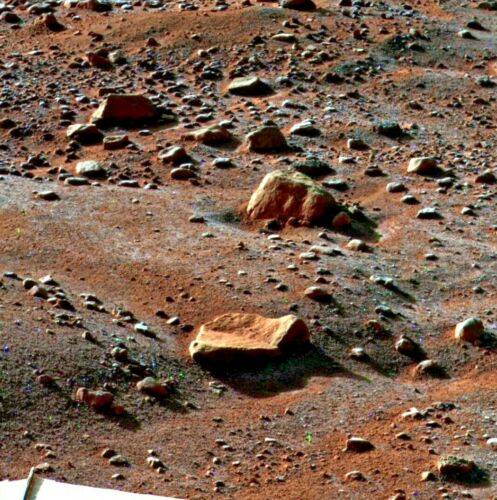
Right: Appearance of morning frost on rocks on Sol 79.
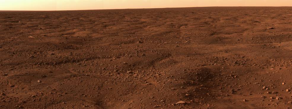
Phoenix’s robotic arm dug a total of 12 trenches into the Martian surface, collecting samples not only for the TEGA but also for the wet chemistry lab in the MECA instrument. The first MECA test on June 26 (Sol 31) returned the first results about the salts in the soil and its alkalinity. Photography and other data showed evidence of morning frost on the Martian surface, snow falling from cirrus clouds, and dust devils formed by small changes in atmospheric pressure. Phoenix provided daily weather reports from its landing site. The discovery of perchlorate in Martian soil, while potentially detrimental to any possible life forms, holds promise as a possible source for rocket fuel and as a source of oxygen for future missions.
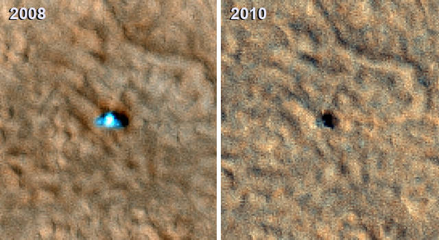
Left: Mars Reconnaissance Orbiter images of Phoenix while active in 2008, left, and
in 2010 following a Martian winter, showing damage to the spacecraft.
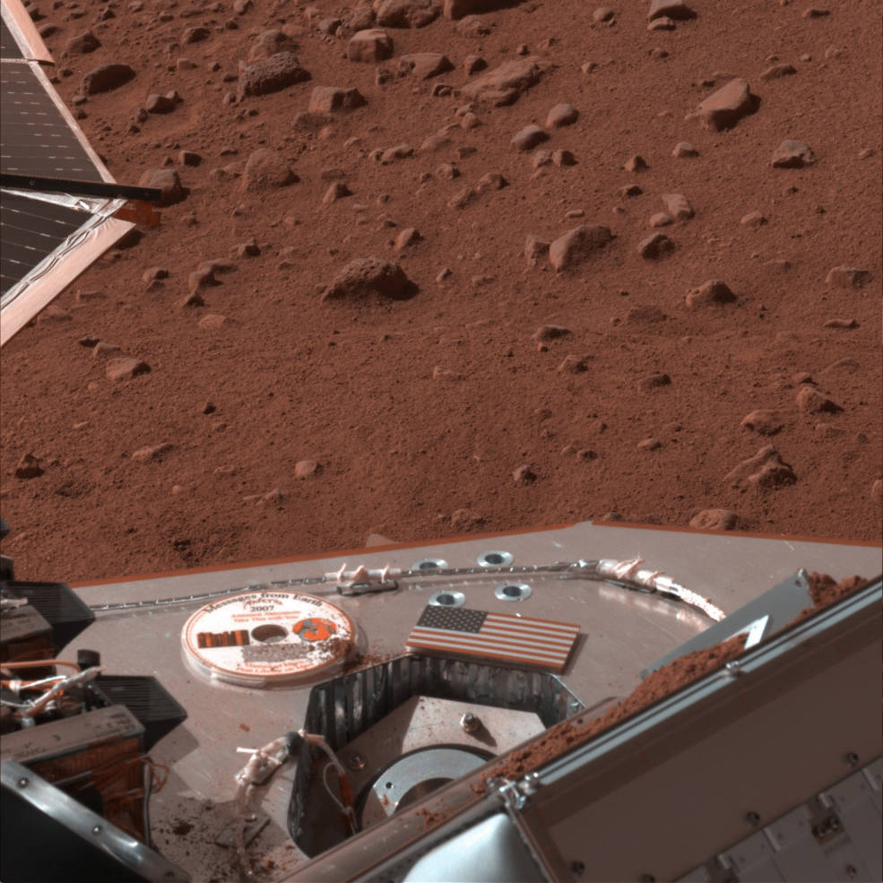
Right: The Planetary Society’s Mars Library DVD on Phoenix.
At the end of its nominal mission on Aug. 26 (Sol 90), Phoenix remained in excellent health and mission managers approved an extension to Sep. 30 (Sol 125), followed by a second extension into November. But with the Martian northern hemisphere transitioning from summer to fall, less sunlight fell onto Phoenix’s solar arrays to power it instruments and heaters, while temperatures at the landing site fell. As controllers turned off its heaters one by one to conserve power, fewer instruments remained in operation. A dust storm in October further aggravated the spacecraft’s power woes. On Oct. 28 (Sol 152), Phoenix entered a safe mode due to lack of power and sent its last signal from the Martian Arctic on Nov. 2 (Sol 157). The spacecraft’s final post on its Twitter account consisted of the word “triumph” in binary code. Efforts to reestablish contact with Phoenix at the end of the Martian winter in January 2010 met with no success. Images from MRO showed significant damage to Phoenix, most likely due to the buildup of frozen carbon dioxide that broke off at least one of its solar panels. Project managers formally declared the end of the mission on May 24, 2010. Phoenix accomplished all its planned objectives, operating two months longer than planned. In case future Martian explorers visit Phoenix, The Planetary Society installed a DVD-ROM on the spacecraft they called “the first library on Mars.” The DVD comes with instructions on how to play it, and if these future visitors figure out a way to do so, they will find Visions of Mars, a multimedia collection of literature and art about the Red Planet, messages addressed to them from noted figures, and a collection of a quarter of a million names submitted through the Internet.