What is PNT?
From pinpointing a spacecraft’s location to timing science measurements, positioning, navigation, and timing enable NASA missions to explore farther, operate safely, and return more science data to Earth.
NASA’s SCaN (Space Communications and Navigation) Program manages and develops positioning, navigation, and timing (PNT) technology for NASA and other missions, leads the development of Moon-to-Mars navigation architectures, and shapes the future of worldwide PNT policies.
Just as GPS makes our lives safer and more viable on Earth, NASA's advancements in PNT technology will do the same for us on the Moon and beyond.

kevin coggins
NASA Deputy Associate Administrator of Space Communications and Navigation
Overview
Positioning, navigation, and timing are critical to space exploration and everyday life on Earth.
- Positioning encompasses the tools that pinpoint the location of a person or object.
- Navigation charts how an object will reach its destination.
- Timing determines the precise moment an event happened, or is expected to happen.
In addition to maintaining current and planned space communications and navigation capabilities, NASA’s SCaN Program collaborates with aerospace industry, international partners, and other agencies to standardize the PNT services that make space travel possible.
Advancements in these services improve the safety and efficiency of space missions and enhance technology on Earth. For example, NASA develops new receiver chips and reduces signal interference, which is then used to improve emergency response systems, air-traffic control technology, and ride-share apps that billions of people use every day.
Reliable navigation and timing are essential to current and future safety of our crew. Astronauts aboard the International Space Station depend on navigation support during launch, flight, docking, and re-entry. Future lunar and Mars explorers will use PNT services to guide spacecraft across the vastness of space, support autonomous landings, and enable surface operations millions of miles from home. As space exploration expands, PNT will be vital to navigating deep space without constant contact with Earth. In the Artemis era, it underpins longer missions, new destinations, and greater achievements.
Understanding Global Navigation Satellite Systems
While you may not have heard of “GNSS” before, you’re likely familiar with GPS, or the Global Positioning System, which is the U.S. government’s one-way orbiting radio-navigation system. Other parts of the world have their own GNSS constellations, such as the European Union’s Galileo. The satellite systems that make up GNSS constellations, including GPS, connect to ground stations on Earth to provide PNT services to users on land, sea, and in the air.
Using GNSS in Space
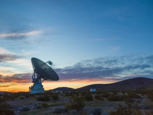
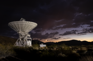
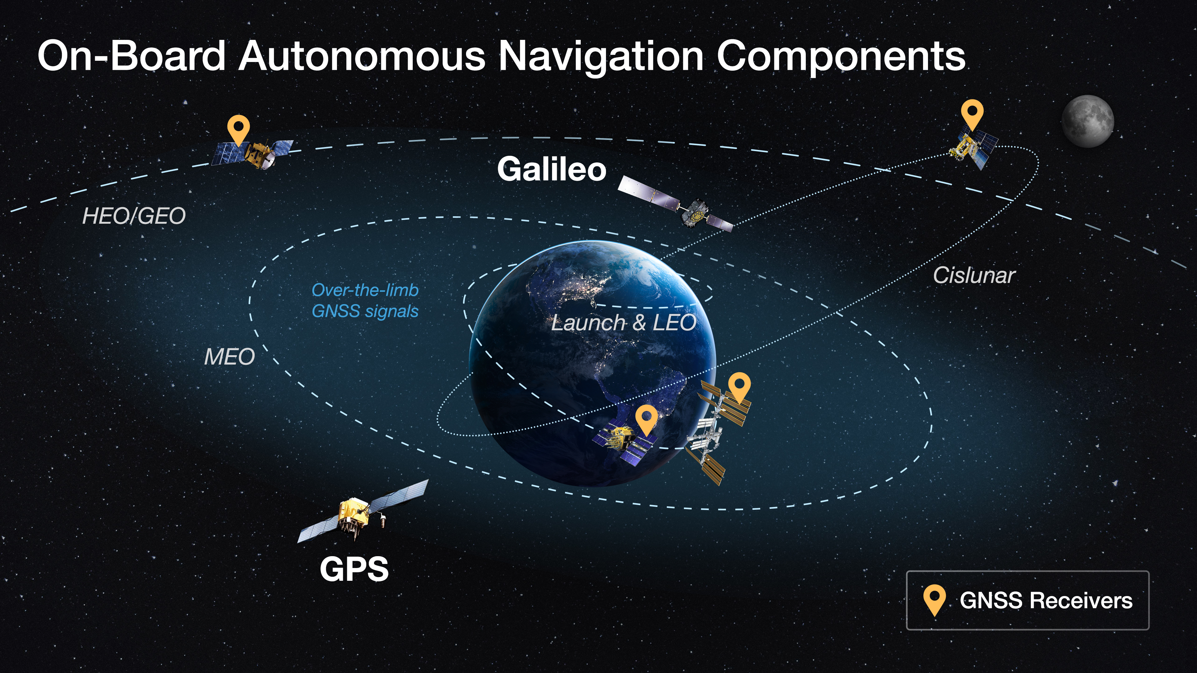
Traditionally, space missions have calculated a spacecraft’s orbit by exchanging signals with ground stations or relay satellites, such as NASA’s Tracking and Data Relay Satellites (TDRS). NASA users in orbit can determine their position and time using communications channel tracking via the Deep Space Network, the Near Space Network, and, most recently, on-board radio navigation signal receivers. These on-board receivers process GNSS signals directly, increasing spacecraft autonomy, enabling new methods of spaceflight operations, and reducing the burden on NASA ground stations.

Global Collaboration and Innovation
NASA works with GNSS providers worldwide to ensure its spacecraft have consistent access to robust, stable PNT capabilities. The agency works with both government and commercial organizations to develop and improve advanced GNSS technologies like flight and science receivers. In 2025, NASA and the Italian Space Agency launched the Lunar GNSS Receiver Experiment (LuGRE), the first demonstration to capture GNSS signals on the Moon. A world first, LuGRE’s achievement suggests existing GNSS systems can support future lunar exploration.
The Future of Space Navigation
As demands for spacecraft autonomy, deep space science, and Earth observation grow, so too will the capabilities of PNT systems. New advancements in relay satellites, such as optical communications, will help expand access to faster, farther-reaching, and more advanced navigation technologies. These systems are reshaping how we explore and operate in space. With ongoing innovations and international cooperation, PNT services will continue to support the future of human space exploration, scientific discovery, and aeronautics research.
Timing in Space

Timing in space is about much more than keeping clocks in sync. It is a core element of how NASA flies spacecraft, conducts science, and keeps missions safe, even millions of miles from Earth. Accurate timing is essential for everything from synchronizing data between spacecraft to coordinating global networks.
NASA maintains accurate time using a combination of technologies on the ground and in space. Many NASA missions carry GNSS receivers that use continuous timing signals to stay synchronized and determine their position in orbit or on other planets.
How NASA Keeps Time
NASA maintains precise timing using a combination of ground and space systems. Many missions carry GNSS receivers, which rely on continuous satellite timing signals to determine a spacecraft’s location and stay synchronized in orbit and even on other planets. As missions expand to the Moon, Mars, and beyond, the demand for reliable, consistent timekeeping across space will only grow.
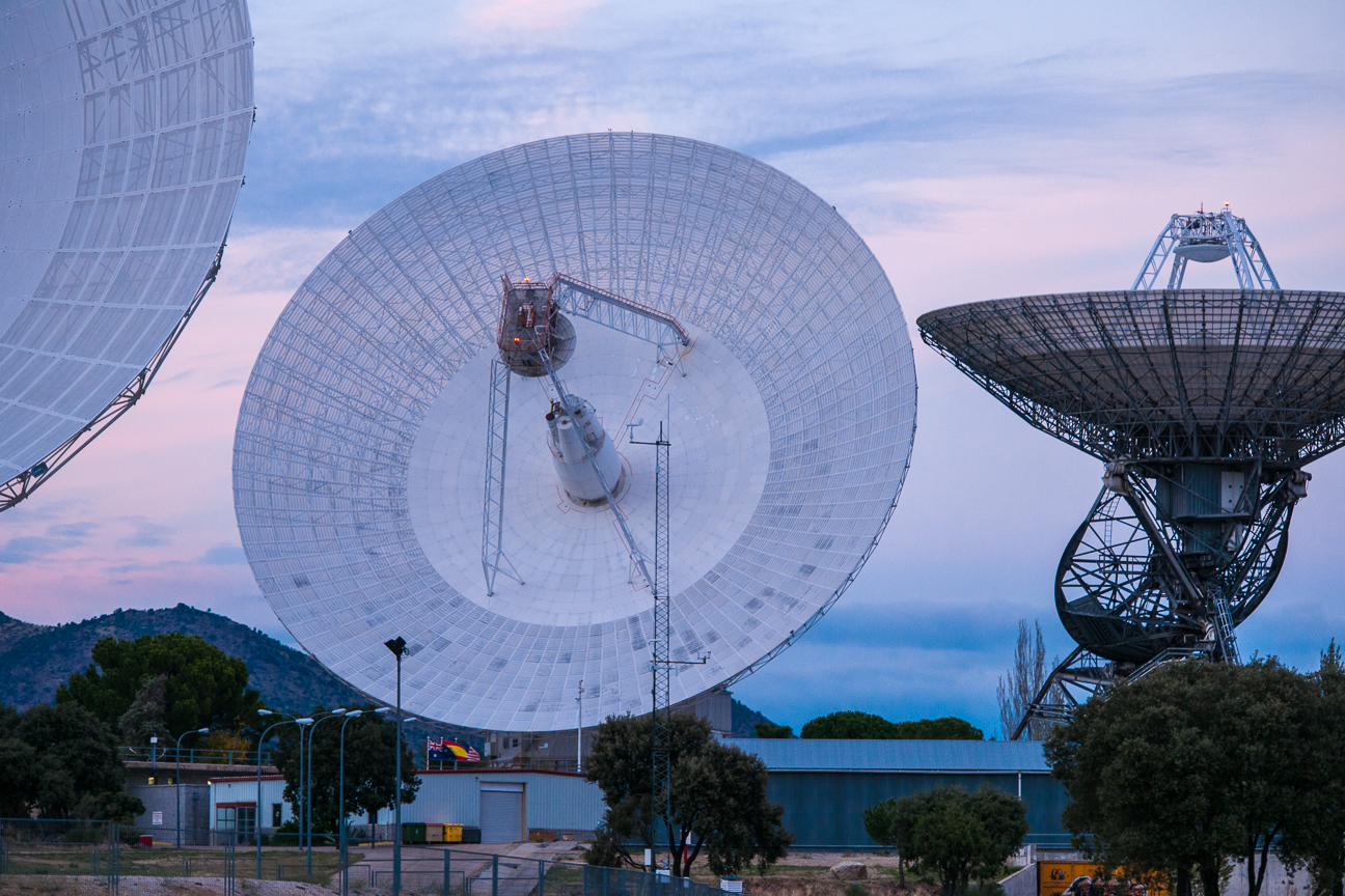
NASA’s Near Space Network and Deep Space Network use ultra-precise atomic clocks to track spacecraft and time-stamp scientific data. These clocks are accurate to within a billionth of a second, helping engineers in space and on Earth monitor mission health and adjust flight paths with confidence.

Pushing the Boundaries of Timekeeping
NASA is exploring new technologies to improve timing accuracy and protect critical systems from potential disruptions, including signal loss, hardware failure, or intentional interference. NASA is testing Delay/Disruption Tolerant Networking, a communications protocol designed to preserve timing and data transmission across distant and unpredictable environments. The agency is also developing laser communications systems, which can transmit high-speed data and precise timing information, enabling new levels of navigation and positioning accuracy.
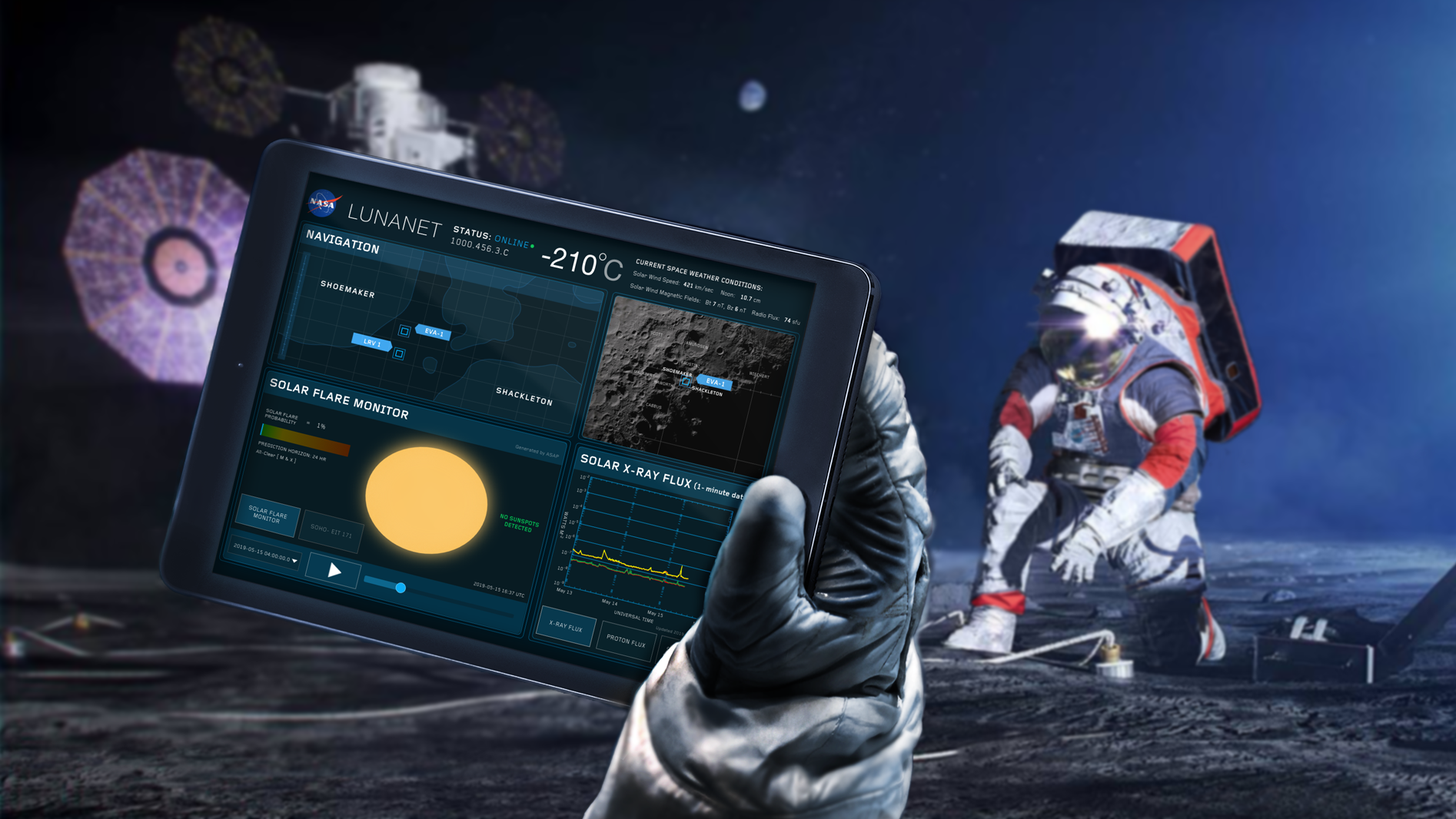
Defining Lunar Time
Accurate timekeeping is a global effort. NASA works with its international partners to establish a coordinated lunar time standard. This time system would allow landers, rovers, orbiters, and astronauts working on or near the Moon to operate on the same coordinated timeline. That shared framework will help ensure the success of future Artemis missions by supporting safe navigation, mission autonomy, and seamless communications among multiple lunar users.