


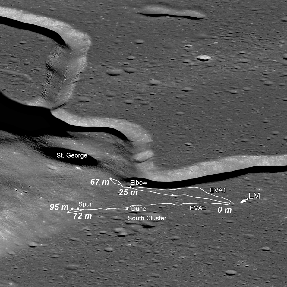
This image from NASA’s Lunar Reconnaissance Orbiter shows the area surrounding Apollo 15’s landing site, annotated with the traverse plots of the mission’s first two moonwalks, abbreviated as EVAs (extra-vehicular activities). Numbers indicate elevations in meters above the landing site (indicated by the arrow labeled “LM” — lunar module). Astronauts David Scott and James Irwin ventured to the lower slopes of Mons Hadley Delta (center left). The distance they travelled from the lunar module to Elbow crater along the edge of Hadley Rille (EVA 1) is about 2.8 miles. Apollo 15 was the first mission on which the “lunar rover” was used.
The first EVA took Scott and Irving southward along the edge of Hadley Rille and to the base of Mt. Hadley Delta near St. George crater. This traverse took them to a height of just over 65 meters (or 213 feet) above the landing site on the mare plain. At this height, much of the surface material of the mountain comprises debris that, over eons, slid down the upper slopes. The area contains very few surface boulders, so materials collected in this area primarily consist of regolith: dusty, rocky debris.
The second EVA took the astronauts southeast to “South Cluster” and Spur craters. At Spur crater, a very old crystalline rock fragment was collected, containing evidence of geologic processes more than 4 billion years old and representing a piece of the original anorthositic crust of the moon. They also discovered an unusual green material composed of volcanic glass.
This traverse ascended about 95 meters (104 yards) in elevation up the base of Hadley Delta. At times, the slope was so steep that the rover had difficulty getting traction, and the mountain peak loomed so high overhead, that the astronauts could not lean back far enough to get it in the frame of their cameras.
During this traverse, the astronauts commented that they thought they could detect a high-mark where lava might once have filled the basin at the base of nearby Mt. Hadley around a height of 85 meters (93 yards) above the current mare plain.
› More images and information from Arizona State University’s LRO Camera website
Image credit: NASA/Goddard/Arizona State University