


![Request for Information – Potential [Placeholder for Prize]](https://assets.science.nasa.gov/dynamicimage/assets/science/psd/solar/2023/09/s/solarsystem_0.jpg?w=1024)


By Amanda Moon Adams
In celebration of Earth Day, it’s important to recognize the role of open science in protecting our planet and advancing NASA’s research efforts. Through initiatives like NASA’s Transform to Open Science (TOPS), researchers can collaborate and share data, promoting transparency and scientific integrity.
By sharing research findings and data publicly, NASA is enabling scientists and the public to develop new insights, tools, and strategies for protecting the environment. As we continue to face pressing environmental challenges, it is important to prioritize open science and work towards a more collaborative and inclusive approach to science for the benefit of all.
Open science principles are being leveraged in a variety of NASA programs, including NeMO-Net, Landsat, and the SERVIR program, which are using artificial intelligence, satellite imagery, and machine learning to better understand and protect our planet’s ecosystems. Highlighted below are just some of the many programs using this collaborative capability:
Mapping Coral Habitats with NeMO-NET

Users can join NASA in protecting our planet’s coral reefs with NeMO-Net. The mobile app and online platform allow users to explore the ocean and classify different types of coral reefs, contributing to our understanding of these vital ecosystems. By using artificial intelligence and satellite imagery, NeMO-Net promotes the power of open science and citizen science in protecting our oceans.
Landsat: An Open Science Approach to Understanding Earth’s Changing Surface

The U.S. Geological Survey and NASA’s Landsat program provides open access to high-resolution images of our planet’s changing surface, which can be used for a variety of applications including monitoring land use and cover changes, tracking the impacts of climate change, and managing natural resources. This information can help inform policy decisions and resource management strategies to better protect the planet’s ecosystems.
NASA-Funded Scientists Estimate Carbon Stored in African Dryland Trees

Dryland trees in Africa play a vital role in the global carbon cycle and climate system. Thanks to the groundbreaking work of NASA-funded scientists, we now have a comprehensive estimate of the carbon stored in almost 10 billion individual trees in the Saharan, Sahel, and Sudanian zones of Africa. By leveraging advanced technology and open science principles, scientists used high-resolution satellite images and machine learning techniques to map and assess the amount of carbon stored outside of dense tropical forests. The data is free and publicly available, allowing us all to better understand the distribution and role of dryland trees in our ecosystem.
Climate Patterns Thousands of Miles Away Affect U.S. Bird Migration
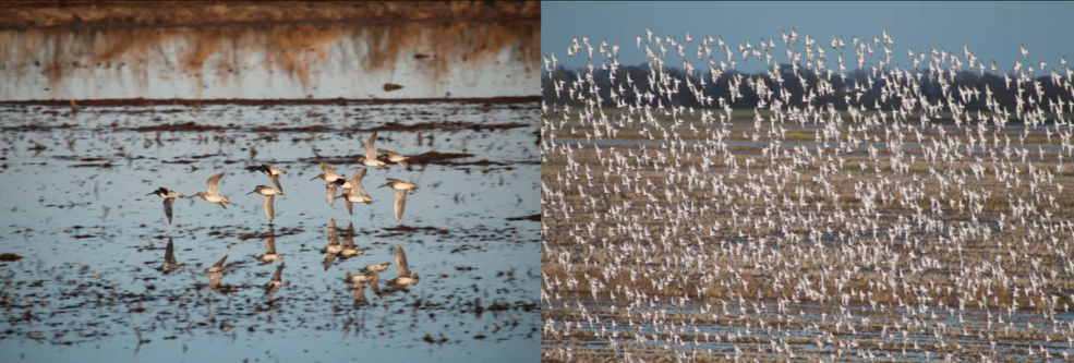
Climate patterns thousands of miles away can affect bird migration timing in the US, and NASA-funded research now allows us to better understand how changes around the globe can impact these bird behaviors and migration patterns. By leveraging advanced satellite technology and open science principles, NASA scientists can track and predict these patterns in real-time, helping us protect and conserve our wildlife.
NASA’s SERVIR Program Takes on Air Pollution in the Himalayas
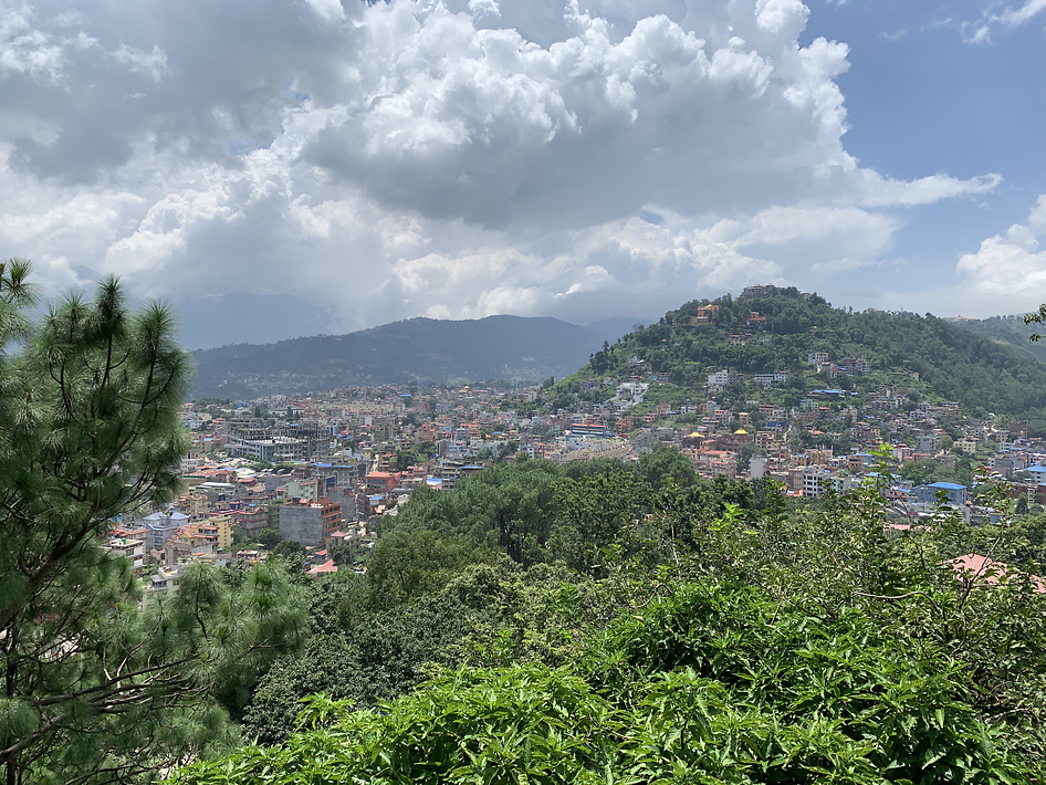
NASA atmospheric scientists and the SERVIR program are working together to improve air quality in Nepal, Bhutan, and Pakistan. Steep valleys and cold, dense mountain air can trap smoke and pollution close to the ground, leading to dangerously poor air quality in cities like Kathmandu. To combat this, the team has built a suite of air quality products, including an air pollution forecast model that integrates data from satellites in low and geostationary Earth orbit.
These data are openly available on the Nepal Department of Environment Air Quality Watch dashboard, allowing policymakers and the public to access and use them. This open science approach fosters collaboration and feedback from decision-makers, enabling the team to continue to improve the data and provide powerful tools to protect breathable air as the region grows.
NASA TOPS aims to promote a culture of open science within NASA and beyond. As part of NASA’s Open-Source Science Initiative, TOPS seeks to rapidly transform agencies, organizations, and communities towards more inclusive and accessible research practices. Through a range of communication activities, TOPS engages with scientists, researchers, and the public to promote the importance of public access to federally funded research and data. TOPS also supports the broader Year of Open Science initiatives and works with aligned stakeholder groups to advance the goals of open science.
For more information about NASA TOPS, visit:
https://science.nasa.gov/open-science/transform-to-open-science
For more information on NASA’s Science Mission Directorate, visit: