![Request for Information – Potential [Placeholder for Prize]](https://assets.science.nasa.gov/dynamicimage/assets/science/missions/a-step/FFR_Earth_Background_20251120%20.png?w=1024)


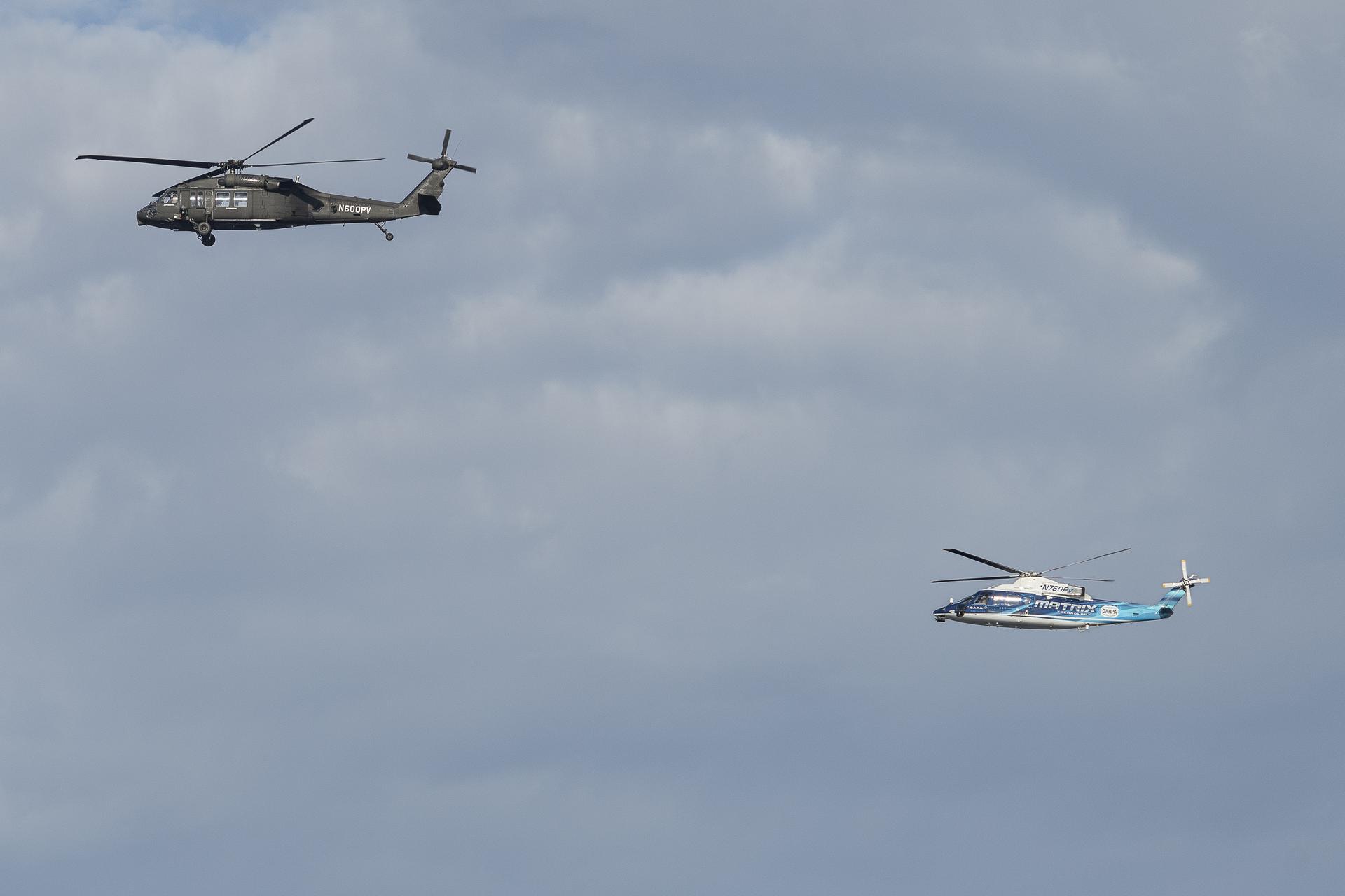
In late October, two research helicopters from the manufacturer Sikorsky, a Lockheed Martin company, made a dozen test flights over Long Island Sound, Connecticut taking care to avoid other aircraft in the area around them. Except the ordinary-looking helicopters were flying autonomously – guided by NASA-designed software – and those other aircraft were virtual, part of a simulation to test pilotless flight systems. This was the first time two autonomous aircraft were flying at one another using NASA designed collision avoidance software.
The test flights were part of a collaboration by NASA, Sikorsky, and DARPA (Defense Advanced Research Projects Agency). Researchers were able to collect data that will advance completely autonomous flight —systems that can operate an aircraft without a pilot from takeoff to touchdown. The work was part of NASA’s efforts to design and evaluate technologies that could eventually lead to air taxis and other new, automated air transportation options.
For the tests, the team used two experimental helicopters adapted for autonomous systems, known as the SARA (Sikorsky Autonomy Research Aircraft) a modified S-76B and the larger OPV (Optionally Piloted Vehicle) Black Hawk. Researchers loaded five NASA-designed software systems into the helicopters, which worked with the automated flight system already integrated by Sikorsky and DARPA.
“These flight tests using Sikorsky’s SARA and OPV helicopters show how we can stack technologies together to increase automation over time in a maintainable and scalable way,” says Adam Yingling, NASA project lead. “These efforts demonstrate that we can safely integrate operations to fly the aircraft using several technologies in one navigation tablet.”
A NASA and a Sikorsky safety pilot onboard each helicopter supervised the flight tests. Sikorsky’s flight autonomy system, in combination with NASA software, running on tablets the agency designed, allowed the helicopters to fly autonomously along multiple planned routes. The tablets also enabled the safety pilots to monitor flight path options the software selected whenever course corrections needed to occur.
The safety pilots observed how the helicopters responded to software-initiated commands, and NASA researchers evaluated how the different software systems worked together to control each aircraft.
The tests also assessed how human pilots interacted with the autonomous systems. During the flights, the NASA research pilots were outfitted with specially designed glasses to understand how long they interacted with the navigation tablets and how they physiologically responded to information the tablets provided. Researchers will employ this user experience data to assist in future visual and interactive designs for the software and tablets.
The team flew 12 successful flights covering 70 different flight test maneuvers and generating more than 30 flight hours for each aircraft. The NASA collaboration with Sikorsky and DARPA offered a foundation for furthering testing of the automation technology.
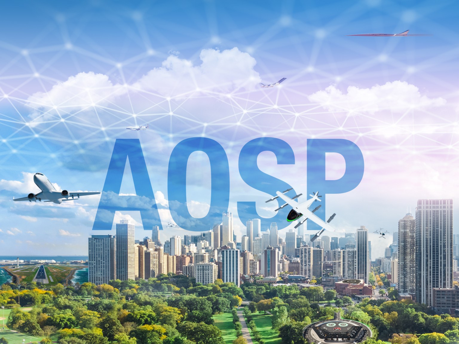
Mixed-Reality Airspace
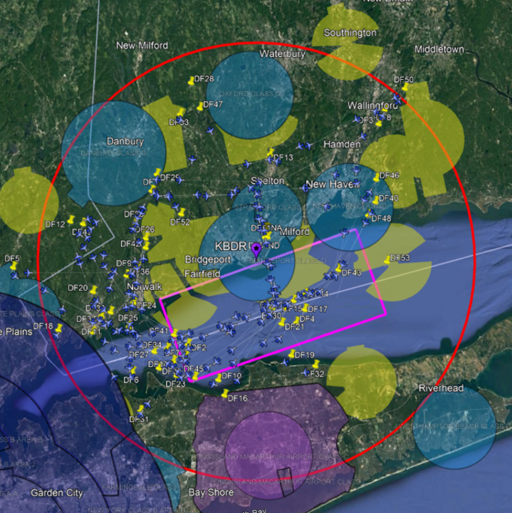
The tests demonstrated the software’s capabilities in a mixed-reality setting. As the SARA and OPV helicopters flew over Long Island Sound, multiple virtual aircraft were added into the same airspace.
“For this test, we are using a model of future Advanced Air Mobility airspace with more than 150 virtual aircraft and their flight plans integrated with the flight path management software and the Sikorsky mission manager technology to fly the two helicopters in a mixed-reality mode,” said Mark Ballin, principal investigator for flight path management system development.
The NASA-designed software, which commanded both the SARA and OPV helicopters simultaneously, allowed research pilots and engineers to run planned interactions with the virtual aircrafts’ flight plans. The multiple software systems aboard the helicopters worked together, making adjustments to avoid the virtual aircraft and each other. That meant changing altitude, speed, and direction to avoid virtual “collisions” or maintain orbital patterns for landing. This NASA, Sikorsky, and DARPA collaboration will help usher in a new era of autonomy in aviation that could save lives, aircraft, and resources. NASA uses these tests to support the integration of automated systems research that will inform the Federal Aviation Administration with data on flight procedures to help introduce Advanced Air Mobility systems into the national airspace.