


Biospheric Science Branch
The Biospheric Science Branch (Code SGE) at NASA’s Ames Research Center focuses on studying the Earth’s terrestrial and marine biospheres; particularly how these ecosystems interact with the atmosphere and how these interactions change over time. Their research supports global efforts to monitor and understand the carbon cycle, land cover and land use change, wildfires, air quality, and ecosystem dynamics through the use of remote sensing and modeling tools.
The branch specializes in using remote sensing technologies— instruments mounted on satellites and aircraft—to observe, measure, and model key environmental variables such as vegetation health, land cover, carbon fluxes, atmospheric composition, and terrestrial and marine ecosystem productivity. Their work supports NASA’s broader Earth science goals by providing insights into how ecosystems are changing and what those changes mean for life on Earth.
Branch Chief
Matthew Johnson
Meet the Team
The Biospheric Science Branch at NASA Ames Research Center conducts research to better understand Earth's ecosystems, focusing on carbon dynamics, land use change, impacts of climate variability, and bidirectional interactions with the atmosphere. Using satellite remote sensing, airborne instruments, and modeling systems, the branch supports NASA’s Earth Science mission to monitor and predict changes in the biosphere and atmosphere.
Meet the Team
Satellite Missions:
The Biospheric Science Branch contributes to several NASA satellite missions with the goal to better understanding Earth’s terrestrial and marine biospheres and atmosphere.
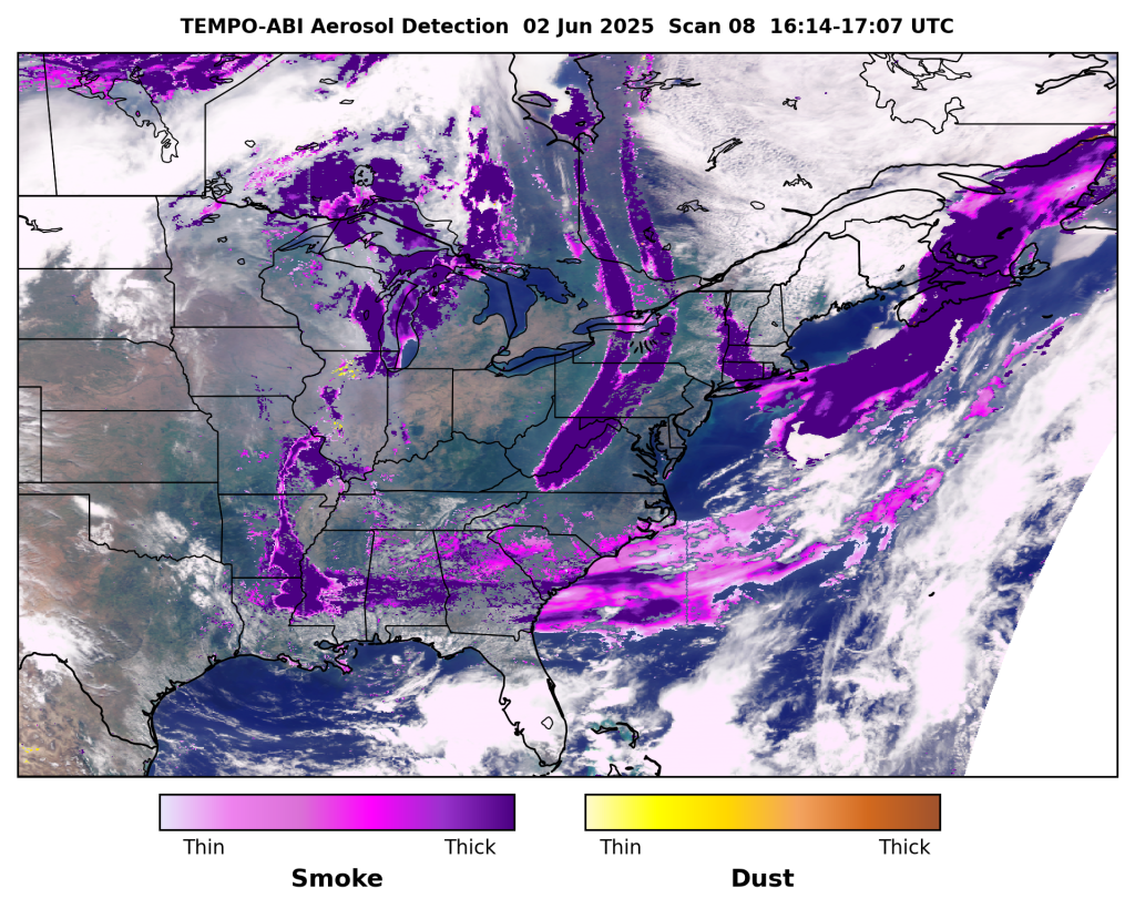
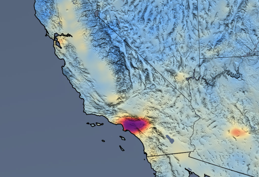
TEMPO
Tropospheric Emissions: Monitoring of Pollution (TEMPO)
Researchers within the biospheric science branch (Matthew Johnson, Claudia Bernier, and Arthur Mizzi) are leading the application and validation of NASA’s TEMPO satellite ozone profile products.
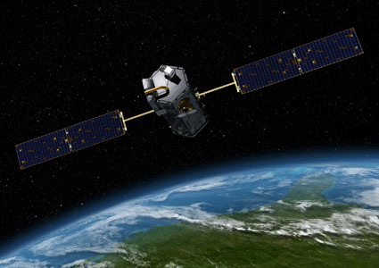
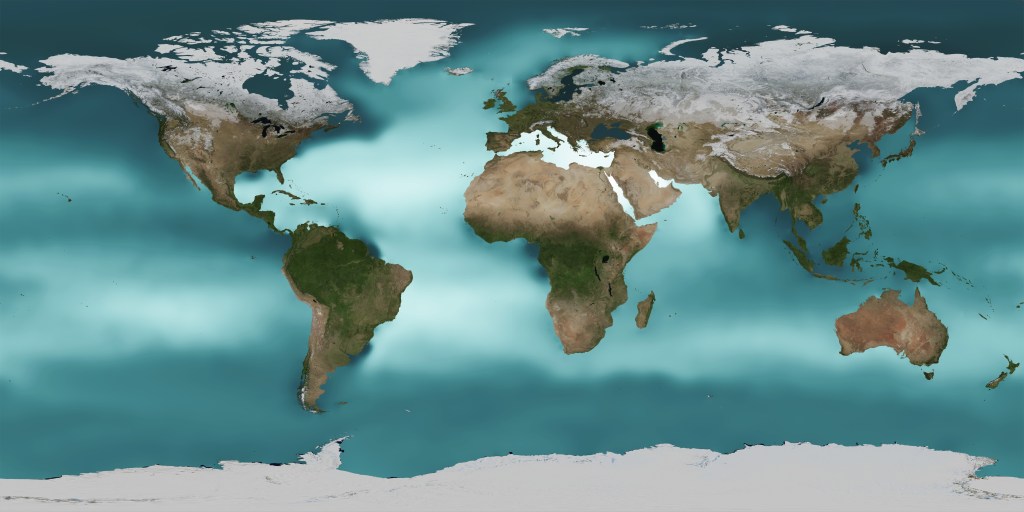
OCO-2 & OCO-3
Orbiting Carbon Observatory-2 and -3 (OCO-2 and OCO-3, respectively)
Biospheric science branch researcher Matthew Johnson plays a key role in the OCO-2/3 Flux Science Team by providing global/regional flux results from the assimilation of this NASA data into the Ames CO2 model.
Aura
The Aura Science Team
Biospheric science branch researchers Matthew Johnson and Jia Jung are Science Team members of NASA’s Aura satellite mission. They conduct critical application and validation studies for retrieved products from this spaceborne sensor.
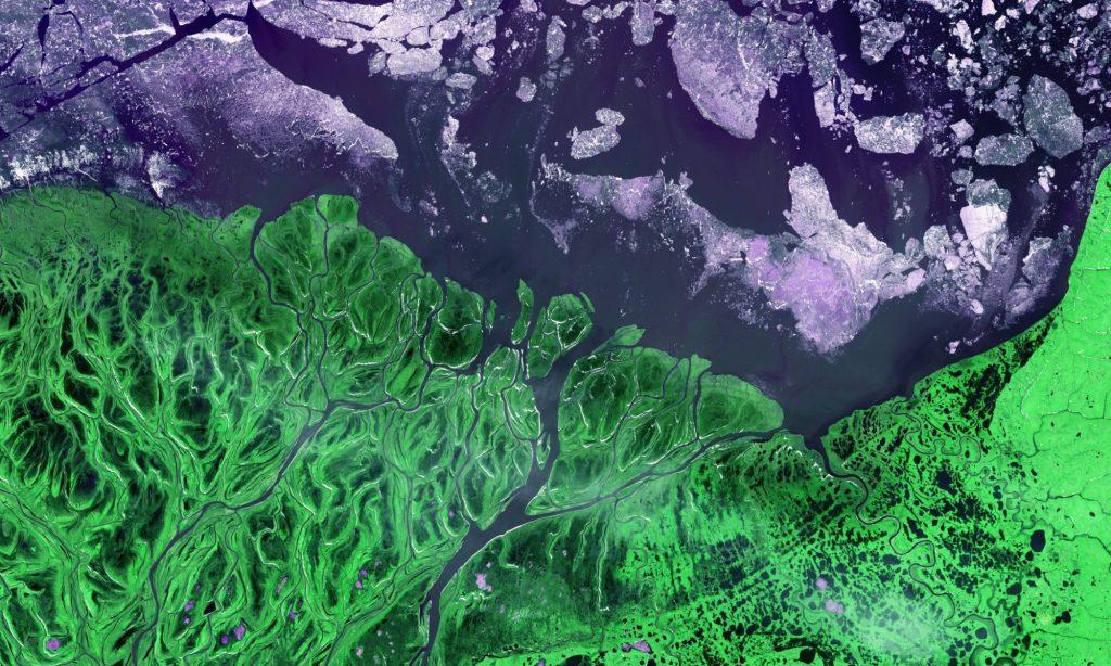
SMAP
Project title: Assimilation of SMAP Global Freeze Thaw (FT) Products to Improve the CASA Ecosystem Model and Our Understanding of Northern Latitude Carbon Fluxes and Wildfire Impacts.
The main objective of Chris Potter’s activities as a member of the SWAT Science Team is to assimilate SMAP observations of daily soil freeze-thaw (FT) state into the CASA (Carnegie-Ames-Stanford) ecosystem model to reduce the uncertainty of global and regional carbon flux estimates and wildfire emissions. A new CASA model “beta” version will be constrained by SMAP FT inputs, such that the current empirical approach, based on monthly (growing and freezing) degree-days, will be overridden by the aggregate observations of the time that soils are thawed (versus frozen).
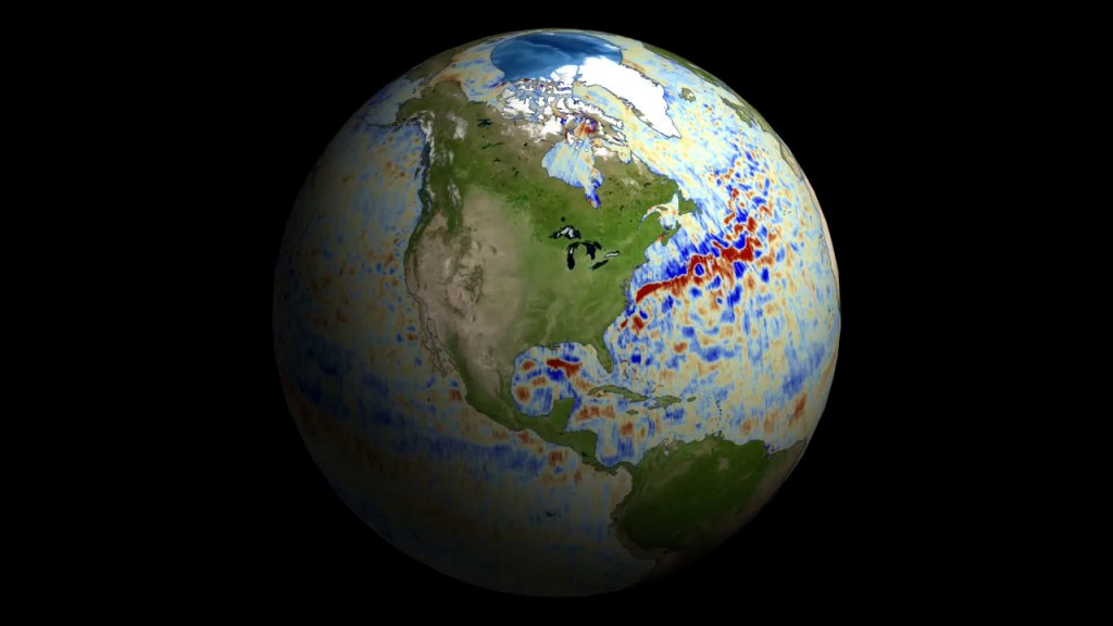
SWOT
Surface Water and Ocean Topography satellite
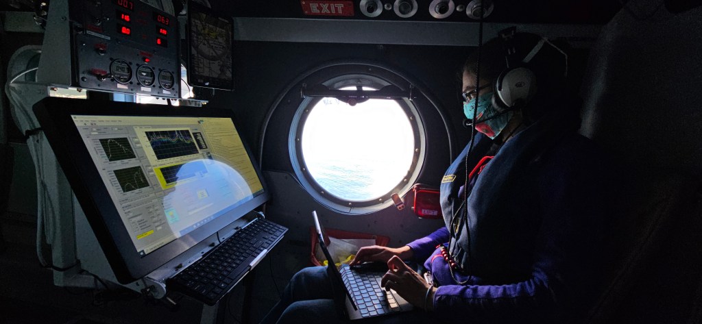
As PI of the TROPIC-SWOT project and member of the SWOT Science Team, Dan Whitt and his team quantify ocean surface currents and understand their physics using the new high-resolution sea level observations from SWOT in the tropical and equatorial oceans. It is anticipated that this fundamental research will lead to improved fine scale predictions of ocean drift in the tropics, e.g. of debris, spilled oil, or distressed boats, as well as improved seasonal and longer term predictions of weather, climate, and the water cycle (e.g., floods, droughts, etc.) via better modeling of El Niño/Southern Oscillation dynamics that depend sensitively on upper ocean physics in the equatorial Pacific.
Suborbital Missions
The Biospheric Science Branch has contributed to multiple NASA suborbital missions with the goals to validate satellite retrieval performance and better understand Earth’s changing ecosystems and atmosphere.
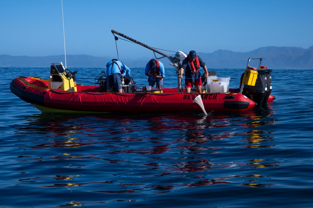
BioSCape
Biospheric science branch researchers (Liane Guild, Juan Torres-Perez, Samantha Sharp) contributed to this suborbital mission by collecting optical and water samples coincident with the 2024 BioSCape hyperspectral airborne campaign in South Africa.
AirSHARP
Biospheric science branch scientists (Liane Guild, Kristen Pistone) have developed a combined airborne sensor approach to validate NASA’s PACE (Plankton, Aerosol, Cloud, ocean Ecosystem) satellite ocean color and aerosol products with airborne radiometers and sunphotometer. Flights of ARC instruments over ship-based instrumented waters and under the PACE overpass enable validated products to study phytoplankton populations, including harmful algal blooms as well as aerosols and their contribution to phytoplankton growth.
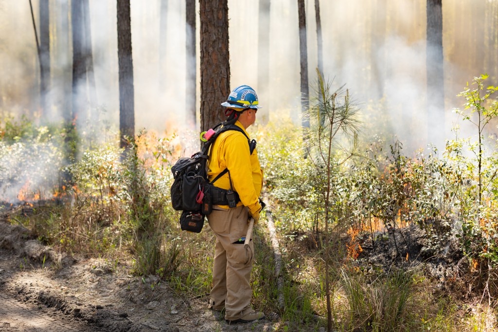
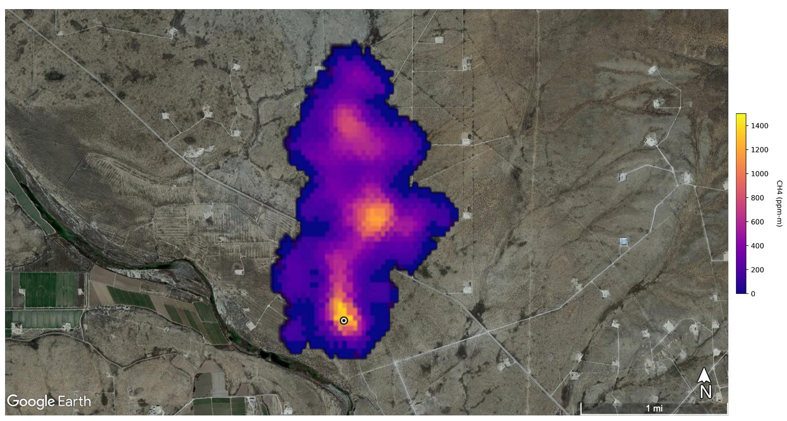
FireSense
Biospheric science branch researcher Clayton Elder is on the FireSense Implementation Team on the AVIRIS-3 real-time spectroscopic products project. Elder collects stakeholder input for high level products related to fires in the wildland urban interface and works with the AVIRIS-3 operational team to produce and deliver those products during time-critical response scenarios.
GEDI
Biospheric science branch researcher Taejin Park is working on integrating GEDI-derived 3D vegetation structure with Landsat and Sentinel satellite observations to enhance the monitoring of large-scale landscape and habitat dynamics, characterize fuel distribution, and quantify key carbon cycle processes. Park also works closely with stakeholders to co-develop GEDI-derived data products that are useful for real-world applications.
OCEANOS
OCEANOS is a NASA Science Activation project aimed at engaging students into STEM disciplines, particularly oceanography and marine biology. The project focuses on in-person training opportunities and hands-on activities which include the use of NASA Earth observations for coastal marine ecosystems and water quality assessment, incorporation of robotics in oceanographic research, and characterization of phytoplankton communities.
PANGEA
Biospheric science branch researchers (Matthew Johnson, Liane Guild) are contributing to this planned airborne mission as lead authors for the selected proposal and white paper. Their science input helped drive the goals of the mission for focusing on wetland/aquatic methane fluxes in tropical ecosystems.
Planetary Boundary Layer (PBL) pre-phase A study
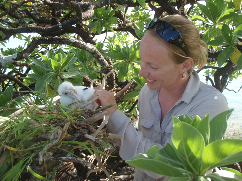
Biospheric science branch researcher Morgan Gilmour is using frigatebird flight behaviors collected by telemetry tags (a.k.a. biologgers) to study the PBL. The team is also developing new biologgers to record in-situ observations of environmental parameters like temperature, pressure, humidity, and wind to characterize PBL dynamics in remote ocean environments. Biospheric science branch expertise contributes to the PBL pre-phase A study by demonstrating how soaring frigatebird behaviors can measure PBL height between the surface and 4,000 meters high.
CyanoSCape
Biospheric science branch scientists Liane Guild, Juan Torres-Perez, and Samantha Sharp are determining the phytoplankton biodiversity of four inland freshwater sites through a field campaign where they collected optical and water samples coincident with the 2024 BioSCape hyperspectral airborne campaign in South Africa.
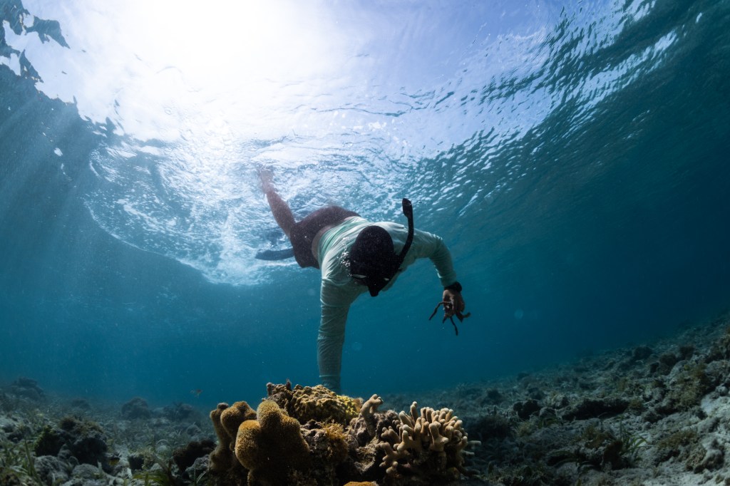
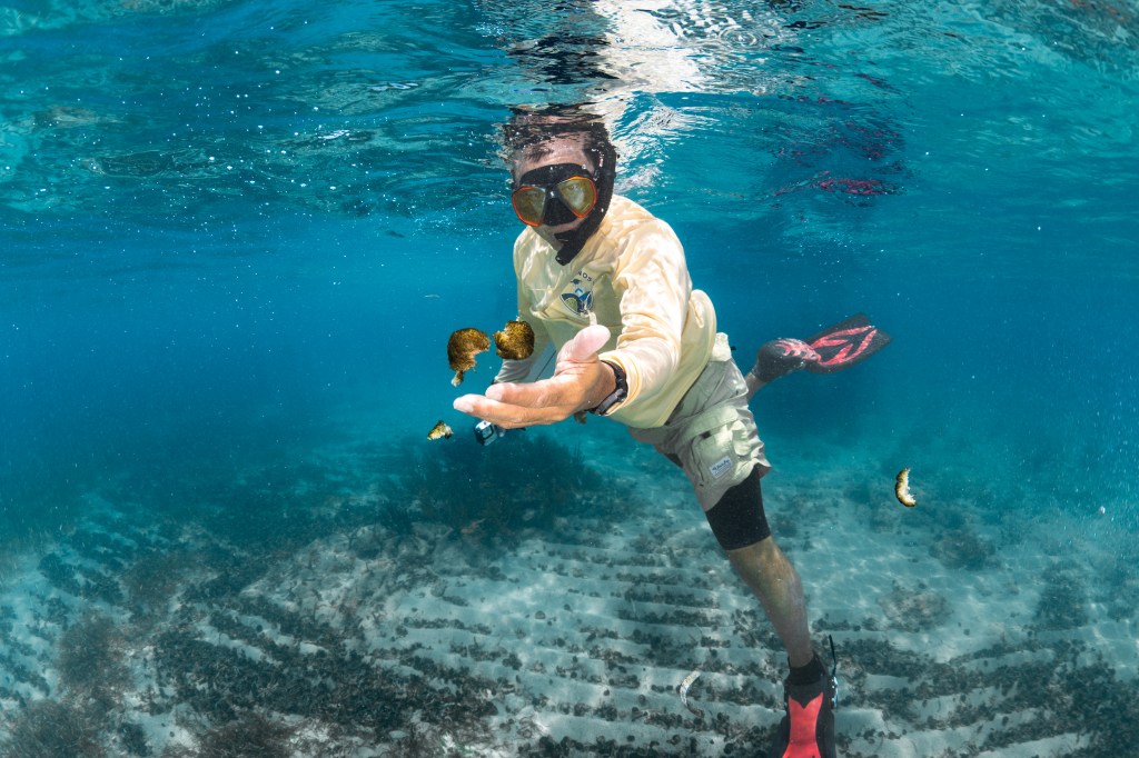
Surfing NASA’s Internet of Animals: Satellites Study Ocean Wildlife
Anchoring the boat in a sandbar, research scientist Morgan Gilmour steps into the shallows and is immediately surrounded by sharks.…
Read the Story
Additional Projects and Programs
NASA Earth Exchange (NEX)
The NASA Earth Exchange (NEX) combines state-of-the-art supercomputing, Earth system modeling, and NASA remote sensing data feeds to deliver a work environment for exploring and analyzing terabyte- to petabyte-scale datasets covering large regions, continents, or the entire globe.
DEVELOP
DEVELOP projects are run at NASA ARC and coordinated by researchers in the Biospheric Science Branch. DEVELOP participants work closely with science advisors in the Earth Science Division to apply Earth observations to address real-world problems. This allows DEVELOP participants to build both research and science communication skills to help set them up for success in the workforce.
ARSET
Biospheric science branch personnel Juan Torres-Pérez, Justin Fain and Sativa Cruz lead the Applied Remote Sensing Training Program (ARSET) Ecological Conservation Thematic Area. They provide online and in-person trainings on the use of NASA Earth Observations and remote sensing technologies for various terrestrial and aquatic applications including land cover and land use change detection, vegetation and aquatic indices, monitoring coastal and marine ecosystems, and biodiversity management.

Disaster Response Coordination System (DRCS)
Ames is a participating center in NASA’s Disaster Response Coordination System (DRCS). These activities at Ames are co-led by the biospheric and atmospheric science branches, who maintain dedicated coordinators in the Earth Sciences Division to actively monitor for disaster threats, network with emergency management agencies, and connect Ames’ Earth Observation experts with emergency responders during disaster response situations.

Earth Science Digital Twins
Biospheric science branch researchers Matthew Johnson, Jia Jung, Justin Fain, Weile Wang, Jessca McCarty are working with NASA’s Land Cover Land Use Change (LCLUC) Science Team to develop NASA Land Earth Science Digital Twins (L-ESDT). The goal of this Digital Twins model is to better understand the impact of LCLUC on weather and climate.