


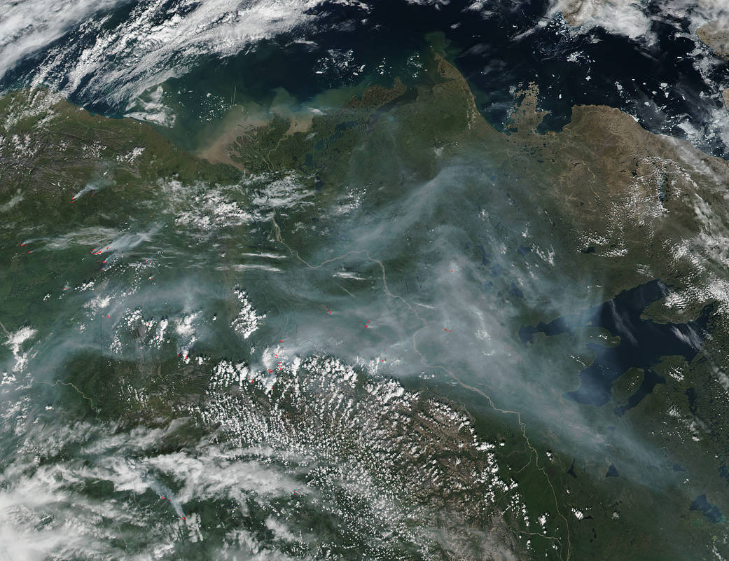
Smoke from wildfires in Canada's Yukon and Northwest Territory can be seen from space.
Smoke from wildfires in Canada’s Yukon and Northwest Territory can be seen from space.
This natural-color satellite image taken at 5:45 p.m. EDT (2125 UTC) on July 9, 2017, was collected by the Visible Infrared Imaging Radiometer Suite (VIIRS) instrument that flies aboard NASA-NOAA’s Suomi NPP satellite. The VIIRS instrument can detect the heat signatures from the fires, and actively burning areas are outlined in red in the image.
In the image, a large area of smoke is seen blanketing areas from Great Bear Lake west to the MacKenzie Mountains and into the Yukon Territory.
NASA image courtesy NASA MODIS Rapid Response Team. Caption: NASA/Goddard, Rob Gutro