


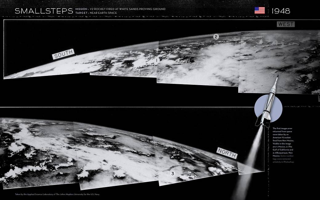
On March 7, 1947, not long after the end of World War II and years before Sputnik ushered in the space age, a group of soldiers and scientists in the New Mexico desert saw something new and wonderful in these grainy black-and-white-photos – the first pictures of Earth as seen from altitude greater than 100 miles in space. Just the year before in 1946, scientists like John T. Mengel, a NASA pioneer who later oversaw the Vanguard Program, began experimenting with captured German V-2 rockets.
Mengel conducted upper atmosphere experiments by launching the rockets into near-earth orbit. He designed and fabricated the first research nose shell to replace of the V-2 warhead and began placing cameras in the nose shell.
Before the Small Steps Program began in 1946 using V-2 rockets to take images from space, the highest pictures ever taken of the Earth’s surface were from the Explorer II balloon, which ascended 13.7 miles in 1935, high enough to discern the curvature of the Earth. The V-2 cameras reached more than five times that altitude and clearly showed the planet set against the blackness of space. When the movie frames were stitched together, the panoramas taken in the late 1940s covered a million square miles or more at a single glance.Image Credit: Johns Hopkins Applied Physics Laboratory