


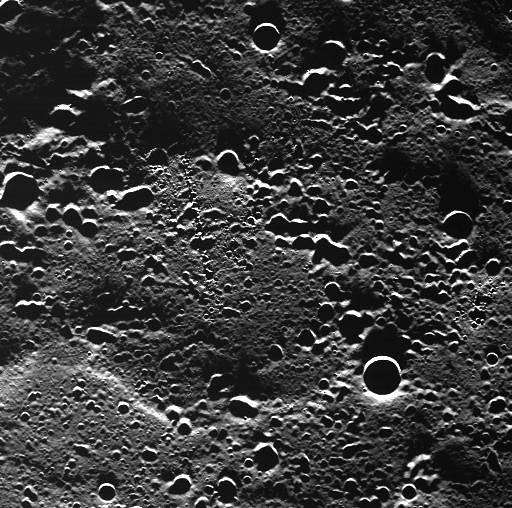
This WAC image showing a never-before-imaged area of Mercury’s surface was taken from an altitude of 450 km (280 miles) above the planet during the spacecraft’s first orbit with the camera in operation. The area is covered in secondary craters made by an impact outside of the field of view. Some of the secondary craters are oriented in chain-like formations.
This image was taken during MESSENGER’s closest approach to the sunlit portion of the surface during this orbit, just before crossing over the terminator. The oblique illumination by the Sun causes the long shadows and accentuates topography. The highly elliptical orbit of MESSENGER brings the spacecraft down to a periapsis (MESSENGER’s closest approach to Mercury) altitude of 200 km (125 miles) and out to an apoapsis (MESSENGER’s farthest distance from Mercury) altitude of 15,000 km (9300 miles).
Date acquired: March 29, 2011Image Credit: NASA/Johns Hopkins University Applied Physics Laboratory/Carnegie Institution of Washington