Transcript
(music)
ABC news report, Hurricane Laura, Aug 26, 2020
Reporter:We’ve been watching here as this hurricane grows in strength, now upgraded to a Cat 4. And just look at the size and scope of this hurricane, these images from the International Space Station. It is 400 miles across…
[0:13] Narrator: It seems like there’s always a storm somewhere in the world.
ABC news report, continued
Reporter:Hurricane Laura speeding towards the Gulf Coast, Texas and Louisiana, emergency evacuations…
CNN news report, Super Cyclone Amphan, May 19, 2020
Reporter:…people are evacuating along the India-Bangladesh border, they’re trying to get to safety ahead of super cyclone Amphan. This is the strongest storm ever recorded in the Bay of Bengal…
9 News, Perth Australia, Super Storm, May 25, 2020
Reporter:…it’s the type of weather that hits just once every ten years, so it makes its presence felt. The super storm smashing more than 2,000 kilometers of WA coastline, from Exmouth to Esperance and inland…
[0:50] Narrator: NASA has been keeping tabs on the world’s weather for 60 years, starting with the Television Infrared Observation Satellite in 1960. That mission had two television cameras to watch developing clouds. And since then, various satellites and instruments have tracked and studied how clouds and winds combine into storms.
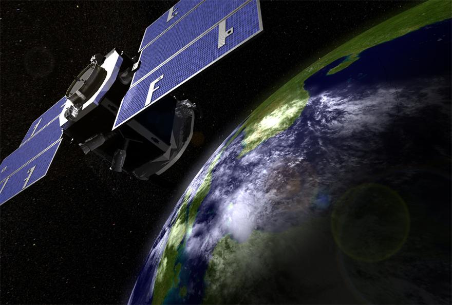
Graeme Stephens is the lead scientist for CloudSat, a satellite launched in 2006. CloudSat studies many aspects of clouds, from their structure and distribution, to how much water they contain – which is not as much water as you might expect.
[1:31] Graeme Stephens:Think about flooding rains, for example. It feels like a lot of water, right, when you see these massive floods? The amount of water in clouds and rain is about 0.5 percent of the total amount of water in the sky. And the total amount of water in the sky, is about one-thousands of one percent of the total amount of water on the planet. So the waters in clouds and rains is a tiny, tiny, tiny, tiny fraction, yet it has a huge influence on human society and life on Earth.
(sound FX: thunderstorm)
Narrator:Storms seem to be more powerful and rapidly intensifying more often than in the past, due to climate change. As the air warms, it’s able to hold more water, and that changes how storms behave.
[2:17] Graeme Stephens:We think the storms are going to be more intense and rain more heavily, because there’s more water vapor that can be condensed — that adds heat to fuel the storms. But storms can’t rain out at the same rate that the water vapor is increasing. So it probably means that when it does rain, there’ll be longer times between more intense rains.
On top of that, the air’s moving, and it’s pushing water vapor in the circulation patterns of the atmosphere. And what that means is that where the circulation wants to funnel the water in the atmosphere, those areas are going to get wetter. And where the air wants to move water out of those areas, those areas will get drier. So on a whole, we think that the wet areas will get wetter and the dry areas will get drier.
[3:08] That’s kind of a simplistic argument really, and there are nuances to that argument. We don’t really have a clear theory for the frequency of which it rains. We understand how much it’s going to rain in total. If you sum up all the water that falls out of the sky, we understand how much it’s going to increase.
We do see over the last 20, 30 years from our satellite observations that indeed the atmosphere is increasing its water content, of about seven percent per degree of warming that’s taking place on the planet. But the interesting thing is that the amount of rain that falls from the sky isn’t controlled by how much water is in the atmosphere. It’s actually controlled by the planet’s energy balance. And the planet’s energy balance, in turn, is influenced by the water in the sky.
Narrator:A warmer, or more energetic atmosphere holds more water, and more water vapor traps more heat. It’s a feedback loop between water and energy that can tip over into runaway heating — as we see on our neighbor planet Venus, where a thick atmosphere traps so much heat, average surface temperatures there are 465 degrees Celsius, or 870 Fahrenheit – hot enough to melt lead. But Graeme says Earth’s clouds have so far saved us from that fate.
[4:30] Graeme Stephens:So what clouds do, they stop the water vapor from building up increasingly forever. It builds up to a point, and then it rains out, and goes back to the ocean. Then it evaporates back again, and builds up again, and rains out. Now, if you didn’t have the clouds, then the water vapor would just keep building, building, building. And so ultimately all the water in the oceans would get in the atmosphere, and you just have one hellhole of Earth. So without clouds, Earth wouldn’t be recognizable from what we see it as today.
(Intro music with NASA audio montage)
[5:33] Narrator:Welcome to “On a Mission,” a podcast of NASA’s Jet Propulsion Laboratory. I’m Leslie Mullen, and in this third season we’re traveling to the ends of the Earth with scientists who explore our tempestuous world. This is episode seven: Storm Warning.
January 28, 2015 weather report, FOX 10 Phoenix:Cory McCloskey: “…they don’t look good either, and frankly, Wickenburg is a total loss. You may as well just get out of anywhere along this 60 here, it’s very warm. Surprise is heating up as well at 1300 degrees, (laughter)so again the safe spots seem to be Chandler and Mesa, Scottsdale is doing ok so far, but, you know, you’re sort of surrounded by some pretty intense heat. So you know, again, I’m not your dad, but I would get out while you still can. I think steel boils at about this temperature, so Cave Creek, there’s probably nothing left up there…(laughter)”
[6:24] Narrator: That infamous 2015 Arizona weather report, in which temperatures on the map reached as high as 2,960 degrees Fahrenheit, was due to a computer glitch. Weather forecasts usually aren’t thatfar off from reality, but we’ve all experienced predictions that didn’t come to pass: the hurricane that was downgraded before it hit land, the rain showers that never materialized, the skies that were supposed to be clear but instead clouded up.
(music)
Forecasting the weather relies on measurements of a lot of different variables that are constantly interacting. Errors made in these measurements, even by the tiniest fractions, can make weather prediction difficult beyond a few days, because the errors compound over time.
This is part of the Butterfly Effect. A butterfly flapping its wings in one part of the world doesn’t actually trigger a tornado somewhere else — the turbulence in air molecules generated by a butterfly is so minute, that breeze doesn’t travel very far. The Butterfly Effect is instead a concept used to describe a chaotic system, like weather, where small changes lead to big outcomes. For weather, the most important changes are in temperature, humidity and air pressure.
[7:46] Air pressure is based on how many air molecules are pulled down toward the ground by gravity. Air molecules warmed by the Sun tend to rise, and because that rising warm air isn’t pushing down as much toward the ground, it creates an area of low pressure. Cool air, meanwhile, sinks, pressing down even more toward the ground and creating areas of high pressure.
Wind is generated as air flows from high pressure to low pressure areas. This process is ever-flowing, because as Earth spins in its tilted orbit around the Sun, the surface and air are heated unevenly, not only between north and south, but also between areas of day and night.
Earth’s spin also leads to the Coriolis Effect, which deflects ocean currents and winds to the right in the Northern Hemisphere, and to the left in the Southern Hemisphere. The Coriolis Effect is what gives huge tropical storms like hurricanes and typhoons their spin. Tornadoes, being so much smaller and shorter-lived, aren’t spun up by the Coriolis Effect; instead their twisting is the result of how humid and dry winds clash to create them.
[9:00] “Twister” movie:(Sounds of tornado)Flying cow: “Mooo”Jo: “Cow”Melissa: “I gotta go Julia, we got cows!”Flying cow: “Mooo”
Narrator: Storms do more than blow things around, like those poor cows in the 1996 tornado movie, “Twister.” They also reshape our planet. Rain, snow, ice and wind erode rocks into smaller fragments, making elements once bound into the rock free to chemically react with water. Our weather constantly scrubs the face of Earth, keeping our planet looking smooth and young compared to our Moon or other worlds deeply cratered by asteroid impacts.
Weather is a snapshot of what’s happening at any given moment, whereas climate is the average of all the weather over time. So weather is a specific blizzard one winter, or a particularly hot summer day. Climate refers to longer-term overall trends of warming or cooling. While day-to-day weather variations can be tricky to predict, the steady march towards a warmer climate has become more obvious than ever.
[10:10] Blue Planet II, Episode 7, “Our Blue Planet”
David Attenborough: We are at a unique stage in our history. Never before have we had such an awareness of what we’re doing to the planet. And never before have we had the power to do something about that. Surely, we have a responsibility to care for our Blue Planet.
Graeme Stephens:You’ve probably heard the phrase, popularized by Attenbourgh’s great documentaries on Earth, Earth’s often called the Blue Planet. But if you look at Earth from space, it’s just as much white as it is blue. And while 97 percent of all the water on Earth is in the oceans, and basically 70 percent of the world’s surface is covered by oceans, more than 70 percent of the Earth’s surface is also covered by a thin veil of whiteness. That’s clouds, snow on the ground, sea ice. The white water covers as much of Earth as the blue water. And that white water actually dramatically influences weather and climate.
[11:16] Narrator: Bright or white areas reflect the heat of sunlight, while darker areas absorb heat. Since clouds are mainly white, you’d think they’d reflect a lot of sunlight’s heat back to space, but Graeme Stephens says it’s not that simple.
(music)
Graeme Stephens:Clouds are quite perverse. They have a greenhouse effect that can warm the planet, but they have this whiteness effect which can cool the planet. And you know, which one’s winning depends on whether they’re all high or whether they’re low, or whether they have much water in them.
Say you get more water vapor in the atmosphere, that condenses and the clouds get wetter. There’s more water in the clouds now. More water in the clouds mean they get whiter. The whiter the cloud, the more sunlight’s reflected from the clouds, and the more they would have a cooling effect on the planet. Right? Now is that what we’re observing? Our observations are still too fuzzy to tell us, and the changes we’re seeing are really small, but not insignificant. So what we see are changes in clouds in one area, but compensating different changes in clouds in other areas.
[12:24] You know, the Northern Hemisphere and Southern Hemisphere are very different. Southern Hemisphere is mostly water. The Northern Hemisphere is mostly land. Land is bright — tends to be brighter than the oceans. The amount of sunlight that the Earth reflects in the Northern Hemisphere is exactly the same, though, as in the Southern Hemisphere. Why is that so? And how is it so? Well, we know how it’s so, because the Southern Hemisphere is actually cloudier. So the more clouds compensate for the less land. Why is it exactly the same, as we far as we can measure? Is there some sort of physical mechanism that wants to maintain it that way?
We could speculate there may well be changes in southern ocean clouds in order to bring the planet back into a symmetric balance. But we don’t know that symmetric balance is the format that Earth wants to be in. It just might be a coincidence. But it’s a pretty bizarre coincidence. So Mother Nature really does throw us curve balls, I can tell you! (laughs)
[13:20] Narrator:Throughout human history, we’ve watched the drifting shapes of clouds and read signs within their patterns. When it comes to weather, clouds are like a crystal ball that help predict the future. This art of using clouds to divine approaching storms or other weather conditions has been refined over centuries, but only in the more recent past did the study of clouds become a true science.
Graeme Stephens:The one thing that they found difficult to classify back in the mid to late 1700s were clouds. They couldn’t classify them because they’re forever changing. And in fact, some philosophers back at that time thought that they were the invention of God. They weren’t meant to be classified. They couldn’t be classified. Others felt that if you could classify these clouds, you could unlock all sorts of secrets of Nature. And it wasn’t until the early 1800s where a chemist, by the name of Luke Howard, came up with a classification strategy that we use today.
[14:19] So he came up with a way of classifying clouds in terms of forms. He recognized that clouds would be more of a system, with a mixture of different types in it. And he was able to break down these eight building blocks of types. So any one scene you see in the atmosphere could have two or three types mixed in. That was the beginning of meteorology as a science.
Narrator:Luke Howard included his own drawings of clouds to illustrate his “Essay on the Modification of Clouds.” Howard’s scientific work inspired many poets and artists of the time, including the English painter John Constable.
Graeme Stephens:Constable used to make very famous paintings of clouds, but what people didn’t realize, in his mind, he believed he was documenting the weather. And he would write on his canvases the local weather at that time. So he’d be painting this cloud scene, and he’d put the date, often. But he didn’t put any dates on a series of cloud studies that he did, and later scholars were able to date those paintings based on matching it to the weather recorded by the weather service at that time.
(sound FX: wind)
[15:31] Narrator:Artistic recreations of weather highlight the beauty of clouds and storms, but barely brush upon their sublime power.
(sound FX: thunderstorm)
A typical thunderstorm discharges enough energy to power New York City for 26 minutes. Every day, Earth experiences more than 40 thousand thunderstorms that generate more than 3 million lightning strikes. The temperature of a bolt of lightning is five times hotter than the surface of the Sun.
The Saffir–Simpson scale for hurricane power is determined by sustained winds, meaning winds that blow at a certain speed for at least a minute. Category 1 hurricanes have maximum sustained winds from 74 to 95 miles per hour, and Category 5 hurricanes have maximum sustained winds greater than 157 miles per hour. The power released by an average hurricane is said to be more than 200 times greater than the electrical generating capacity of the entire world.
[16:36] The Fujita-scale ranking of tornado power is based on both wind speeds and the amount of damage they cause – as described by the storm chasers in the movie, “Twister.”
“Twister” movie:
Preacher:That was a good size twister. What was it, an F3? Bill:Solid F2.
Melissa:See, now you have lost me again.
Bill :It’s the Fujita scale. It measures a tornado’s intensity by how much it eats.Melissa :Eats?
Bill :Destroys.
Laurence :That one we encountered back there was a strong F2, possibly an F3.
Beltzer :Maybe we’ll see some 4’s.
Haynes :That would be sweet!Bill: “4 is good. 4 will relocate your house fairly efficiently.”(laughter)Melissa: “Is there an F5? (everyone goes silent)What would that be like?”Preacher: “The finger of God.”
[17:19] Graeme Stephens:I don’t think people appreciate the vastness and the scope and the power of Nature, and the nature of storms. The power of these storms is unbelievable. Probably the big issue for us is going to be the severity of storms. And what the extremes are going to be is something that will occupy us for the next decade or more. How’s extreme weather’s going to change? That’s going to be our challenge to try to address, and we don’t really have a clear way to address it, in reality.
Narrator: Graeme was never a storm chaser, but when he was a PhD student in Australia, he would fly on planes into clouds to test scientific instruments and capture aerosol particles.
Graeme Stephens:We had to capture particles on an oiled glass slide that might be three inches long and half an inch wide. And it was fired by a special U-shaped gun, where a slide would go around this U-shaped track, and it’d be exposed to the air part of the way and then come back again, and the cloud particles would imprint on the slide, and you’d stack the slide and you get the next one. Then you have to look under a microscope to count up all the cloud particles. This was before the automated optical systems that we have today.
[18:29] And so you put this gun thing out the copilot side window. And I didn’t hold onto it tight enough, because the drag rammed it back against the window. You’re supposed to hold it and brace it as much as you can. Well I didn’t really brace it, and it went back and cracked into the window. The pilot’s just looking at me like, “you idiot.” (laughs)
It was really funny, actually. So I was doing wimpy clouds, and he wanted to do big stuff. Pilots in Australia had carte blanche to sort of fly visually — you know, we could see cloud systems we want to go over and measure. Where here you can’t; you have to follow a vector of a certain flight path and you can’t deviate. Where in Australia, I could deviate. This is back in the seventies. And I want to go over and make measurements in this little puffy cumulus cloud. And then there’s a thunderstorm way out in the horizon. And the pilot looked at the cloud I was pointing to that I wanted to do, little cumulus cloud. He said to me, “That’s not a cloud.” Then he pointed to the thunderstorm, and said, “That’s what a cloud is!”
[19:26] “Crocodile Dundee” movie:
Sue Charlton: “Mick, give him your wallet.”Crocodile Dundee: “What for?”Sue Charlton: “He’s got a knife.”Crocodile Dundee: “Haha, that’s not a knife. That’s a knife.”
Graeme Stephens:Well, that was before Crocodile Dundee. That was a pretty funny guy. “That’s not a cloud,” he would say. “That’s a cloud!” (laughs) “Okay, let’s go and do that one!” So we flew through it. It was pretty fun actually.
“Stormy Weather” – Etta James
“Don’t know why
There’s no Sun up in the sky
Stormy weather…”
Narrator: Robbie Hood spent her 21-year career at NASA flying in storms all over the world.
[20:24] Robbie Hood:In my career at NASA, I did field experiments in Alaska, Australia, and Cape Verde off the coast of Africa. I did experiments in Brazil and Costa Rica. Of course, a lot of them in Florida, but, you know, we were studying tropical weather, and so you had to go to tropical places to see the weather.
(music)
Robbie Hood:When I first started at NASA, we were using higher-altitude manned aircraft. And so I was working with the NASA ER-2, which is a high altitude aircraft that flies at about 65,000 feet. And that the goal of that was to fly up over, say a thunderstorm or a hurricane or a rainstorm, and look down through the atmosphere at that. The ER-2, that flies so high that the pilot actually wears an oxygen suit, just like an astronaut does. So it was similar to a satellite, only it was flying closer to the storm, so it just saw everything in higher detail.
[21:22] I would fly on the DC-8, which flies at about 40,000 feet. I was pretty world-renowned for taking a Dramamine before the flights. We were flying through the tops of the storms, and you didn’t want to kill people or harm the aircraft, so if it was too intense, we just would fly around it. It would get bumpy when you would go across the eye wall, but a lot of times it wasn’t any different than what you might experience on a regular airline flight, flying at 30,000 feet.
When we were flying on the DC-8 aircraft, that would carry instruments and people, and the kind of instrument we worked with was a passive microwave radiometer. It was tuned to certain frequencies — everything in the Universe gives off a certain energy signal. And if you have an instrument that’s tuned to the right frequency, you can see it. It’s just the same thing as night vision goggles that’s tuned to the frequencies that can see the heat of a person or an animal in the dark. Well, a passive microwave radiometer on an aircraft is tuned so it can see the different precipitation particles in a storm. So it could see the rain droplets, it can see the ice crystals.
[22:30] We were also looking at how storms over the ocean developed and intensified and how much rainfall they would produce. And then that kind of led into hurricanes, and also looking at what could you do to better understand hurricanes by using a variety of information: aircraft and satellites, and the Hurricane Hunter information, the ocean buoys, how does all of that work together to get a better handle on how a hurricane is structured and how it moves, how it intensifies, that kind of thing.
Narrator:The “Hurricane Hunters” are aircrews who fly right through the blinding rain and violent winds of hurricanes over and over again to monitor how a storm is progressing. The 53rd Weather Reconnaissance Squadron of the US Air Force Reserves were the original Hurricane Hunters, and the information they collect is used in forecasts by the National Hurricane Center. The National Oceanic and Atmospheric Administration, or NOAA, also has Hurricane Hunters who collect science data for hurricane research.
[23:35] Robbie Hood:The real heroes, as far as being true storm chasers, are the Hurricane Hunters. They fly at 10,000 feet, right down through the bottom of the storm. And I have flown on some of those flights with my NOAA colleagues and they’re pretty exciting too, but they can get pretty intense.
(sound FX: plane turbulence)
I know a lot of people who love to fly through storms, and it is a lot of fun, but I didn’t feel like I had all the information at my fingertips, and I kept wishing part of me could be back at my desk and still get all the ground-based data and the satellite data. And that’s how I got interested in UAS, or Unmanned Aircraft Systems. Why couldn’t we fly robotic aircraft through storms and over storms to collect information? And so I started getting interested in that, and then eventually I got so interested that I switched over to work for NOAA, and I was in charge of the unmanned aircraft system program there for the last nine years of my career.
[24:37] And so when I went to NOAA, I turned around and partnered with NASA, because NASA had bought a Global Hawk from the Air Force. And a Global Hawk is an unmanned aircraft that flies at 65, 70 thousand feet. And it was flying over the storm with no pilot on, carrying all the same instruments we’d carried before on our previous NASA experiments.
Plus we were also doing what we call dropsondes, which are a device you can release from the aircraft and it falls through the storm and it collects temperature, pressure, humidity, all of that information as it’s falling through the storm. And so we were the first group to ever remotely drop a dropsonde from a robotic aircraft into a hurricane.
That was fascinating work, and I will say that to me, being able to sit in a control room and watch that flight, watch the monitors and see the data come across, was every bit as exciting as sitting on the plane myself and flying through the storm.
(sound FX: wind)
[25:38] Narrator: Certain areas of the world are more apt to have storms than others, due to the special conditions that encourage storm formation. Hurricane Alley, for instance, is a region of the southern Atlantic Ocean where storms arise thanks to the mixture of warm winds and ocean water near the coast of Africa, and then, as though on a conveyor belt in a bakery, the storms puff up as they spin westward, towards the Americas.
Robbie Hood:If you think of how a hurricane forms, you have to have certain ingredients: warm ocean water, buoyancy in the air — basically we call it instability, is it moving up and down vertically? And then there’s light wind structure from the surface up into the sky so that it doesn’t blow that storm apart when it’s starting to form. Some of those things are just a few of the ingredients.
[26:26] So if you think of it as trying to bake a cake, sometimes if you put a little too much butter or a little too much flour into it, your cake will come out one way. Sometimes you have a bumper crop of ingredients that you need, and so you get a lot. And so if you think of it as trying to perfect a recipe, we’re still tweaking that recipe.
Sahara dust can decrease the severity of storms, but then again, we also may be seeing, because we have a warmer atmosphere going forward with climate change, that storms may be able to hold more water. So we’re still perfecting that recipe of how can we understand and bake a consistent hurricane forecast.
Narrator: Storms can be dangerous but also hypnotic, and there’s a fascination in watching them.
[27:13] Robbie Hood:I love the weather. I love talking about it. I love studying it. It was just the beauty of it. There were times when we were going over across the top of hurricanes, and you could look down into the center of the eye and it was just so fascinating. There were a few times when you could see all the way down to the ocean, you could see the whitecaps in the ocean. But then looking down into the storm, you, there was just like every kind of cloud you’d ever seen in your whole life.
Because we worked for NASA and at Marshall Space Flight Center — they’re one of the premier lightning research groups in the country — and so that team had lightning instrumentation on the aircraft. There were definitely times, in intensifying storms especially, when the ER-2 pilot was flying by himself up above the storm, and he had seen some lightning coming from the top. And there is a field of study now that’s continuing that lightning is seen as an indicator of storm intensification.
(sound FX: thunder and lightning)
Discovery Channel “Storm Chasers”
Announcer:The Storms are gatheringStorm chaser: We got tornado on the ground!Storm chaser: This thing is moving quick!Announcer:And this Fall,Storm chaser: Oh my God!Announcer:An all-new chase is on.Storm Chaser:Wow, that thing is a monster!
Narrator:Programs like the Discovery Channel’s “Storm Chasers” shows how many people are drawn to the beauty and power of extreme weather. Robbie says the broad public interest in weather tracking could be a key part of forecasting in the future.
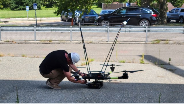
[28:38] Robbie Hood:It’s funny, because I’ve worked most of my career with big aircraft and supported satellite development. But now that I’m retired, I’m interested in what are low cost, economical ways to collect weather. You could make a weather station very cheaply now. And University of Oklahoma and Oklahoma State, they’ve got an active program where they’re putting weather sensors on small drones and collecting weather observations.
(sound FX: drone)
Robbie Hood:If we’re really going to have drones delivering packages and carrying people, then you’ve got to understand the weather in the part of the atmosphere that the drones are flying in, and traditionally up until now, we’ve been fine with satellites and weather stations spread across state areas, but you’re going to have to have a much more dense, local observing network.
[29:28] I think we are going to be moving towards a new model that the federal government just can’t pay for all of our weather observations. At least for ground-based weather observations. Maybe the government still needs to do the satellites and the big expensive stuff, but are there local weather networks that people could invest in and use locally, but then also be part of a larger collective that’s providing data?
So now’s the time to really open up scientific observations to underrepresented communities like tribal nations and rural communities who have maybe not felt like they were part of the big science scene. So to me, this is a way to kind of level the playing field, as far as putting science into everybody’s hands.
(music)
[30:18] Robbie Hood:I have worked with the Choctaw nation in Oklahoma. They’ve been supported by the FAA to develop a testing ground for unmanned aircraft systems. They’ve taken 25 miles of their Choctaw tribal land, and they’re turning it into a research corridor for sampling drones and different kinds of UAS activity.
Narrator:Robbie’s roots are in Oklahoma – her parents were raised there, and her family is part of the Cherokee Nation. She first became interested in storms growing up on the Midwestern Prairie.
Robbie Hood:We always had tornadoes. I grew up in a small town called Neosho, Missouri, which is in Southwestern, Missouri. And my dad, he worked for North American Rockwell and Rocketdyne, and they were the ones that were building the Apollo jet engines. And so at one part of his career, he went to work in Picayune, Mississippi. And we were living down there when Hurricane Camille came.
[31:14] WWLTV New Orleans 2019 news clip: Hurricane Camille 50 years agoAnnouncer:The coast braced for Camille’s landfall. In reality, nothing could’ve prepared people in south Mississippi for what was to come. The Category 5 hurricane’s winds were so strong they broke most of the wind-recording devices, although one reading put them at 175 miles an hour. 24-foot seas in some areas caused massive destruction that people spent decades trying to describe.
Robbie Hood:I had never experienced a hurricane. I was just amazed at how powerful a hurricane was and what it could do. How it could just completely devastate your community or bring your whole economy to a standstill.
Narrator: When Robbie started working at NASA’s Marshall Space and Rocket Center in Huntsville, Alabama, it not only connected her to her dad’s work on the Apollo rockets to the Moon. It also connected her to a deeper part of her family’s history, because this area of northern Alabama was a stop on the forced migration of Native Americans known as the Trail of Tears.
[32:08] Robbie Hood:The Cherokees, along with other tribes like the Chickasaws, the Choctaws, and the Seminoles, had farming communities and were landowners, had cotton plantations and the whole nine yards in the Eastern United States back in the 1800s. But enough white settlers started moving in that they wanted the land that the Cherokees had.
(music)
And so, John Ross, who was the Chief of the Cherokees at the time, began to work in DC to file various lawsuits against the government to hang onto their land. And they actually had a decision that was ruled in their favor by the Supreme Court that said that the Cherokees, based on treaties in place at the time, should be allowed to keep their land. But Andrew Jackson decided he didn’t care. And he brought the Army in and forcibly removed people from their homes and literally marched them from the Eastern United States to Oklahoma.
[33:02] So John Ross was the Chief, and I’m a direct descendant of him. Basically his great granddaughter is my great grandmother. I remember my mother telling me the story of the Trail of Tears, and she said, “You’ll never learn about this in school.” People are somewhat familiar with it now, but it’s still not studied intensely. It’s a very sad story, and I don’t think people realize that they were farmers, but they were also wealthy farmers, and they were lawyers and doctors, and many of them had sent their kids to Ivy League colleges in the Northeast. So basically it would be like any of us, you know, the Army soldiers show up in your driveway one night and just say, “You’ve got to leave.” So it’s really hard to think about.
(sound FX: rain and thunder)
Robbie Hood: A lot of times when you see artistic depictions of the Trail of Tears, it’s raining or snowing, you know, because it took a month to walk, and so they walked through all kinds of weather conditions. So when I got the job at NASA in Huntsville, Alabama, I’ve always taken a lot of great pride that even though the Cherokees were moved to Oklahoma, I’m back on the Cherokee Trail of Tears.
[34:12] Narrator: For Robbie, that history has important lessons for the weather and climate challenges of our future.
Robbie Hood:Most current tribal nations are on land that they were put on, and they’ve learned to adapt to that land. And there’s always also indigenous knowledge about how to adapt to weather changes and climate changes. You know, there’s different tribes and different languages, but in some respects, tribal nations have some similarities. And one similarity is most of them treat the Earth as not a resource, but as a relative. So the weather is your relative and, you know, the mountains are your relative. So you need to treat them with the same respect that you would treat a member of your family, as opposed to a resource that you’re trying to use up. So there really is, especially among indigenous scientists now, an effort to earn respect for the traditional knowledge that they have, along with the more contemporary scientific methods that people are learning.
(music)
[35:15] Robbie Hood: In the early part of my career, I always used to get asked, “Do you or do you not believe in global warming?” And in the early days, the data wasn’t in, but I think the data is in now. And we just need to pay attention that it’s here, but then just start thinking realistically, how are we going to adapt, like Native Americans have done their whole lives?
I do think underrepresented communities are very resilient, whether it’s the Black communities or Native American or Latino. I mean, you have to be resilient when you’re underrepresented. So I think there’s a lot we can learn from that, but we really need to pay attention to science, and make science more accessible to everybody.
(music)
Narrator: If you like this podcast, please subscribe, rate us on your podcast platform, and share us on social media. We’re “On a Mission,” a podcast of NASA’s Jet Propulsion Laboratory.
(music to finish)
[run time = 36:22]

