


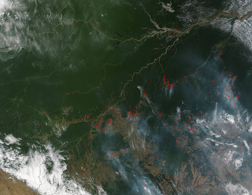
Researchers and scientists at NASA and UC-Irvine reported this year that the wildfire risk for the western Amazon Basin should be lower this year than in year’s past, however the fire projection for the eastern part will be higher. This natural-color image collected by the Terra satellite with the Moderate Resolution Imaging Spectroradiometer, MODIS, instrument on September 10, 2015, seems to prove that model was correct. In the area of Amazonas, fire activity is low, but in Acre, Mato Grosso, Para, and Rodonia, the fire activity seen is much higher. The study goes on to say the reason has to do with the El Niño event which developed earlier this year and in currently in full effect. According to the study, “Sea surface temperatures in the Pacific Ocean are warmer than normal – El Niño conditions – which suppress rainfall in the eastern Amazon. The three regions at highest risk are Brazil states Maranhão, Mato Grosso and Pará. Meanwhile, sea surface temperatures in the tropical North Atlantic are average or cooler than average, keeping higher amounts of rainfall in the south and southwestern Amazon.”
To read the full study: Amazon Fire Risk Differs Across East-West Divide in 2015
Actively burning areas, detected by MODIS’s thermal bands, are outlined in red. NASA image courtesy Jeff Schmaltz LANCE/EOSDIS MODIS Rapid Response Team, GSFC. Caption by Lynn Jenner