


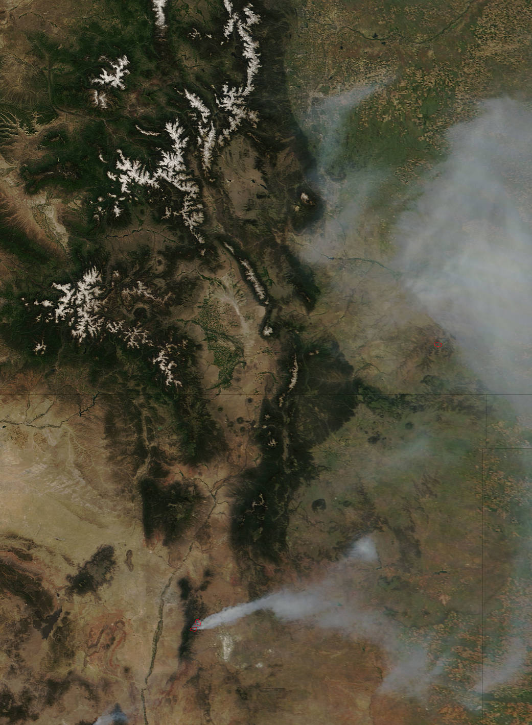
According to Inciweb, an interagency all-risk incident information management system that coordinates with federal, state and local agencies to manage wildfires, as of June 16, the Dog Head Fire in New Mexico had covered 16,000 acres.
The Moderate Resolution Imaging Spectroradiometer (MODIS) instrument that flies aboard NASA’s Terra satellite captured an image of smoke from the Dog Head Fire on June 16, 2016, at 2:30 p.m. EDT (18:30 UTC). The large red pixel outlines are the heat signatures from the fire as detected by MODIS. The large area of smoke, a light brown color, was streaming to the northeast of the fire.
Inciweb noted that the fire began on Tuesday, June 14, 2016 at approximately 11 a.m. MDT, about 6 miles northwest of Tajique, New Mexico.
For updates on all fires, visit the Inciweb website: http://inciweb.nwcg.gov.
Image credit: NASA/Goddard/LANCE/EOSDIS MODIS Rapid Response Team, Jeff Schmaltz
Text credit: Rob Gutro, NASA’s Goddard Space Flight Center, Greenbelt, Md.