


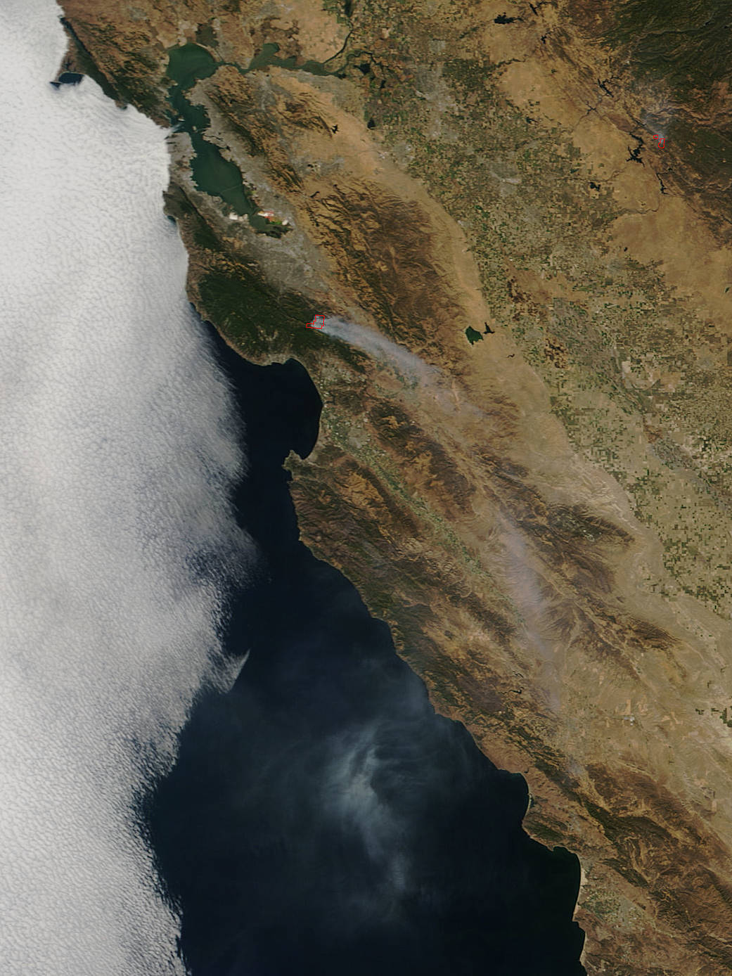
The Loma Fire in California broke out on September 26, 2016, and quickly spread to be 2,250 acres in size. Three hundred structures are threatened by this fire at present. One residence and six outbuildings have been destroyed and one residence has been damaged. This fire is located 10 miles northwest of Morgan Hill in the Santa Cruz mountain area.
Firefighters from throughout California are aggressively fighting the Loma Fire which continues to spread in the Loma Chiquita Road and Loma Prieta Road area of the Santa Cruz mountains. The fire is burning in steep inaccessible terrain covered in dry drought stressed fuels. Firefighters continue to build a line around the fire and are holding the existing containment line. The fire is currently 10% contained. The cause of the fire is under investigation.
This natural-color satellite image was collected by the Moderate Resolution Imaging Spectroradiometer (MODIS) aboard the Terra satellite on September 27, 2016. Actively burning areas, detected by MODIS’s thermal bands, are outlined in red. NASA image courtesy Jeff Schmaltz, MODIS Rapid Response Team. Caption: NASA/Goddard, Lynn Jenner with information from the Government of California Fire website