


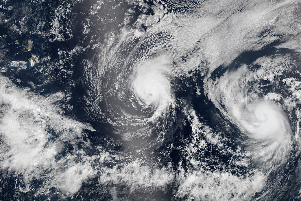
In early August 2014, not one but two hurricanes were headed for the Hawaiian Islands. Storms arriving from the east are a relative rarity, and landfalling storms are also pretty infrequent.
On Aug. 5, the Visible Infrared Imaging Radiometer Suite (VIIRS) sensor on the Suomi National Polar-orbiting Partnership (NPP) satellite captured natural-color images of both Iselle and Hurricane Julio en route to Hawaii. This image is a composite of three satellite passes over the tropical Pacific Ocean in the early afternoon. Note that Iselle’s eyewall had grown less distinct; the storm had descreased to category 2 intensity. The bright shading toward the center-left of the image is sunglint, the reflection of sunlight off the water and directly back at the satellite sensor.
> More information and annotated images> Latest storm images and data: NASA Hurricane
Image Credit: NASA image by Jeff Schmaltz, LANCE/EOSDIS Rapid Response
Caption Credit: Mike Carlowicz