NASA’s Hurricane and Severe Storms Sentinel or HS3 mission is taking flight, and Principal Investigator Scott Braun answered some behind-the-scenes questions about the 2014 mission. This is the final year of the HS3 mission which uses NASA instrumented, remotely piloted Global Hawk aircraft to investigate the processes that underlie hurricane formation and intensity change in the Atlantic Ocean basin.
As a result of electrical issues, one of the Global Hawk aircraft will be unavailable for the mission. The HS3 team is therefore moving two of its three instruments from that Global Hawk to a piloted NASA WB-57 aircraft that will already be conducting science missions for the Office of Naval Research in mid-September into October.
The WB-57 aircraft will test a new dropsonde system and focus on the upper-level outflow from storms and its connection to the inner-core region. The HS3 instruments will measure winds and precipitation and include the High-Altitude Imaging Wind and Rain Airborne Profiler (HIWRAP) conically scanning Doppler radar and the Hurricane Imaging Radiometer (HIRAD). The instruments can be found on this graphic: http://espo.nasa.gov/missions/hs3/content/HS3_Global_Hawk_Payload
Just click on the instrument name to get a description of the instrument. For more information about the WB-57, visit: https://airbornescience.nasa.gov/aircraft/WB-57.
Q: Where will the Global Hawk be located and what can it do?
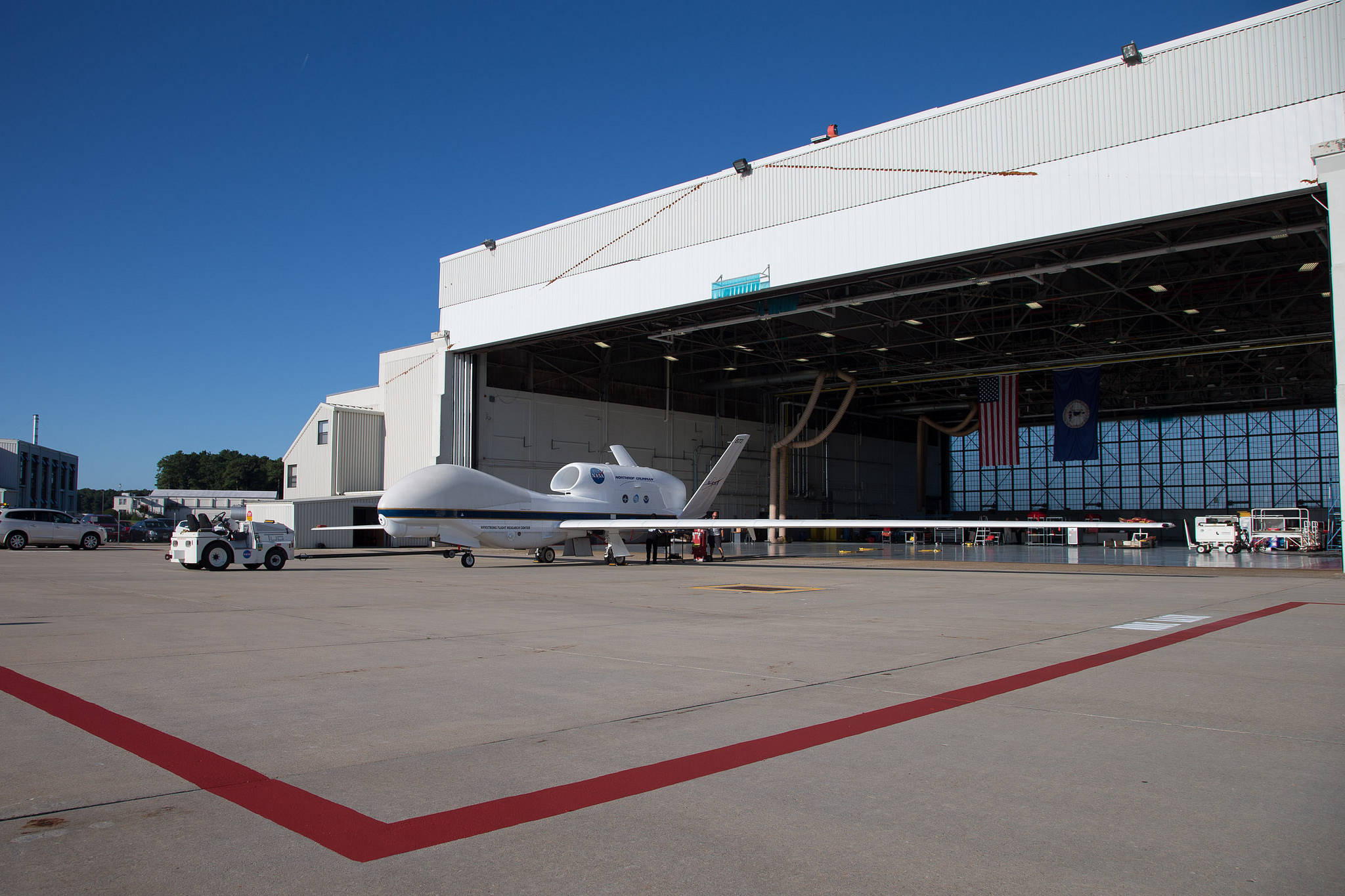
A: The unmanned Global Hawk aircraft will fly from NASA’s Wallops Flight Facility in on the Atlantic coastline in Virginia. The aircraft is capable of flight altitudes of up to 63,000 feet and flight durations of as long as 26 hours. The Global Hawk is carrying instruments geared toward measurement of a storm’s environment.
Q: What are the science goals of HS3?
A: 1. What impact does the large-scale environment, particularly the Saharan Air Layer (SAL), have on intensity change of tropical cyclones?
2. What is the role of storm internal processes such as deep convective towers?
3. To what extent are these intensification processes predictable?
For more information, visit: http://espo.nasa.gov/missions/hs3/content/HS3_Science_Page.
Q: Describe the Global Hawk Operations Center
A: The West Coast Global Hawk Operations Center or GHOC is located at NASA’s Armstrong Flight Research Center in California. That’s where the Global Hawks (the unmanned aircraft used in the HS3 mission) are based. A second, East Coast, GHOC is located at the Wallops Flight Facility. The GHOCs are divided into a “cockpit” room and a payload room. The GHOC is typically populated with the 2 pilots and 1 mission director in the cockpit room, while there are about 10 persons in the payload room, including a payload manager.
Q: How many scientists are involved from NASA?
A: Three instruments are mounted on the Global Hawk, and this typically requires about 4-6 scientists for operating and monitoring the instruments over the course of a 24-hour flight. We also have 6-9 mission scientists making science decisions with regard to sampling strategy a storm. There is also a payload (the instruments an aircraft carries) manager (for coordinating between mission scientists, instrument scientists, and the mission manager), and an IT (information technology) specialist.
Q: What is the role of the Global Hawk in HS3?
A: The aircraft’s key roles are to collect data from high altitudes (above the storms) and for long–duration surveillance over the large areas around the storm (i.e., the environment). In addition, the long-duration surveillance allows for observations of changes that occur in storm structure over periods of many hours (12-18 hours). The GH is essential to the mission. We could not overfly these vast stretches of the Atlantic, nor would we have much time on station, without this plane.
Q: The Global Hawk has different instruments that have different functions. What instrumentation does the Global Hawk 872 carry?
A: Global Hawk 872 (also known as AV-6 or “air vehicle 6”) carries three instruments to examine the environment around the storms, including the Scanning High-resolution Interferometer Sounder (S-HIS), the Advanced Vertical Atmospheric Profiling System (AVAPS), also known as dropsondes, and the Cloud Physics Lidar (CPL). The suite of instruments can be found on this graphic: http://espo.nasa.gov/missions/hs3/content/HS3_Global_Hawk_Payload
Just click on the instrument name to get a description of the instrument.
Q: What hurricane research does Global Hawk 872 conduct?
A: The role of the environmental instruments is to obtain critical measurements in the hurricane environment in order to identify the role of key factors such as large-scale wind systems (troughs, jet streams), Saharan air masses, African Easterly Waves and their embedded critical layers (that help to isolate tropical disturbances from hostile environments). The following bullet points outline the instruments associated with these roles:
- Continuous sampling of temperature and relative humidity in the clear-air environment from the Scanning High-resolution Interferometer Sounder (S-HIS).
- Full tropospheric wind, temperature, and humidity profiles from the Advanced Vertical Atmospheric Profiling System (AVAPS) dropsonde system, which is capable of releasing up to 88 dropsondes in a single flight.
- Aerosol and cloud layer vertical structure from the Cloud Physics Lidar (CPL).


